 |
|
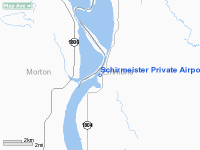
Schirmeister Private Airport |
Location & QuickFacts
| FAA Information Effective: | 2008-09-25 |
| Airport Identifier: | 48ND |
| Airport Status: | Operational |
| Longitude/Latitude: | 100-33-01.4310W/46-30-44.9780N
-100.550397/46.512494 (Estimated) |
| Elevation: | 1650 ft / 502.92 m (Estimated) |
| Land: | 0 acres |
| From nearest city: | 11 nautical miles NW of Hazelton, ND |
| Location: | Emmons County, ND |
| Magnetic Variation: | 09E (1985) |
Owner & Manager
| Ownership: | Privately owned |
| Owner: | Leo Schirmeister |
| Address: | Hce Box 234
Hazelton, ND 58544 |
| Address: |
|
Airport Operations and Facilities
| Airport Use: | Private
PERSONAL USE. |
| Wind indicator: | Yes |
| Segmented Circle: | No |
| Control Tower: | No |
| Landing fee charge: | No |
| Sectional chart: | Twin Cities |
| Region: | AGL - Great Lakes |
| Boundary ARTCC: | ZMP - Minneapolis |
| Tie-in FSS: | GFK - Grand Forks |
| FSS on Airport: | No |
| FSS Toll Free: | 1-800-WX-BRIEF |
Airport Services
Runway Information
Runway N/S
| Dimension: | 2500 x 80 ft / 762.0 x 24.4 m |
| Surface: | TURF, |
| |
Runway N |
Runway S |
| Traffic Pattern: | Left | Left |
|
Radio Navigation Aids
| ID |
Type |
Name |
Ch |
Freq |
Var |
Dist |
| BI | NDB | Jadan | | 230.00 | 11E | 11.8 nm |
| BIS | VOR/DME | Bismarck | 112X | 116.50 | 12E | 15.7 nm |
Remarks
Images and information placed above are from
http://www.airport-data.com/airport/48ND/
We thank them for the data!
| General Info
|
| Country |
United States
|
| State |
NORTH DAKOTA
|
| FAA ID |
48ND
|
| Latitude |
46-30-44.978N
|
| Longitude |
100-33-01.431W
|
| Elevation |
1650 feet
|
| Near City |
HAZELTON
|
We don't guarantee the information is fresh and accurate. The data may
be wrong or outdated.
For more up-to-date information please refer to other sources.
|
|


