 |
|
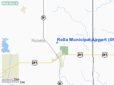
Location & QuickFacts
| FAA Information Effective: | 2008-09-25 |
| Airport Identifier: | 06D |
| Airport Status: | Operational |
| Longitude/Latitude: | 099-37-15.1570W/48-53-03.6280N
-99.620877/48.884341 (Estimated) |
| Elevation: | 1822 ft / 555.35 m (Surveyed) |
| Land: | 206 acres |
| From nearest city: | 2 nautical miles N of Rolla, ND |
| Location: | Rolette County, ND |
| Magnetic Variation: | 08E (2000) |
Owner & Manager
| Ownership: | Publicly owned |
| Owner: | Rolla Airport Authority |
| Address: | Rr1 Box 103b
Rolla, ND 58367 |
| Phone number: | 701-477-5145 |
| Manager: | Gordon Krech |
| Address: | Rr1 Box 103b
Rolla, ND 58367 |
| Phone number: | 701-477-5145
ADDNL PHONE 701-477-6780/ 550-9884 CELL OR AL KRECH 477-0914 |
Airport Operations and Facilities
| Airport Use: | Open to public |
| Wind indicator: | Yes |
| Segmented Circle: | No |
| Control Tower: | No |
| Lighting Schedule: | DUSK-DAWN
ACTVT MIRL RY 14/32 & PAPI RYS 14 & 32 - CTAF. |
| Beacon Color: | Clear-Green (lighted land airport) |
| Landing fee charge: | No |
| Sectional chart: | Twin Cities |
| Region: | AGL - Great Lakes |
| Boundary ARTCC: | ZMP - Minneapolis |
| Tie-in FSS: | GFK - Grand Forks |
| FSS on Airport: | No |
| FSS Toll Free: | 1-800-WX-BRIEF |
| NOTAMs Facility: | GFK (NOTAM-d service avaliable) |
| Federal Agreements: | N1 |
Airport Communications
| CTAF: | 122.800 |
| Unicom: | 122.800 |
Airport Services
| Fuel available: | 100LLA
24 HOUR SELF SERVICE CREDIT CARD FUEL AVBL. |
| Airframe Repair: | NONE |
| Power Plant Repair: | NONE |
| Bottled Oxygen: | NONE |
| Bulk Oxygen: | NONE |
Runway Information
Runway 07/25
| Dimension: | 2400 x 100 ft / 731.5 x 30.5 m |
| Surface: | TURF, Good Condition |
| |
Runway 07 |
Runway 25 |
| Longitude: | 099-37-30.5150W | 099-36-55.0140W |
| Latitude: | 48-52-59.7230N | 48-53-03.0230N |
| Elevation: | 1820.00 ft | 1810.00 ft |
| Alignment: | 82 | 127 |
| Traffic Pattern: | Left | Left |
| Obstruction: | , 50:1 slope to clear | 19 ft road, 260.0 ft from runway, 13:1 slope to clear |
|
Runway 14/32
| Dimension: | 4300 x 75 ft / 1310.6 x 22.9 m |
| Surface: | ASPH, Good Condition |
| Weight Limit: | Single wheel: 12500 lbs. |
| Edge Lights: | Medium |
| |
Runway 14 |
Runway 32 |
| Longitude: | 099-37-32.5140W | 099-37-00.5150W |
| Latitude: | 48-53-23.3230N | 48-52-46.5230N |
| Elevation: | 1822.00 ft | 1816.00 ft |
| Alignment: | 127 | 127 |
| Traffic Pattern: | Left | Left |
| Markings: | Non-precision instrument, Good Condition | Non-precision instrument, Good Condition |
| Crossing Height: | 25.00 ft | 25.00 ft |
| VASI: | 2-light PAPI on left side | 2-light PAPI on left side |
| Visual Glide Angle: | 3.00° | 3.00° |
| Obstruction: | 15 ft road, 850.0 ft from runway, 200 ft left of centerline, 43:1 slope to clear | 50 ft trees, 1270.0 ft from runway, 200 ft right of centerline, 21:1 slope to clear |
|
Radio Navigation Aids
| ID |
Type |
Name |
Ch |
Freq |
Var |
Dist |
| RLL | NDB | Rolla | | 263.00 | 09E | 0.3 nm |
| RUG | NDB | Rugby | | 212.00 | 08E | 33.9 nm |
Remarks
- FOR SNOW REMOVAL & ARPT CONDS CALL AMGR (701) 477-5145/6780/0914
- CTN: LOW FLYING MILITARY ACFT INVOF ARPT.
- RY 07/25 CLSD WINTER MONTHS (OCT-APR) DUE TO LACK OF SNOW REMOVAL.
- WATERFOWL & BIRDS ON & INVOF AIRPORT.
- EXISTED PRIOR TO 1959.
Images and information placed above are from
http://www.airport-data.com/airport/06D/
We thank them for the data!
| General Info
|
| Country |
United States
|
| State |
NORTH DAKOTA
|
| FAA ID |
06D
|
| Latitude |
48-53-03.628N
|
| Longitude |
099-37-15.157W
|
| Elevation |
1822 feet
|
| Near City |
ROLLA
|
We don't guarantee the information is fresh and accurate. The data may
be wrong or outdated.
For more up-to-date information please refer to other sources.
|
|


