 |
|
Location & QuickFacts
| FAA Information Effective: | 2008-09-25 |
| Airport Identifier: | 5K9 |
| Airport Status: | Closed Indefinitely |
| Longitude/Latitude: | 098-56-31.3840W/46-17-19.8910N
-98.942051/46.288859 (Estimated) |
| Elevation: | 1982 ft / 604.11 m (Estimated) |
| Land: | 10 acres |
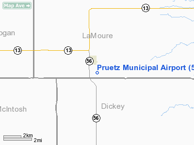
| From nearest city: | 1 nautical miles S of Kulm, ND |
| Location: | La Moure County, ND |
| Magnetic Variation: | 08E (1985) |
Owner & Manager
| Ownership: | Publicly owned |
| Owner: | Kulm Arpt Authority
APT CHAIRMAN LORENCE HOLMGREN |
| Address: | P.o. Box 291
Kulm, ND 58456 |
| Phone number: | 701-647-2835 |
| Manager: | Anthony Buerkley |
| Address: | 114 4th Ave Se
Kulm, ND 58456 |
| Phone number: | 701-647-2448
HOME PHONE FOR APT MGR 701-6472280 OR CONTACT MIKE HOLMGREN AT 701-647-2207 |
Airport Operations and Facilities
| Airport Use: | Open to public |
| Wind indicator: | Yes |
| Segmented Circle: | No |
| Control Tower: | No |
| Landing fee charge: | No |
| Sectional chart: | Twin Cities |
| Region: | AGL - Great Lakes |
| Boundary ARTCC: | ZMP - Minneapolis |
| Tie-in FSS: | GFK - Grand Forks |
| FSS on Airport: | No |
| FSS Toll Free: | 1-800-WX-BRIEF |
| NOTAMs Facility: | GFK (NOTAM-d service avaliable) |
Airport Communications
Airport Services
| Airframe Repair: | NONE |
| Power Plant Repair: | NONE |
| Bottled Oxygen: | NONE |
| Bulk Oxygen: | NONE |
Runway Information
Runway 17/35
| Dimension: | 2900 x 110 ft / 883.9 x 33.5 m |
| Surface: | TURF, Fair Condition |
| |
Runway 17 |
Runway 35 |
| Longitude: | 098-56-35.5000W | 098-56-35.5000W |
| Latitude: | 46-17-40.1300N | 46-17-11.5000N |
| Elevation: | 1970.00 ft | 1982.00 ft |
| Traffic Pattern: | Left | Left |
| Obstruction: | 4 ft fence, 20.0 ft from runway, 10 ft left of centerline, 5:1 slope to clear | 15 ft pole, 10.0 ft from runway, 60 ft left of centerline |
|
Radio Navigation Aids
| ID |
Type |
Name |
Ch |
Freq |
Var |
Dist |
| JMS | VOR/DME | Jamestown | 092X | 114.50 | 10E | 40.2 nm |
Remarks
- RY 17/35 NSTD LONGITUDINAL GRADES OF 5% MAXIMUM.
- RY 17 +125' ATHLETE FIELD LIGHT POLES 1600' FM THR ON CNTLN.
- CONFIRM WINTER CONDITIONS & SNOW REMOVAL WITH AMGR PRIOR TO USE - CALL 701-647-2448/2280/2835 OR 701-830-0292.
- TWY TO HNGRS LCTD WITHIN RY 17 RY PROTECTION ZONE.
- (ARPT STATUS) ARPT CLSD INDEFLY.
Images and information placed above are from
http://www.airport-data.com/airport/5K9/
We thank them for the data!
| General Info
|
| Country |
United States
|
| State |
NORTH DAKOTA
|
| FAA ID |
5K9
|
| Latitude |
46-17-19.891N
|
| Longitude |
098-56-31.384W
|
| Elevation |
1982 feet
|
| Near City |
KULM
|
We don't guarantee the information is fresh and accurate. The data may
be wrong or outdated.
For more up-to-date information please refer to other sources.
|
|


