 |
|
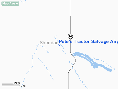
Pete's Tractor Salvage Airport |
Location & QuickFacts
| FAA Information Effective: | 2008-09-25 |
| Airport Identifier: | ND75 |
| Airport Status: | Operational |
| Longitude/Latitude: | 100-16-08.4720W/47-43-11.9920N
-100.269020/47.719998 (Estimated) |
| Elevation: | 1655 ft / 504.44 m (Estimated) |
| Land: | 0 acres |
| From nearest city: | 10 nautical miles S of Anamoose, ND |
| Location: | Sheridan County, ND |
| Magnetic Variation: | 09E (1985) |
Owner & Manager
| Ownership: | Privately owned |
| Owner: | Pete Engen |
| Address: | 2163 15th Ave Ne
Anamoose, ND 58710 |
| Phone number: | 701-465-3274 |
| Manager: | Pete Engen |
| Address: | 2163 15th Ave Ne
Anamoose, ND 58710 |
Airport Operations and Facilities
| Airport Use: | Private |
| Wind indicator: | Yes |
| Segmented Circle: | No |
| Control Tower: | No |
| Landing fee charge: | No |
| Sectional chart: | Twin Cities |
| Region: | AGL - Great Lakes |
| Boundary ARTCC: | ZMP - Minneapolis |
| Tie-in FSS: | GFK - Grand Forks |
| FSS on Airport: | No |
| FSS Toll Free: | 1-800-WX-BRIEF |
Runway Information
Runway 13/31
| Dimension: | 3000 x 60 ft / 914.4 x 18.3 m |
| Surface: | TURF, |
| |
Runway 13 |
Runway 31 |
| Traffic Pattern: | Left | Left |
|
Radio Navigation Aids
| ID |
Type |
Name |
Ch |
Freq |
Var |
Dist |
| RUG | NDB | Rugby | | 212.00 | 08E | 41.3 nm |
Images and information placed above are from
http://www.airport-data.com/airport/ND75/
We thank them for the data!
| General Info
|
| Country |
United States
|
| State |
NORTH DAKOTA
|
| FAA ID |
ND75
|
| Latitude |
47-43-11.992N
|
| Longitude |
100-16-08.472W
|
| Elevation |
1655 feet
|
| Near City |
ANAMOOSE
|
We don't guarantee the information is fresh and accurate. The data may
be wrong or outdated.
For more up-to-date information please refer to other sources.
|
|


