 |
|
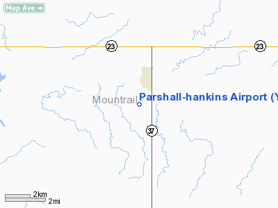
Location & QuickFacts
| FAA Information Effective: | 2008-09-25 |
| Airport Identifier: | Y74 |
| Airport Status: | Operational |
| Longitude/Latitude: | 102-08-31.6110W/47-56-11.0430N
-102.142114/47.936401 (Estimated) |
| Elevation: | 2031 ft / 619.05 m (Surveyed) |
| Land: | 176 acres |
| From nearest city: | 1 nautical miles S of Parshall, ND |
| Location: | Mountrail County, ND |
| Magnetic Variation: | 11E (1985) |
Owner & Manager
| Ownership: | Publicly owned |
| Owner: | Parshall Airport Authority
APT AUTH CLERK AND CITY AUDITOR |
| Address: | Po Box 254
Parshall, ND 58770 |
| Phone number: | 701-862-3459 |
| Manager: | John Kuehn
ADDNL CTC JIM HALDEN 701-862-3181/3386. |
| Address: | Po Box 159
Parshall, ND 58770 |
| Phone number: | 701-862-3535
OCT-APR HOME PHONE FOR AMGR 701-838-6653. |
Airport Operations and Facilities
| Airport Use: | Open to public |
| Wind indicator: | Yes |
| Segmented Circle: | Yes |
| Control Tower: | No |
| Lighting Schedule: | DUSK-DAWN
MIRL RY 12/30 OPERS DUSK-2300; AFTER 2300 ACTVT - CTAF. |
| Beacon Color: | Clear-Green (lighted land airport) |
| Landing fee charge: | No |
| Sectional chart: | Billings |
| Region: | AGL - Great Lakes |
| Boundary ARTCC: | ZMP - Minneapolis |
| Tie-in FSS: | GFK - Grand Forks |
| FSS on Airport: | No |
| FSS Toll Free: | 1-800-WX-BRIEF |
| NOTAMs Facility: | GFK (NOTAM-d service avaliable) |
| Federal Agreements: | NGY |
Airport Communications
Airport Services
| Fuel available: | 100LL
SELF SERVICE 24 HOUR CREDIT CARD FUELING SYSTEM AVBL. |
| Airframe Repair: | NONE |
| Power Plant Repair: | NONE |
| Bottled Oxygen: | NONE |
| Bulk Oxygen: | NONE |
Runway Information
Runway 12/30
| Dimension: | 3200 x 60 ft / 975.4 x 18.3 m
ONLY CENTER 20 FT MOWED FREQUENTLY; 250 FT AVBL. |
| Surface: | ASPH, Good Condition |
| Weight Limit: | Single wheel: 12000 lbs. |
| Edge Lights: | Medium |
| |
Runway 12 |
Runway 30 |
| Longitude: | 102-08-53.1100W | 102-08-02.9000W |
| Latitude: | 47-56-20.0400N | 47-55-52.7100N |
| Elevation: | 1997.00 ft | 2042.00 ft |
| Traffic Pattern: | Left | Left |
| Markings: | Non-precision instrument, Good Condition | Non-precision instrument, Good Condition |
| Runway End Identifier: | No | No |
| Centerline Lights: | No | No |
| Touchdown Lights: | No | No |
|
Runway 17/35
| Dimension: | 1350 x 20 ft / 411.5 x 6.1 m
ONLY CENTER 20 FT MOWED FREQUENTLY; 250 FT AVBL. |
| Surface: | TURF, Fair Condition |
| |
Runway 17 |
Runway 35 |
| Longitude: | 102-08-38.0100W | 102-08-38.0300W |
| Latitude: | 47-56-26.7300N | 47-56-13.4100N |
| Elevation: | 1992.00 ft | 2011.00 ft |
| Traffic Pattern: | Left | Left |
| Runway End Identifier: | No | No |
| Centerline Lights: | No | No |
| Touchdown Lights: | No | No |
| Obstruction: | 380 ft tower, 11500.0 ft from runway, 2000 ft left of centerline, 30:1 slope to clear | , 50:1 slope to clear |
|
Radio Navigation Aids
| ID |
Type |
Name |
Ch |
Freq |
Var |
Dist |
| PSH | NDB | Parshall | | 379.00 | 11E | 0.2 nm |
| MIB | TACAN | Deering | 096X | | 10E | 42.4 nm |
| MOT | VORTAC | Minot | 118X | 117.10 | 13E | 39.5 nm |
Remarks
- RY 12/30 CONFIRM SNOW REMOVAL AT 701-898-4113, OR CITY HALL 701-862-3459, OR CITY WATER PLANT MGR 701-862-3510.
- CITY PLANT MGR AL CHRISTENSON.
- TWY MARKED WITH REFLECTORS ONLY.
Images and information placed above are from
http://www.airport-data.com/airport/Y74/
We thank them for the data!
| General Info
|
| Country |
United States
|
| State |
NORTH DAKOTA
|
| FAA ID |
Y74
|
| Latitude |
47-56-11.043N
|
| Longitude |
102-08-31.611W
|
| Elevation |
2031 feet
|
| Near City |
PARSHALL
|
We don't guarantee the information is fresh and accurate. The data may
be wrong or outdated.
For more up-to-date information please refer to other sources.
|
|


