 |
|
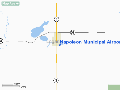
Location & QuickFacts
| FAA Information Effective: | 2008-09-25 |
| Airport Identifier: | 5B5 |
| Airport Status: | Operational |
| Longitude/Latitude: | 099-45-36.3910W/46-29-39.9260N
-99.760109/46.494424 (Estimated) |
| Elevation: | 1983 ft / 604.42 m (Estimated) |
| Land: | 118 acres |
| From nearest city: | 1 nautical miles S of Napoleon, ND |
| Location: | Logan County, ND |
| Magnetic Variation: | 09E (1985) |
Owner & Manager
| Ownership: | Publicly owned |
| Owner: | Napoleon Arpt Auth
ROD WENTZ SEC TREAS OF ARPT AUTH; HOME PHONE 701-754-2606. |
| Address: | Box 46
Napoleon, ND 58561 |
| Phone number: | 701-754-2256 |
| Manager: | Dave Sorgatz |
| Address: | Box 146
Napoleon, ND 58561 |
| Phone number: | 701-754-2226
OR 701-754-2958 AFTER 1700 ON MON-FRI OR SAT-SUN. |
Airport Operations and Facilities
| Airport Use: | Open to public |
| Wind indicator: | Yes |
| Segmented Circle: | No |
| Control Tower: | No |
| Lighting Schedule: | DUSK-0000
ACTVT LIRL RY 12/30 AFTER 0000 - CTAF. |
| Landing fee charge: | No |
| Sectional chart: | Twin Cities |
| Region: | AGL - Great Lakes |
| Boundary ARTCC: | ZMP - Minneapolis |
| Tie-in FSS: | GFK - Grand Forks |
| FSS on Airport: | No |
| FSS Toll Free: | 1-800-WX-BRIEF |
| NOTAMs Facility: | GFK (NOTAM-d service avaliable) |
Airport Communications
Airport Services
| Fuel available: | 100LL
FOR FUEL AFTER 1700 HRS CTC CITY POLICE 701-754-2626 OR DURING HRS AMGR 701-754-2226. |
| Airframe Repair: | NONE |
| Power Plant Repair: | NONE |
Runway Information
Runway 08/26
| Dimension: | 2500 x 80 ft / 762.0 x 24.4 m |
| Surface: | TURF, Fair Condition
ASPH SFC HAS NUMEROUS CRACKS & LOOSE STONES. |
| |
Runway 08 |
Runway 26 |
| Longitude: | 099-45-59.7500W | 099-45-24.0100W |
| Latitude: | 46-29-38.1500N | 46-29-38.1700N |
| Elevation: | 1960.00 ft | 1970.00 ft |
| Traffic Pattern: | Left | Left |
| Runway End Identifier: | No | No |
| Centerline Lights: | No | No |
| Touchdown Lights: | No | No |
| Obstruction: | 25 ft tree, 150.0 ft from runway, 100 ft right of centerline, 6:1 slope to clear | 5 ft bank, 100.0 ft from runway, 20:1 slope to clear |
|
Runway 12/30
| Dimension: | 3200 x 60 ft / 975.4 x 18.3 m |
| Surface: | ASPH, Fair Condition
ASPH SFC HAS NUMEROUS CRACKS & LOOSE STONES. |
| Weight Limit: | Single wheel: 6000 lbs. |
| Edge Lights: | Low |
| |
Runway 12 |
Runway 30 |
| Longitude: | 099-45-44.8900W | 099-45-09.4500W |
| Latitude: | 46-29-49.9300N | 46-29-29.9600N |
| Elevation: | 1959.00 ft | 1985.00 ft |
| Traffic Pattern: | Left | Left |
| Markings: | Basic, Fair Condition | Basic, Fair Condition |
| Runway End Identifier: | No | No |
| Centerline Lights: | No | No |
| Touchdown Lights: | No | No |
| Obstruction: | 75 ft trees, 1700.0 ft from runway, 20:1 slope to clear | , 50:1 slope to clear |
|
Radio Navigation Aids
| ID |
Type |
Name |
Ch |
Freq |
Var |
Dist |
| BI | NDB | Jadan | | 230.00 | 11E | 38.6 nm |
| BIS | VOR/DME | Bismarck | 112X | 116.50 | 12E | 40.7 nm |
Remarks
- IREG SNOW REMOVAL. CONFIRM WINTER COND WITH AMGR DURG DAY ON 701-754-2226 & EVES ON 701-754-2958.
- RY 08/26 CLSD OCT-APR DUE TO LACK OF SNOW REMOVAL.
- RY 8 HAS 3 FT DITCH 50 FT FROM THR OUTBOUND.
- RY 12/30 CULTIVATED FIELD 55 FT L & R OF RY CNTRLN.
Images and information placed above are from
http://www.airport-data.com/airport/5B5/
We thank them for the data!
| General Info
|
| Country |
United States
|
| State |
NORTH DAKOTA
|
| FAA ID |
5B5
|
| Latitude |
46-29-39.926N
|
| Longitude |
099-45-36.391W
|
| Elevation |
1983 feet
|
| Near City |
NAPOLEON
|
We don't guarantee the information is fresh and accurate. The data may
be wrong or outdated.
For more up-to-date information please refer to other sources.
|
|


