 |
|
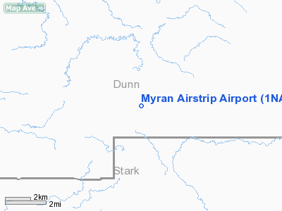
Location & QuickFacts
| FAA Information Effective: | 2008-09-25 |
| Airport Identifier: | 1NA9 |
| Airport Status: | Operational |
| Longitude/Latitude: | 102-29-44.6650W/47-02-00.0280N
-102.495740/47.033341 (Estimated) |
| Elevation: | 2120 ft / 646.18 m (Estimated) |
| Land: | 5 acres |
| From nearest city: | 10 nautical miles NW of Taylor, ND |
| Location: | Dunn County, ND |
| Magnetic Variation: | 11E (1985) |
Owner & Manager
| Ownership: | Privately owned |
| Address: |
|
| Manager: | Ken Myran |
| Address: |
Taylor, ND 58656 |
| Phone number: | 701-974-3484 |
Airport Operations and Facilities
| Airport Use: | Private |
| Segmented Circle: | No |
| Control Tower: | No |
| Sectional chart: | Billings |
| Region: | AGL - Great Lakes |
| Boundary ARTCC: | ZMP - Minneapolis |
| Tie-in FSS: | GFK - Grand Forks |
| FSS on Airport: | No |
| FSS Toll Free: | 1-800-WX-BRIEF |
Runway Information
Runway 11/29
| Dimension: | 1600 x 60 ft / 487.7 x 18.3 m |
| Surface: | TURF-DIRT, |
| |
Runway 11 |
Runway 29 |
| Traffic Pattern: | Left | Left |
|
Radio Navigation Aids
| ID |
Type |
Name |
Ch |
Freq |
Var |
Dist |
| DIK | VORTAC | Dickinson | 076X | 112.90 | 14E | 15.4 nm |
Remarks
- RWY 11/29 DIRT SFC UNDER DEVELOPMENT TO GRASS.
Images and information placed above are from
http://www.airport-data.com/airport/1NA9/
We thank them for the data!
| General Info
|
| Country |
United States
|
| State |
NORTH DAKOTA
|
| FAA ID |
1NA9
|
| Latitude |
47-02-00.028N
|
| Longitude |
102-29-44.665W
|
| Elevation |
2120 feet
|
| Near City |
TAYLOR
|
We don't guarantee the information is fresh and accurate. The data may
be wrong or outdated.
For more up-to-date information please refer to other sources.
|
|


