 |
|
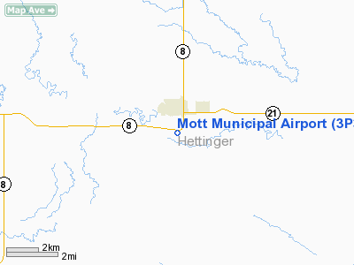
Location & QuickFacts
| FAA Information Effective: | 2008-09-25 |
| Airport Identifier: | 3P3 |
| Airport Status: | Operational |
| Longitude/Latitude: | 102-19-22.5800W/46-21-35.0100N
-102.322939/46.359725 (Estimated) |
| Elevation: | 2411 ft / 734.87 m (Estimated) |
| Land: | 100 acres |
| From nearest city: | 1 nautical miles S of Mott, ND |
| Location: | Hettinger County, ND |
| Magnetic Variation: | 11E (1985) |
Owner & Manager
| Ownership: | Publicly owned |
| Owner: | Mott Airport Authority
REX KELSCH CHRMN APT AUTH. |
| Address: | Box 236
Mott, ND 58646 |
| Phone number: | 701-824-2030 |
| Manager: | Rex Kelsch
ADDNL CTC PAUL SCHWARTZ 701-824-2676. |
| Address: | Box 236
Mott, ND 58646 |
| Phone number: | 701-824-2030 |
Airport Operations and Facilities
| Airport Use: | Open to public |
| Wind indicator: | Yes |
| Segmented Circle: | Yes |
| Control Tower: | No |
| Lighting Schedule: | RDO-CTL
ACTVT LIRL RY 09/27 - CTAF. |
| Landing fee charge: | No |
| Sectional chart: | Billings |
| Region: | AGL - Great Lakes |
| Boundary ARTCC: | ZMP - Minneapolis |
| Tie-in FSS: | GFK - Grand Forks |
| FSS on Airport: | No |
| FSS Toll Free: | 1-800-WX-BRIEF |
| NOTAMs Facility: | GFK (NOTAM-d service avaliable) |
| Federal Agreements: | NGY |
Airport Communications
Airport Services
| Fuel available: | 100LL
SELF SERVICE FUEL AVBL 24 HRS WITH CREDIT CARD. |
| Airframe Repair: | NONE |
| Power Plant Repair: | NONE |
| Bottled Oxygen: | NONE |
| Bulk Oxygen: | NONE |
Runway Information
Runway 09/27
| Dimension: | 3500 x 60 ft / 1066.8 x 18.3 m |
| Surface: | ASPH, Good Condition |
| Surface Treatment: | Aggregate Friction Seal Coat |
| Weight Limit: | Single wheel: 10000 lbs. |
| Edge Lights: | Low |
| |
Runway 09 |
Runway 27 |
| Longitude: | 102-20-02.6700W | 102-19-14.5800W |
| Latitude: | 46-21-37.2300N | 46-21-28.0100N |
| Elevation: | 2408.00 ft | 2408.00 ft |
| Alignment: | 106 | 127 |
| Traffic Pattern: | Left | Left |
| Markings: | Basic, Good Condition | Basic, Good Condition |
| Obstruction: | 26 ft pline, 1380.0 ft from runway, 45:1 slope to clear | 13 ft road, 600.0 ft from runway, 160 ft right of centerline, 30:1 slope to clear |
|
Radio Navigation Aids
| ID |
Type |
Name |
Ch |
Freq |
Var |
Dist |
| HEI | NDB | Hettinger | | 392.00 | 12E | 24.7 nm |
| BOD | NDB | Bowman | | 374.00 | 10E | 47.1 nm |
| LEM | VOR | Lemmon | | 111.40 | 13E | 28.0 nm |
| DIK | VORTAC | Dickinson | 076X | 112.90 | 14E | 35.4 nm |
Remarks
- +100'TWR-L ON FARMSTEAD 1800'R OF RWY 27 THR.
- CONFIRM WINTER COND CALL (701) 824-2030/2676/2552/2991 PRIOR TO USE. IREG SNOW REMOVAL.
Images and information placed above are from
http://www.airport-data.com/airport/3P3/
We thank them for the data!
| General Info
|
| Country |
United States
|
| State |
NORTH DAKOTA
|
| FAA ID |
3P3
|
| Latitude |
46-21-35.010N
|
| Longitude |
102-19-22.580W
|
| Elevation |
2411 feet
|
| Near City |
MOTT
|
We don't guarantee the information is fresh and accurate. The data may
be wrong or outdated.
For more up-to-date information please refer to other sources.
|
|


