 |
|
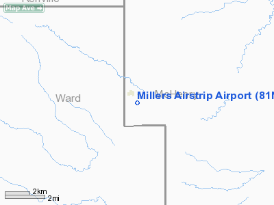
Location & QuickFacts
| FAA Information Effective: | 2008-09-25 |
| Airport Identifier: | 81ND |
| Airport Status: | Operational |
| Longitude/Latitude: | 101-02-41.5490W/48-23-19.0580N
-101.044875/48.388627 (Estimated) |
| Elevation: | 1545 ft / 470.92 m (Estimated) |
| Land: | 0 acres |
| From nearest city: | 1 nautical miles S of Deering, ND |
| Location: | Mc Henry County, ND |
| Magnetic Variation: | 10E (1985) |
Owner & Manager
| Ownership: | Privately owned |
| Owner: | Jerry Miller |
| Address: | 205 Miller Road
Deering, ND 58731 |
| Phone number: | 701-728-6708 |
| Manager: | Jerry Miller |
| Address: | 205 Miller Road
Deering, ND 58731 |
| Phone number: | 701-728-6708 |
Airport Operations and Facilities
| Airport Use: | Private |
| Wind indicator: | No |
| Segmented Circle: | No |
| Control Tower: | No |
| Landing fee charge: | No |
| Sectional chart: | Billings |
| Region: | AGL - Great Lakes |
| Boundary ARTCC: | ZMP - Minneapolis |
| Tie-in FSS: | GFK - Grand Forks |
| FSS on Airport: | No |
| FSS Toll Free: | 1-800-WX-BRIEF |
Runway Information
Runway 13/31
| Dimension: | 2400 x 50 ft / 731.5 x 15.2 m |
| Surface: | TURF, |
| |
Runway 13 |
Runway 31 |
| Traffic Pattern: | Left | Left |
|
Radio Navigation Aids
| ID |
Type |
Name |
Ch |
Freq |
Var |
Dist |
| HBC | NDB | Mohall | | 350.00 | 11E | 29.8 nm |
| RUG | NDB | Rugby | | 212.00 | 08E | 40.6 nm |
| MIB | TACAN | Deering | 096X | | 10E | 12.9 nm |
| MOT | VORTAC | Minot | 118X | 117.10 | 13E | 12.4 nm |
Images and information placed above are from
http://www.airport-data.com/airport/81ND/
We thank them for the data!
| General Info
|
| Country |
United States
|
| State |
NORTH DAKOTA
|
| FAA ID |
81ND
|
| Latitude |
48-23-19.058N
|
| Longitude |
101-02-41.549W
|
| Elevation |
1545 feet
|
| Near City |
DEERING
|
We don't guarantee the information is fresh and accurate. The data may
be wrong or outdated.
For more up-to-date information please refer to other sources.
|
|


