 |
|
Location & QuickFacts
| FAA Information Effective: | 2008-09-25 |
| Airport Identifier: | 2ND2 |
| Airport Status: | Operational |
| Longitude/Latitude: | 100-43-16.4920W/47-34-00.9960N
-100.721248/47.566943 (Estimated) |
| Elevation: | 1910 ft / 582.17 m (Estimated) |
| Land: | 0 acres |
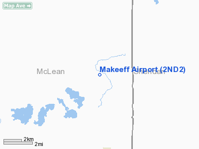
| From nearest city: | 4 nautical miles N of Mercer, ND |
| Location: | Mc Lean County, ND |
| Magnetic Variation: | 10E (1985) |
Owner & Manager
| Ownership: | Privately owned |
| Owner: | Russell Makeeff |
| Address: |
Mercer, ND 58559 |
| Phone number: | 701-447-2467 |
| Address: |
|
Airport Operations and Facilities
| Airport Use: | Private |
| Wind indicator: | Yes |
| Segmented Circle: | No |
| Control Tower: | No |
| Landing fee charge: | No |
| Sectional chart: | Twin Cities |
| Region: | AGL - Great Lakes |
| Boundary ARTCC: | ZMP - Minneapolis |
| Tie-in FSS: | GFK - Grand Forks |
| FSS on Airport: | No |
| FSS Toll Free: | 1-800-WX-BRIEF |
Runway Information
Runway E/W
| Dimension: | 2600 x 70 ft / 792.5 x 21.3 m |
| Surface: | TURF, |
| |
Runway E |
Runway W |
| Traffic Pattern: | Left | Left |
|
Radio Navigation Aids
| ID |
Type |
Name |
Ch |
Freq |
Var |
Dist |
| BIS | VOR/DME | Bismarck | 112X | 116.50 | 12E | 48.5 nm |
| MOT | VORTAC | Minot | 118X | 117.10 | 13E | 47.5 nm |
Remarks
- OBSTNS IN RY APCH SLOPE SFC BE REMOVED/LOWERED OR RY THR DSPLCD AND MKD TO PRVD MIN 20:1 APCH CLNC AND AREA 125' EITHER SIDE RY CNTRLN CLRD OF ANY OBSTNS.
Images and information placed above are from
http://www.airport-data.com/airport/2ND2/
We thank them for the data!
| General Info
|
| Country |
United States
|
| State |
NORTH DAKOTA
|
| FAA ID |
2ND2
|
| Latitude |
47-34-00.996N
|
| Longitude |
100-43-16.492W
|
| Elevation |
1910 feet
|
| Near City |
MERCER
|
We don't guarantee the information is fresh and accurate. The data may
be wrong or outdated.
For more up-to-date information please refer to other sources.
|
|


