 |
|
Location & QuickFacts
| FAA Information Effective: | 2008-09-25 |
| Airport Identifier: | 6D3 |
| Airport Status: | Operational |
| Longitude/Latitude: | 099-31-37.4810W/47-58-40.0330N
-99.527078/47.977787 (Estimated) |
| Elevation: | 1600 ft / 487.68 m (Estimated) |
| Land: | 85 acres |
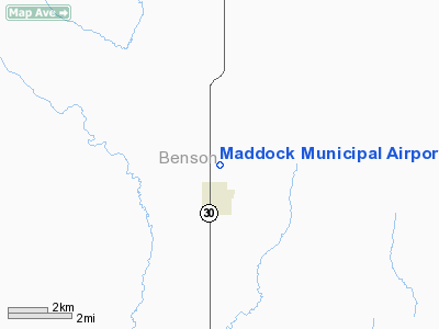
| From nearest city: | 1 nautical miles N of Maddock, ND |
| Location: | Benson County, ND |
| Magnetic Variation: | 09E (1985) |
Owner & Manager
| Ownership: | Publicly owned |
| Owner: | Maddock Arpt Auth
APT AUTH CLERK JEAN MOSER |
| Address: | P.o. Box 276
Maddock, ND 58348 |
| Phone number: | 701-438-2252
JEAN MOSSER SEC/TREAS APT AUTH. |
| Manager: | Dave Kenner |
| Address: | 4862 44th St Ne
Maddock, ND 58348 |
| Phone number: | 701-438-2694 |
Airport Operations and Facilities
| Airport Use: | Open to public |
| Wind indicator: | Yes |
| Segmented Circle: | No |
| Control Tower: | No |
| Landing fee charge: | No |
| Sectional chart: | Twin Cities |
| Region: | AGL - Great Lakes |
| Boundary ARTCC: | ZMP - Minneapolis |
| Tie-in FSS: | GFK - Grand Forks |
| FSS on Airport: | No |
| FSS Toll Free: | 1-800-WX-BRIEF |
| NOTAMs Facility: | GFK (NOTAM-d service avaliable) |
Airport Communications
Airport Services
| Fuel available: | 100LL |
| Airframe Repair: | NONE |
| Power Plant Repair: | NONE |
| Bottled Oxygen: | NONE |
| Bulk Oxygen: | NONE |
Runway Information
Runway 12/30
| Dimension: | 3200 x 100 ft / 975.4 x 30.5 m |
| Surface: | TURF, Fair Condition |
| |
Runway 12 |
Runway 30 |
| Longitude: | 099-31-56.3800W | 099-31-20.6100W |
| Latitude: | 47-59-00.0000N | 47-58-39.4900N |
| Elevation: | 1594.00 ft | 1595.00 ft |
| Alignment: | 127 | 127 |
| Traffic Pattern: | Left | Left |
| Obstruction: | 19 ft road, 380.0 ft from runway, 125 ft right of centerline, 20:1 slope to clear | 15 ft road, 100.0 ft from runway, 100 ft left of centerline, 6:1 slope to clear |
|
Radio Navigation Aids
| ID |
Type |
Name |
Ch |
Freq |
Var |
Dist |
| RUG | NDB | Rugby | | 212.00 | 08E | 31.8 nm |
| DVL | VOR/DME | Devils Lake | 047X | 111.00 | 07E | 26.0 nm |
Remarks
- NO SNOW REMOVAL; CONFIRM ARPT CONDITION DURING WINTER MONTHS.
- MIDFIELD E/W ASPH TWY OPEN TO WEST SIDE APRON AND HANGAR.
Images and information placed above are from
http://www.airport-data.com/airport/6D3/
We thank them for the data!
| General Info
|
| Country |
United States
|
| State |
NORTH DAKOTA
|
| FAA ID |
6D3
|
| Latitude |
47-58-40.033N
|
| Longitude |
099-31-37.481W
|
| Elevation |
1600 feet
|
| Near City |
MADDOCK
|
We don't guarantee the information is fresh and accurate. The data may
be wrong or outdated.
For more up-to-date information please refer to other sources.
|
|


