 |
|
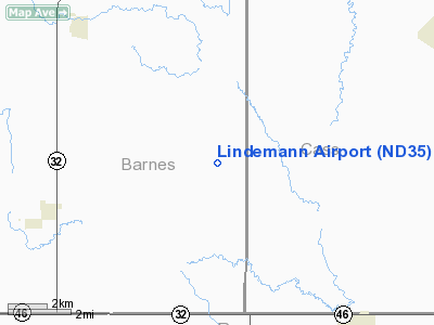
Location & QuickFacts
| FAA Information Effective: | 2008-09-25 |
| Airport Identifier: | ND35 |
| Airport Status: | Operational |
| Longitude/Latitude: | 097-42-01.3670W/46-41-59.9100N
-97.700380/46.699975 (Estimated) |
| Elevation: | 1199 ft / 365.46 m (Estimated) |
| Land: | 0 acres |
| From nearest city: | 1 nautical miles SE of Lucca, ND |
| Location: | Barnes County, ND |
| Magnetic Variation: | 07E (1985) |
Owner & Manager
| Ownership: | Privately owned |
| Owner: | Larry Lindemann |
| Address: | Box 96
Valley City, ND 58072 |
| Phone number: | 701-924-8300 |
| Address: |
|
Airport Operations and Facilities
| Airport Use: | Private |
| Wind indicator: | Yes |
| Segmented Circle: | No |
| Control Tower: | No |
| Landing fee charge: | No |
| Sectional chart: | Twin Cities |
| Region: | AGL - Great Lakes |
| Boundary ARTCC: | ZMP - Minneapolis |
| Tie-in FSS: | GFK - Grand Forks |
| FSS on Airport: | No |
| FSS Toll Free: | 1-800-WX-BRIEF |
Airport Services
| Fuel available: | 80 |
| Airframe Repair: | NONE |
| Power Plant Repair: | NONE |
Runway Information
Runway NW/SE
| Dimension: | 1800 x 100 ft / 548.6 x 30.5 m |
| Surface: | TURF, |
| |
Runway NW |
Runway SE |
| Traffic Pattern: | Left | Left |
|
Radio Navigation Aids
| ID |
Type |
Name |
Ch |
Freq |
Var |
Dist |
| VCY | NDB | Valley City | | 382.00 | 07E | 13.8 nm |
| GWR | NDB | Gwinner | | 278.00 | 07E | 28.7 nm |
| AA | NDB | Kenie | | 365.00 | 06E | 40.9 nm |
| JMS | VOR/DME | Jamestown | 092X | 114.50 | 10E | 42.6 nm |
| FAR | VORTAC | Fargo | 109X | 116.20 | 09E | 35.1 nm |
Images and information placed above are from
http://www.airport-data.com/airport/ND35/
We thank them for the data!
| General Info
|
| Country |
United States
|
| State |
NORTH DAKOTA
|
| FAA ID |
ND35
|
| Latitude |
46-41-59.910N
|
| Longitude |
097-42-01.367W
|
| Elevation |
1199 feet
|
| Near City |
LUCCA
|
We don't guarantee the information is fresh and accurate. The data may
be wrong or outdated.
For more up-to-date information please refer to other sources.
|
|


