 |
|
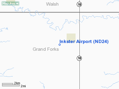
Location & QuickFacts
| FAA Information Effective: | 2008-09-25 |
| Airport Identifier: | ND24 |
| Airport Status: | Operational |
| Longitude/Latitude: | 097-40-21.3110W/48-08-24.9700N
-97.672586/48.140269 (Estimated) |
| Elevation: | 1092 ft / 332.84 m (Estimated) |
| Land: | 160 acres |
| From nearest city: | 1 nautical miles SW of Inkster, ND |
| Location: | Grand Forks County, ND |
| Magnetic Variation: | 07E (1985) |
Owner & Manager
| Ownership: | Publicly owned |
| Owner: | City Of Inkster |
| Address: | Po Box 36
Inkster, ND 58244 |
| Phone number: | 701-865-4217 |
| Manager: | Kenneth Ingersoll |
| Address: | 511 6th St
Inkster, ND 58244 |
| Phone number: | 701-865-4101 |
Airport Operations and Facilities
| Airport Use: | Private |
| Wind indicator: | Yes |
| Segmented Circle: | No |
| Control Tower: | No |
| Landing fee charge: | No |
| Sectional chart: | Twin Cities |
| Region: | AGL - Great Lakes |
| Boundary ARTCC: | ZMP - Minneapolis |
| Tie-in FSS: | GFK - Grand Forks |
| FSS on Airport: | No |
| FSS Toll Free: | 1-800-WX-BRIEF |
Airport Services
| Airframe Repair: | NONE |
| Power Plant Repair: | NONE |
| Bottled Oxygen: | NONE |
| Bulk Oxygen: | NONE |
Runway Information
Runway 08/26
| Dimension: | 2400 x 60 ft / 731.5 x 18.3 m
SFC RUTTED DUE TO VEHICLES DRIVING ON CENTER OF RY. |
| Surface: | TURF, Fair Condition
08/26, 17/35--ALL TURF SURFACES ROLLING WITH GRASS CLUMPS. |
| |
Runway 08 |
Runway 26 |
| Longitude: | 097-40-31.0000W | 097-39-55.6100W |
| Latitude: | 48-08-38.0000N | 48-08-38.0000N |
| Elevation: | 1093.00 ft | 1085.00 ft |
| Traffic Pattern: | Left | Left |
| Runway End Identifier: | No | No |
| Centerline Lights: | No | No |
| Touchdown Lights: | No | No |
| Obstruction: | 16 ft road, 1.0 ft from runway, 1 ft left of centerline | 60 ft trees, 100.0 ft from runway, 50 ft right of centerline, 1:1 slope to clear |
|
Runway 17/35
| Dimension: | 2200 x 150 ft / 670.6 x 45.7 m
SFC RUTTED DUE TO VEHICLES DRIVING ON CENTER OF RY. |
| Surface: | TURF, Fair Condition
08/26, 17/35--ALL TURF SURFACES ROLLING WITH GRASS CLUMPS. |
| |
Runway 17 |
Runway 35 |
| Longitude: | 097-40-31.0000W | 097-40-31.0000W |
| Latitude: | 48-08-37.0000N | 48-08-15.2900N |
| Elevation: | 1094.00 ft | 1093.00 ft |
| Traffic Pattern: | Left | Left |
| Runway End Identifier: | No | No |
| Centerline Lights: | No | No |
| Touchdown Lights: | No | No |
| Obstruction: | 25 ft pole, 200.0 ft from runway, 60 ft right of centerline, 8:1 slope to clear | 16 ft road, 1.0 ft from runway |
|
Radio Navigation Aids
| ID |
Type |
Name |
Ch |
Freq |
Var |
Dist |
| CKN | NDB | Crookston | | 400.00 | 07E | 46.2 nm |
| RDR | TACAN | Red River | 111X | | 06E | 15.4 nm |
| GFK | VOR/DME | Grand Forks | 090X | 114.30 | 09E | 22.5 nm |
| DVL | VOR/DME | Devils Lake | 047X | 111.00 | 07E | 49.8 nm |
| HML | VORTAC | Humboldt | 071X | 112.40 | 09E | 49.1 nm |
Remarks
- RY 17 HAS +80 FT TREES 2600 FT FROM THR ON CNTRLN; APCH RATIO 32:1.
- RY 26 HAS +16' ROAD 30 FT FROM THLD ON CNTRLN, APCH RATIO 1:1.
- 3 FT METAL POST ALONG RWY 08 EDGE 50 FT FROM THR AND 30 FT LEFT RWY CNTRLN.
- IREG GRASS MOWING RYS 08/26 & 17/35.
- RY 17/35 HAS +15' IRRIGATION LOCATED 250 FT WEST OF CNTRLN.
- PVDD RWY THRS ARE LCTD/DSPLCD, CLEARLY MKD TO PVD A 20:1 APCH OVER ALL OBSTACLES IN RWY APCH SFC AREAS.
Images and information placed above are from
http://www.airport-data.com/airport/ND24/
We thank them for the data!
| General Info
|
| Country |
United States
|
| State |
NORTH DAKOTA
|
| FAA ID |
ND24
|
| Latitude |
48-08-24.970N
|
| Longitude |
097-40-21.311W
|
| Elevation |
1092 feet
|
| Near City |
INKSTER
|
We don't guarantee the information is fresh and accurate. The data may
be wrong or outdated.
For more up-to-date information please refer to other sources.
|
|


