 |
|
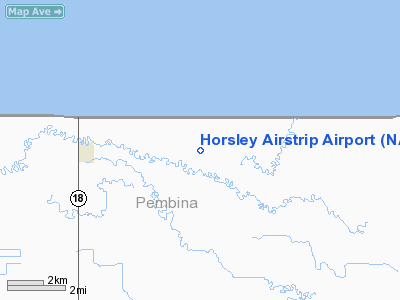
Location & QuickFacts
| FAA Information Effective: | 2008-09-25 |
| Airport Identifier: | NA67 |
| Airport Status: | Operational |
| Longitude/Latitude: | 097-27-52.2720W/48-59-01.9640N
-97.464520/48.983879 (Estimated) |
| Elevation: | 815 ft / 248.41 m (Estimated) |
| Land: | 2 acres |
| From nearest city: | 4 nautical miles E of Neche, ND |
| Location: | Pembina County, ND |
| Magnetic Variation: | 07E (1985) |
Owner & Manager
| Ownership: | Privately owned |
| Owner: | Garnet R Horsley |
| Address: | Rr 1 Box 3
Neche, ND 58265 |
| Phone number: | 701-886-7614 |
| Manager: | Garnet R Horsley |
| Address: | Rr 1 Box 3
Neche, ND 58265 |
| Phone number: | 701-886-7614 |
Airport Operations and Facilities
| Airport Use: | Private |
| Wind indicator: | No |
| Segmented Circle: | No |
| Control Tower: | No |
| Lighting Schedule: | NONE |
| Landing fee charge: | No |
| Sectional chart: | Twin Cities |
| Region: | AGL - Great Lakes |
| Boundary ARTCC: | ZMP - Minneapolis |
| Tie-in FSS: | GFK - Grand Forks |
| FSS on Airport: | No |
| FSS Toll Free: | 1-800-WX-BRIEF |
Runway Information
Runway 17/35
| Dimension: | 2000 x 60 ft / 609.6 x 18.3 m |
| Surface: | TURF, |
| |
Runway 17 |
Runway 35 |
| Traffic Pattern: | Left | Left |
| Obstruction: | | 50 ft trees, 600.0 ft from runway |
|
Radio Navigation Aids
| ID |
Type |
Name |
Ch |
Freq |
Var |
Dist |
| LF | NDB | La Salle | | 336.00 | 08E | 40.1 nm |
| HML | VORTAC | Humboldt | 071X | 112.40 | 09E | 15.4 nm |
Images and information placed above are from
http://www.airport-data.com/airport/NA67/
We thank them for the data!
| General Info
|
| Country |
United States
|
| State |
NORTH DAKOTA
|
| FAA ID |
NA67
|
| Latitude |
48-59-01.964N
|
| Longitude |
097-27-52.272W
|
| Elevation |
815 feet
|
| Near City |
NECHE
|
We don't guarantee the information is fresh and accurate. The data may
be wrong or outdated.
For more up-to-date information please refer to other sources.
|
|


