 |
|
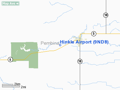
Location & QuickFacts
| FAA Information Effective: | 2008-09-25 |
| Airport Identifier: | 9ND8 |
| Airport Status: | Operational |
| Longitude/Latitude: | 097-40-20.3220W/48-47-07.9750N
-97.672312/48.785549 (Estimated) |
| Elevation: | 908 ft / 276.76 m (Estimated) |
| Land: | 0 acres |
| From nearest city: | 2 nautical miles W of Cavalier, ND |
| Location: | Pembina County, ND |
| Magnetic Variation: | 07E (1985) |
Owner & Manager
| Ownership: | Privately owned |
| Owner: | Dale Hinkle |
| Address: | Rr 2 Box 690
Cavalier, ND 58220 |
| Phone number: | 701-265-8875 |
| Manager: | Dale Hinkle |
| Address: | Rr 2 Box 690
Cavalier, ND 58220 |
| Phone number: | 701-265-8875 |
Airport Operations and Facilities
| Airport Use: | Private |
| Wind indicator: | Yes |
| Segmented Circle: | No |
| Control Tower: | No |
| Landing fee charge: | No |
| Sectional chart: | Twin Cities |
| Region: | AGL - Great Lakes |
| Boundary ARTCC: | ZMP - Minneapolis |
| Tie-in FSS: | GFK - Grand Forks |
| FSS on Airport: | No |
| FSS Toll Free: | 1-800-WX-BRIEF |
Runway Information
Runway 07/25
| Dimension: | 2100 x 40 ft / 640.1 x 12.2 m |
| Surface: | TURF, |
| |
Runway 07 |
Runway 25 |
| Traffic Pattern: | Left | Left |
| Obstruction: | | 100 ft trees, 330.0 ft from runway |
|
Radio Navigation Aids
| ID |
Type |
Name |
Ch |
Freq |
Var |
Dist |
| HML | VORTAC | Humboldt | 071X | 112.40 | 09E | 22.5 nm |
Remarks
- PROVIDED ALL LANDINGS ARE TO THE EAST AND ALL DEPARTURES ARE TO THE WEST.
Images and information placed above are from
http://www.airport-data.com/airport/9ND8/
We thank them for the data!
| General Info
|
| Country |
United States
|
| State |
NORTH DAKOTA
|
| FAA ID |
9ND8
|
| Latitude |
48-47-07.975N
|
| Longitude |
097-40-20.322W
|
| Elevation |
908 feet
|
| Near City |
CAVALIER
|
We don't guarantee the information is fresh and accurate. The data may
be wrong or outdated.
For more up-to-date information please refer to other sources.
|
|


