 |
|
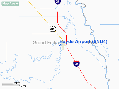
Location & QuickFacts
| FAA Information Effective: | 2008-09-25 |
| Airport Identifier: | 8ND4 |
| Airport Status: | Operational |
| Longitude/Latitude: | 097-11-10.2750W/48-04-24.9420N
-97.186188/48.073595 (Estimated) |
| Elevation: | 820 ft / 249.94 m (Estimated) |
| Land: | 0 acres |
| From nearest city: | 1 nautical miles W of Manvel, ND |
| Location: | Grand Forks County, ND |
| Magnetic Variation: | 07E (1990) |
Owner & Manager
| Ownership: | Privately owned |
| Owner: | Ray Heyde |
| Address: | Rt 1 Box 75
Manvel, ND 58256 |
| Phone number: | 701-696-2501 |
| Manager: | Ray Heyde |
| Address: | Rt 1 Box 75
Manvel, ND 58256 |
| Phone number: | 701-696-2501 |
Airport Operations and Facilities
| Airport Use: | Private |
| Wind indicator: | Yes |
| Segmented Circle: | No |
| Control Tower: | No |
| Sectional chart: | Twin Cities |
| Region: | AGL - Great Lakes |
| Boundary ARTCC: | ZMP - Minneapolis |
| Tie-in FSS: | GFK - Grand Forks |
| FSS Toll Free: | 1-800-WX-BRIEF |
Airport Services
| Fuel available: | 100LLMOGAS |
Runway Information
Runway 17/35
| Dimension: | 2500 x 200 ft / 762.0 x 61.0 m |
| Surface: | TURF, |
| |
Runway 17 |
Runway 35 |
| Traffic Pattern: | Left | Left |
|
Radio Navigation Aids
| ID |
Type |
Name |
Ch |
Freq |
Var |
Dist |
| CKN | NDB | Crookston | | 400.00 | 07E | 26.9 nm |
| RDR | TACAN | Red River | 111X | | 06E | 11.3 nm |
| GFK | VOR/DME | Grand Forks | 090X | 114.30 | 09E | 7.1 nm |
| TVF | VOR/DME | Thief River Falls | 021X | 108.40 | 08E | 40.2 nm |
| HML | VORTAC | Humboldt | 071X | 112.40 | 09E | 47.9 nm |
Remarks
- CONFIRM WINTER CONDITIONS WITH AMGR ON 701-696-2501.
- PRVDD THE AREA 125 FT EITHER SIDE OF RY CENTRLN & 200 FT FM BOTH ENDS OF RY BE CLEAR OF OBST. ANY OBST IN RY APCH SLOPE BE LOWERED OR REMOVED OTHERWISE THE RY THRS SHOULD BE DSPLCD & MKD TO PROVIDE A 20:1 APCH CLNC OVER OBST.
Images and information placed above are from
http://www.airport-data.com/airport/8ND4/
We thank them for the data!
| General Info
|
| Country |
United States
|
| State |
NORTH DAKOTA
|
| FAA ID |
8ND4
|
| Latitude |
48-04-24.942N
|
| Longitude |
097-11-10.275W
|
| Elevation |
820 feet
|
| Near City |
MANVEL
|
We don't guarantee the information is fresh and accurate. The data may
be wrong or outdated.
For more up-to-date information please refer to other sources.
|
|


