 |
|
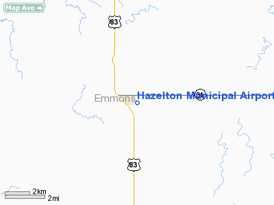
Location & QuickFacts
| FAA Information Effective: | 2008-09-25 |
| Airport Identifier: | 6H8 |
| Airport Status: | Operational |
| Longitude/Latitude: | 100-16-11.4030W/46-28-54.9640N
-100.269834/46.481934 (Estimated) |
| Elevation: | 2003 ft / 610.51 m (Estimated) |
| Land: | 12 acres |
| From nearest city: | 1 nautical miles E of Hazelton, ND |
| Location: | Emmons County, ND |
| Magnetic Variation: | 09E (1985) |
Owner & Manager
| Ownership: | Publicly owned |
| Owner: | Mike Appert |
| Address: | 755 Hwy 34
Hazelton, ND 58544 |
| Phone number: | 701-782-6269 |
| Address: |
|
Airport Operations and Facilities
| Airport Use: | Open to public |
| Wind indicator: | Yes |
| Segmented Circle: | No |
| Control Tower: | No |
| Landing fee charge: | No |
| Sectional chart: | Twin Cities |
| Region: | AGL - Great Lakes |
| Boundary ARTCC: | ZMP - Minneapolis |
| Tie-in FSS: | GFK - Grand Forks |
| FSS on Airport: | No |
| FSS Toll Free: | 1-800-WX-BRIEF |
| NOTAMs Facility: | GFK (NOTAM-d service avaliable) |
Airport Communications
Airport Services
| Airframe Repair: | NONE |
| Power Plant Repair: | NONE |
| Bottled Oxygen: | NONE |
| Bulk Oxygen: | NONE |
Runway Information
Runway 17/35
| Dimension: | 3800 x 100 ft / 1158.2 x 30.5 m |
| Surface: | TURF, Fair Condition
SFC FAIR WITH GRASS CLUMPS & HOLES POSSIBLE. |
| |
Runway 17 |
Runway 35 |
| Longitude: | 100-15-50.5100W | 100-15-50.4935W |
| Latitude: | 46-29-14.6800N | 46-28-37.1675N |
| Elevation: | 1995.00 ft | 0.00 ft |
| Traffic Pattern: | Left | Left |
| Markings: | None, | None, |
| Runway End Identifier: | No | No |
| Centerline Lights: | No | No |
| Touchdown Lights: | No | No |
| Obstruction: | 30 ft road, 130.0 ft from runway, 4:1 slope to clear | 4 ft fence, 0.0 ft from runway |
|
Radio Navigation Aids
| ID |
Type |
Name |
Ch |
Freq |
Var |
Dist |
| BI | NDB | Jadan | | 230.00 | 11E | 20.3 nm |
| BIS | VOR/DME | Bismarck | 112X | 116.50 | 12E | 23.4 nm |
Remarks
- PILOTS AT WEST END OF TWY CANNOT SEE ACFT ON OPPOSITE END DUE TO STEEP DOWNSLOPE.
- TWY CNTRLN AREA HAS ROUGH TURF SFC; SMOOTHEST IS SOUTH THIRD.
- CONFIRM WINTER COND BEFORE USE; SNOW REMOVAL IRREGULAR; CALL (701) 782-6878.
- RY 17/35: +50 FT TREES 200 FT PARALLEL TO RY CNTRLN CAUSING PSBL CROSSWIND TURBULENCE.
- RY 17 -3 FT DITCH 30 FT OUTBOUND FM THLD.
- GRAVEL-DIRT ACCESS ROAD POOR & SOFT WHEN WET; POTHOLES POSSIBLE.
- RY 17 ALSO +16 FT ROAD 75 FT FM THR ON CNTRLN; APCH RATIO 4:1.
- RY 17 ALSO +30 FT TREES 300 FT FM THLD; 150 FT R OF CNTRLN; APCH RATIO 10:1.
Images and information placed above are from
http://www.airport-data.com/airport/6H8/
We thank them for the data!
| General Info
|
| Country |
United States
|
| State |
NORTH DAKOTA
|
| FAA ID |
6H8
|
| Latitude |
46-28-54.964N
|
| Longitude |
100-16-11.403W
|
| Elevation |
2003 feet
|
| Near City |
HAZELTON
|
We don't guarantee the information is fresh and accurate. The data may
be wrong or outdated.
For more up-to-date information please refer to other sources.
|
|


