 |
|
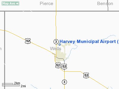
Location & QuickFacts
| FAA Information Effective: | 2008-09-25 |
| Airport Identifier: | 5H4 |
| Airport Status: | Operational |
| Longitude/Latitude: | 099-55-54.2720W/47-47-28.4390N
-99.931742/47.791233 (Estimated) |
| Elevation: | 1605 ft / 489.20 m (Surveyed) |
| Land: | 215 acres |
| From nearest city: | 1 nautical miles N of Harvey, ND |
| Location: | Wells County, ND |
| Magnetic Variation: | 08E (2000) |
Owner & Manager
| Ownership: | Publicly owned |
| Owner: | Harvey Airport Authority |
| Address: | 120 West 8th Street
Harvey, ND 58341 |
| Phone number: | 701-324-2000
HARVEY CITY HALL |
| Manager: | Mark Demory
CHARIMAN OF AIRPORT AUTHORITY. |
| Address: | 120 West 8th Street
|
| Phone number: | 701-324-2000
ADDL PHONE MARK DEMORY, CHAIRMAN 701-324-2281/4909 OR BOB ALJETS 701-324-2680 / 4111 |
Airport Operations and Facilities
| Airport Use: | Open to public |
| Wind indicator: | Yes |
| Segmented Circle: | Yes |
| Control Tower: | No |
| Lighting Schedule: | DUSK-DAWN
MIRL RY 11/29 PRESET ON LOW INTST; TO INCR INTST & ACTVT PAPI RYS 11 & 29 - CTAF. |
| Beacon Color: | Clear-Green (lighted land airport) |
| Landing fee charge: | No |
| Sectional chart: | Twin Cities |
| Region: | AGL - Great Lakes |
| Boundary ARTCC: | ZMP - Minneapolis |
| Tie-in FSS: | GFK - Grand Forks |
| FSS on Airport: | No |
| FSS Toll Free: | 1-800-WX-BRIEF |
| NOTAMs Facility: | GFK (NOTAM-d service avaliable) |
| Federal Agreements: | NGY |
Airport Communications
| CTAF: | 122.800 |
| Unicom: | 122.800
UNICOM LCTD AT HOSPITAL. |
Airport Services
| Fuel available: | 100LL
FOR FUEL-CALL 701-324-2225 HARVEY POLICE DEPT OR ARPT MGR 701-324-2000. |
| Bottled Oxygen: | NONE |
| Bulk Oxygen: | NONE |
Runway Information
Runway 11/29
| Dimension: | 3600 x 60 ft / 1097.3 x 18.3 m |
| Surface: | ASPH, Good Condition |
| Weight Limit: | Single wheel: 12500 lbs. |
| Edge Lights: | Medium |
| |
Runway 11 |
Runway 29 |
| Longitude: | 099-56-17.1160W | 099-55-31.4320W |
| Latitude: | 47-47-37.3030N | 47-47-19.5730N |
| Elevation: | 1603.00 ft | 1604.00 ft |
| Alignment: | 120 | 127 |
| Traffic Pattern: | Left | Left |
| Markings: | Non-precision instrument, Good Condition | Non-precision instrument, Good Condition |
| Crossing Height: | 26.00 ft | 28.00 ft |
| VASI: | 2-light PAPI on left side | 2-light PAPI on left side |
| Visual Glide Angle: | 3.00° | 3.00° |
| Obstruction: | 17 ft road, 640.0 ft from runway, 150 ft right of centerline, 25:1 slope to clear | 30 ft pline, 1450.0 ft from runway, 300 ft right of centerline, 41:1 slope to clear |
|
Radio Navigation Aids
| ID |
Type |
Name |
Ch |
Freq |
Var |
Dist |
| RUG | NDB | Rugby | | 212.00 | 08E | 36.1 nm |
| DVL | VOR/DME | Devils Lake | 047X | 111.00 | 07E | 45.4 nm |
Remarks
- CONFIRM SNOW REMOVAL AFT MAJOR STORM AMGR 701-324-2000.
- EXISTED PRIOR TO 1959.
Images and information placed above are from
http://www.airport-data.com/airport/5H4/
We thank them for the data!
| General Info
|
| Country |
United States
|
| State |
NORTH DAKOTA
|
| FAA ID |
5H4
|
| Latitude |
47-47-28.439N
|
| Longitude |
099-55-54.272W
|
| Elevation |
1605 feet
|
| Near City |
HARVEY
|
We don't guarantee the information is fresh and accurate. The data may
be wrong or outdated.
For more up-to-date information please refer to other sources.
|
|


