 |
|
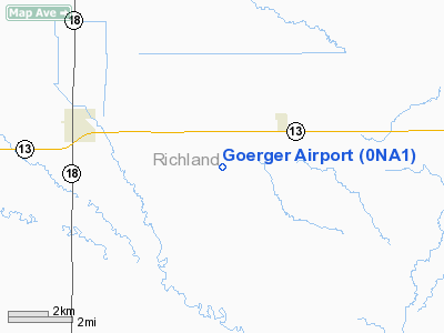
Location & QuickFacts
| FAA Information Effective: | 2008-09-25 |
| Airport Identifier: | 0NA1 |
| Airport Status: | Operational |
| Longitude/Latitude: | 097-02-15.3080W/46-14-43.8540N
-97.037586/46.245515 (Estimated) |
| Elevation: | 1045 ft / 318.52 m (Estimated) |
| Land: | 2 acres |
| From nearest city: | 2 nautical miles SW of Barney, ND |
| Location: | Richland County, ND |
| Magnetic Variation: | 06E (1985) |
Owner & Manager
| Ownership: | Privately owned |
| Owner: | Allan E. Goerger |
| Address: | 8085 161 Ave Se
Barney, ND 58008 |
| Phone number: | 701-640-2460 |
| Manager: | Allan E. Goerger |
| Address: | 8085 161 Ave Se
Barney, ND 58008 |
| Phone number: | 701-439-2754 |
Airport Operations and Facilities
| Airport Use: | Private |
| Wind indicator: | Yes |
| Segmented Circle: | No |
| Control Tower: | No |
| Landing fee charge: | No |
| Sectional chart: | Twin Cities |
| Region: | AGL - Great Lakes |
| Boundary ARTCC: | ZMP - Minneapolis |
| Tie-in FSS: | GFK - Grand Forks |
| FSS on Airport: | No |
| FSS Toll Free: | 1-800-WX-BRIEF |
Runway Information
Runway 08/26
| Dimension: | 2600 x 50 ft / 792.5 x 15.2 m |
| Surface: | TURF, |
| |
Runway 08 |
Runway 26 |
| Traffic Pattern: | Left | Left |
|
Radio Navigation Aids
| ID |
Type |
Name |
Ch |
Freq |
Var |
Dist |
| BWP | NDB | Breckenridge-wahpeton | | 233.00 | 05E | 18.0 nm |
| GWR | NDB | Gwinner | | 278.00 | 07E | 25.2 nm |
| ETH | NDB | Wheaton | | 326.00 | 05E | 34.5 nm |
| BTN | NDB | Britton | | 386.00 | 06E | 39.1 nm |
| AA | NDB | Kenie | | 365.00 | 06E | 46.8 nm |
| FFM | VOR/DME | Fergus Falls | 041X | 110.40 | 05E | 36.7 nm |
| FAR | VORTAC | Fargo | 109X | 116.20 | 09E | 31.5 nm |
Remarks
- CONDITIONAL-PROVIDED ALL TRAFFIC OPEARATIONS ARE CONDUCTED SO OF RWY; OBSTRUCTIONS IN RWY26 APPROACH SLOPE SURFACE BE REMOVED OR LOWERED OR RWY THRESHOLD BE DISPLACED & CLEARLY MARKED TO PROVIDE A MIN 20:1 APPROACH CLEARANCE OVER ALL OBSTRUCTIONS.
Images and information placed above are from
http://www.airport-data.com/airport/0NA1/
We thank them for the data!
| General Info
|
| Country |
United States
|
| State |
NORTH DAKOTA
|
| FAA ID |
0NA1
|
| Latitude |
46-14-43.854N
|
| Longitude |
097-02-15.308W
|
| Elevation |
1045 feet
|
| Near City |
BARNEY
|
We don't guarantee the information is fresh and accurate. The data may
be wrong or outdated.
For more up-to-date information please refer to other sources.
|
|


