 |
|
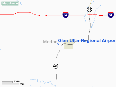
Location & QuickFacts
| FAA Information Effective: | 2008-09-25 |
| Airport Identifier: | D57 |
| Airport Status: | Operational |
| Longitude/Latitude: | 101-51-36.5600W/46-48-46.0190N
-101.860156/46.812783 (Estimated) |
| Elevation: | 2089 ft / 636.73 m (Estimated) |
| Land: | 165 acres |
| From nearest city: | 2 nautical miles W of Glen Ullin, ND |
| Location: | Morton County, ND |
| Magnetic Variation: | 11E (1985) |
Owner & Manager
| Ownership: | Publicly owned |
| Owner: | Glen Ullin Arpt Authority |
| Address: | Box 70
Glen Ullin, ND 58631-0070 |
| Phone number: | 701-348-3683
CLERK FOR CITY OF GLEN ULLIN. |
| Manager: | Roger Kinnischtzke
CHRMN ARPT AUTH MEMBER |
| Address: | 6740 39th St
Glen Ullin, ND 58631 |
| Phone number: | 701-348-3170
ADDNL PHONE ROGER KINNISHTZKE ON ARPT CONDS/SNOW REMOVAL 701-348-3170. |
Airport Operations and Facilities
| Airport Use: | Open to public |
| Wind indicator: | Yes |
| Segmented Circle: | No |
| Control Tower: | No |
| Lighting Schedule: | DUSK-DAWN
ACRVT MIRL RY 11/29 & PAPI RYS 11 & 29 - CTAF. |
| Beacon Color: | Clear-Green (lighted land airport) |
| Landing fee charge: | No |
| Sectional chart: | Billings |
| Region: | AGL - Great Lakes |
| Boundary ARTCC: | ZMP - Minneapolis |
| Tie-in FSS: | GFK - Grand Forks |
| FSS on Airport: | No |
| FSS Toll Free: | 1-800-WX-BRIEF |
| NOTAMs Facility: | GFK (NOTAM-d service avaliable) |
| Federal Agreements: | N1 |
Airport Communications
Airport Services
| Fuel available: | 100LL
FOR FUEL CALL (701) 348-3170/3683/3586 OR 471-4752 |
| Airframe Repair: | NONE |
| Power Plant Repair: | NONE |
| Bottled Oxygen: | NONE |
| Bulk Oxygen: | NONE |
Runway Information
Runway 11/29
| Dimension: | 3800 x 60 ft / 1158.2 x 18.3 m |
| Surface: | ASPH, Good Condition |
| Weight Limit: | Single wheel: 12500 lbs. |
| Edge Lights: | Medium |
| |
Runway 11 |
Runway 29 |
| Longitude: | 101-52-18.7500W | 101-51-30.6000W |
| Latitude: | 46-49-00.3700N | 46-48-42.6400N |
| Elevation: | 2091.00 ft | 2091.00 ft |
| Traffic Pattern: | Left | Left |
| Markings: | Non-precision instrument, Good Condition | Non-precision instrument, Good Condition |
| Crossing Height: | 25.00 ft | 25.00 ft |
| VASI: | 2-light PAPI on left side | 2-light PAPI on left side |
| Visual Glide Angle: | 3.00° | 3.00° |
| Obstruction: | , 50:1 slope to clear | 19 ft trees, 900.0 ft from runway, 100L/ ft right of centerline, 36:1 slope to clear |
|
Radio Navigation Aids
| ID |
Type |
Name |
Ch |
Freq |
Var |
Dist |
| BIS | VOR/DME | Bismarck | 112X | 116.50 | 12E | 49.3 nm |
| DIK | VORTAC | Dickinson | 076X | 112.90 | 14E | 37.7 nm |
Remarks
- TO CONFIRM IREG SNOW REMOVAL & WINTER CONDITION CALL 701-348-3170/3683/3586 OR 471-4752
Images and information placed above are from
http://www.airport-data.com/airport/D57/
We thank them for the data!
| General Info
|
| Country |
United States
|
| State |
NORTH DAKOTA
|
| FAA ID |
D57
|
| Latitude |
46-48-46.019N
|
| Longitude |
101-51-36.560W
|
| Elevation |
2089 feet
|
| Near City |
GLEN ULLIN
|
We don't guarantee the information is fresh and accurate. The data may
be wrong or outdated.
For more up-to-date information please refer to other sources.
|
|


