 |
|
Location & QuickFacts
| FAA Information Effective: | 2008-09-25 |
| Airport Identifier: | ND14 |
| Airport Status: | Operational |
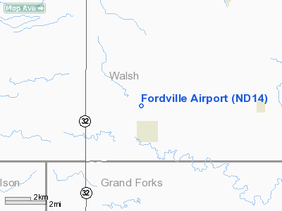
| Longitude/Latitude: | 097-48-06.3230W/48-14-04.9760N
-97.801756/48.234716 (Estimated) |
| Elevation: | 1154 ft / 351.74 m (Surveyed) |
| Land: | 160 acres |
| From nearest city: | 2 nautical miles NW of Fordville, ND |
| Location: | Walsh County, ND |
| Magnetic Variation: | 07E (1985) |
Owner & Manager
| Ownership: | Privately owned |
| Owner: | C, Roger Aafedt |
| Address: | 132 2nd St. S
Sabin, MN 56580 |
| Phone number: | 218-789-7394 |
| Manager: | C. Roger Aafedt |
| Address: | 132 2nd St. S
Sabin, MN 56580 |
| Phone number: | 218-789-7394 |
Airport Operations and Facilities
| Airport Use: | Private |
| Wind indicator: | Yes |
| Segmented Circle: | No |
| Control Tower: | No |
| Landing fee charge: | No |
| Sectional chart: | Twin Cities |
| Region: | AGL - Great Lakes |
| Boundary ARTCC: | ZMP - Minneapolis |
| Tie-in FSS: | GFK - Grand Forks |
| FSS on Airport: | No |
| FSS Toll Free: | 1-800-WX-BRIEF |
Airport Services
| Airframe Repair: | NONE |
| Power Plant Repair: | NONE |
| Bottled Oxygen: | NONE |
| Bulk Oxygen: | NONE |
Runway Information
Runway 08/26
| Dimension: | 2200 x 100 ft / 670.6 x 30.5 m |
| Surface: | TURF, Fair Condition
& 17/35 TURF ROLLING TERRAIN WITH HOLES POSSIBLE. |
| |
Runway 08 |
Runway 26 |
| Longitude: | 097-48-22.3200W | 097-47-49.3200W |
| Latitude: | 48-14-16.9700N | 48-14-16.9700N |
| Elevation: | 1154.00 ft | 1154.00 ft |
| Traffic Pattern: | Left | Left |
| Markings: | None, | None, |
| Runway End Identifier: | No | No |
| Centerline Lights: | No | No |
| Touchdown Lights: | No | No |
| Obstruction: | 3 ft post, 50.0 ft from runway, 16:1 slope to clear | 20 ft trees, 10.0 ft from runway |
|
Runway 17/35
| Dimension: | 2600 x 100 ft / 792.5 x 30.5 m |
| Surface: | TURF, Fair Condition
& 17/35 TURF ROLLING TERRAIN WITH HOLES POSSIBLE. |
| |
Runway 17 |
Runway 35 |
| Longitude: | 097-47-49.3200W | 097-47-49.3200W |
| Latitude: | 48-14-16.9700N | 48-13-51.9700N |
| Elevation: | 1154.00 ft | 1154.00 ft |
| Traffic Pattern: | Left | Left |
| Markings: | None, | None, |
| Runway End Identifier: | No | No |
| Centerline Lights: | No | No |
| Touchdown Lights: | No | No |
| Obstruction: | 4 ft fence, 10.0 ft from runway, 2:1 slope to clear | 3 ft post, 10.0 ft from runway, 3:1 slope to clear |
|
Radio Navigation Aids
| ID |
Type |
Name |
Ch |
Freq |
Var |
Dist |
| RDR | TACAN | Red River | 111X | | 06E | 23.0 nm |
| GFK | VOR/DME | Grand Forks | 090X | 114.30 | 09E | 29.9 nm |
| DVL | VOR/DME | Devils Lake | 047X | 111.00 | 07E | 45.1 nm |
| HML | VORTAC | Humboldt | 071X | 112.40 | 09E | 46.9 nm |
Remarks
- ARPT CLSD WINTERS DUE TO LACK OF SNOW REMOVAL. (NOV-APR)
- RY 35 LOW AREA HAS WATER IN SPRING THAW.
- RY 17 & 26 NUMEROUS TREES & BLDGS IN THIS AREA.
- EXISTED PRIOR TO 1959.
Images and information placed above are from
http://www.airport-data.com/airport/ND14/
We thank them for the data!
| General Info
|
| Country |
United States
|
| State |
NORTH DAKOTA
|
| FAA ID |
ND14
|
| Latitude |
48-14-04.976N
|
| Longitude |
097-48-06.323W
|
| Elevation |
1154 feet
|
| Near City |
FORDVILLE
|
We don't guarantee the information is fresh and accurate. The data may
be wrong or outdated.
For more up-to-date information please refer to other sources.
|
|


