 |
|
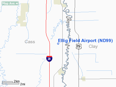
Location & QuickFacts
| FAA Information Effective: | 2008-09-25 |
| Airport Identifier: | ND99 |
| Airport Status: | Operational |
| Longitude/Latitude: | 096-48-34.3000W/46-43-12.8700N
-96.809528/46.720242 (Estimated) |
| Elevation: | 910 ft / 277.37 m (Estimated) |
| Land: | 130 acres |
| From nearest city: | 3 nautical miles N of Hickson, ND |
| Location: | Cass County, ND |
| Magnetic Variation: | 06E (1990) |
Owner & Manager
| Ownership: | Privately owned |
| Owner: | Todd L Ellig |
| Address: | 2005 124th Avenue S.
Horace, ND 58047 |
| Phone number: | 701-237-5478 |
| Manager: | Todd L Ellig |
| Address: | 2005 124th Avenue S.
Horace, ND 58047 |
| Phone number: | 701-793-9695 |
Airport Operations and Facilities
| Airport Use: | Private |
| Wind indicator: | Yes |
| Segmented Circle: | No |
| Control Tower: | No |
| Sectional chart: | Twin Cities |
| Region: | AGL - Great Lakes |
| Boundary ARTCC: | ZMP - Minneapolis |
| Tie-in FSS: | GFK - Grand Forks |
| FSS Toll Free: | 1-800-WX-BRIEF |
Runway Information
Runway 18/36
| Dimension: | 2640 x 66 ft / 804.7 x 20.1 m |
| Surface: | TURF, Good Condition |
| |
Runway 18 |
Runway 36 |
| Traffic Pattern: | Left | Left |
| Displaced threshold: | 0.00 ft | 200.00 ft |
|
Radio Navigation Aids
| ID |
Type |
Name |
Ch |
Freq |
Var |
Dist |
| AA | NDB | Kenie | | 365.00 | 06E | 17.4 nm |
| BWP | NDB | Breckenridge-wahpeton | | 233.00 | 05E | 29.8 nm |
| GWR | NDB | Gwinner | | 278.00 | 07E | 45.6 nm |
| VCY | NDB | Valley City | | 382.00 | 07E | 46.4 nm |
| FFM | VOR/DME | Fergus Falls | 041X | 110.40 | 05E | 37.4 nm |
| DTL | VOR/DME | Detroit Lakes | 049X | 111.20 | 05E | 38.5 nm |
| FAR | VORTAC | Fargo | 109X | 116.20 | 09E | 2.6 nm |
Remarks
- PRVDD THE AREA 125' EITHER SIDE OF RY CTR & 200' FM EITHER END OF RY END BE CLEAR OF ANY OBSTN. RELCTG RY 36 THR 200' N. ANY OBSTNS IN THE RY APCH SLOPE SFC BE LOWERED OR REMOVED OTRW THE RY THRS SHOULD BE DSPLCD & CLEARLY MKD SO AS TO PROVIDE A MINIMUM 20:1 APCH CLNC OVER ALL OBSTN.
Images and information placed above are from
http://www.airport-data.com/airport/ND99/
We thank them for the data!
| General Info
|
| Country |
United States
|
| State |
NORTH DAKOTA
|
| FAA ID |
ND99
|
| Latitude |
46-43-12.870N
|
| Longitude |
096-48-34.300W
|
| Elevation |
910 feet
|
| Near City |
HICKSON
|
We don't guarantee the information is fresh and accurate. The data may
be wrong or outdated.
For more up-to-date information please refer to other sources.
|
|


