 |
|
Location & QuickFacts
| FAA Information Effective: | 2008-09-25 |
| Airport Identifier: | Y71 |
| Airport Status: | Operational |
| Longitude/Latitude: | 101-50-42.5220W/46-22-58.0240N
-101.845145/46.382784 (Estimated) |
| Elevation: | 2355 ft / 717.80 m (Surveyed) |
| Land: | 10 acres |
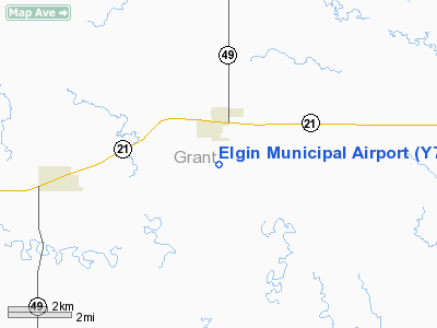
| From nearest city: | 1 nautical miles S of Elgin, ND |
| Location: | Grant County, ND |
| Magnetic Variation: | 10E (1985) |
Owner & Manager
| Ownership: | Publicly owned |
| Owner: | Elgin Arpt Authority |
| Address: | 7025 76th Ave Sw
Elgin, ND 58533 |
| Phone number: | 701-584-2973 |
| Manager: | Carlton Levorsen
CHRMN OF ARPT AUTH; HOME PHONE 701-594-2973. |
| Address: | 7025 76th Ave Sw
Elgin, ND 58533 |
| Phone number: | 701-584-2973
OR RON WELKUM 701-594-2988/2986. |
Airport Operations and Facilities
| Airport Use: | Open to public |
| Wind indicator: | Yes |
| Segmented Circle: | No |
| Control Tower: | No |
| Lighting Schedule: | DUSK-DAWN
ACTVT LIRL RY 12/30 - CTAF |
| Beacon Color: | Clear-Green (lighted land airport)
ARPT BCN OTS INDEFLY. |
| Landing fee charge: | No |
| Sectional chart: | Billings |
| Region: | AGL - Great Lakes |
| Boundary ARTCC: | ZMP - Minneapolis |
| Tie-in FSS: | GFK - Grand Forks |
| FSS on Airport: | No |
| FSS Toll Free: | 1-800-WX-BRIEF |
| NOTAMs Facility: | GFK (NOTAM-d service avaliable) |
Airport Communications
Airport Services
| Airframe Repair: | NONE |
| Power Plant Repair: | NONE |
| Bottled Oxygen: | NONE |
| Bulk Oxygen: | NONE |
Runway Information
Runway 12/30
| Dimension: | 3000 x 120 ft / 914.4 x 36.6 m |
| Surface: | TURF, Good Condition |
| Edge Lights: | Low |
| |
Runway 12 |
Runway 30 |
| Longitude: | 101-50-57.2300W | 101-50-27.5000W |
| Latitude: | 46-23-09.3000N | 46-22-48.0000N |
| Elevation: | 2338.00 ft | 2355.00 ft |
| Traffic Pattern: | Left | Left |
| Markings: | None, | None, |
| Runway End Identifier: | No | No |
| Centerline Lights: | No | No |
| Touchdown Lights: | No | No |
| Obstruction: | 4 ft fence, 100.0 ft from runway, 12 ft right of centerline, 25:1 slope to clear | , 50:1 slope to clear |
|
Radio Navigation Aids
| ID |
Type |
Name |
Ch |
Freq |
Var |
Dist |
| HEI | NDB | Hettinger | | 392.00 | 12E | 40.0 nm |
| LEM | VOR | Lemmon | | 111.40 | 13E | 29.8 nm |
| DIK | VORTAC | Dickinson | 076X | 112.90 | 14E | 47.9 nm |
Remarks
- CONFIRM SNOW REMOVAL; ON REQUEST ONLY IN WINTER MOS WITH AMGR BEFORE USE 701-584-2525/2973.
- NO LINE-OF-SIGHT BTN RWYS 12 & 30 BGNG 500'FM RWY 12 END & 1000'FM RWY 30 END TO A HGT OF 20' MID-CNTR.
- TWY SFC FAIR WITH SMALL ROCKS.
- RY 30 -10 FT DROPOFF 100 FT FROM THR OUTBOUND.
Images and information placed above are from
http://www.airport-data.com/airport/Y71/
We thank them for the data!
| General Info
|
| Country |
United States
|
| State |
NORTH DAKOTA
|
| FAA ID |
Y71
|
| Latitude |
46-22-58.024N
|
| Longitude |
101-50-42.522W
|
| Elevation |
2355 feet
|
| Near City |
ELGIN
|
We don't guarantee the information is fresh and accurate. The data may
be wrong or outdated.
For more up-to-date information please refer to other sources.
|
|


