 |
|
| Crosby Municipal Airport |
| IATA: none – ICAO: none – FAA LID: D50 |
| Summary |
| Airport type |
Public |
| Owner |
Crosby Airport Authority |
| Location |
Crosby, North Dakota |
| Elevation AMSL |
1950 ft / 594.4 m |
| Coordinates |
48°55′43″N 103°17′50″W / 48.92861°N 103.29722°W / 48.92861; -103.29722Coordinates: 48°55′43″N 103°17′50″W / 48.92861°N 103.29722°W / 48.92861; -103.29722 |
| Runways |
| Direction |
Length |
Surface |
| ft |
m |
| 12/30 |
3,800 |
1,158 |
Asphalt |
| 3/21 |
2,700 |
823 |
Turf |
| Statistics (2007) |
| Aircraft operations |
2,440 |
| Source: Federal Aviation Administration |
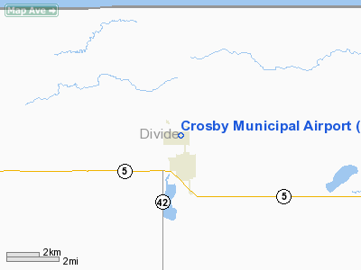
Crosby Municipal Airport (FAA LID: D50) is a public airport located one mile (1.6 km) north of the central business district of Crosby, in Divide County, North Dakota, United States. It is owned by the Crosby Airport Authority.
Facilities and aircraft
Crosby Municipal Airport covers an area of 217 acres (88 ha) which contains two runways:
- Runway 12/30: 3,800 x 60 ft (1,158 x 18 m), Surface: Asphalt
- Runway 3/21: 2,700 x 100 ft (823 x 30m), Surface: Turf
For the 12-month period ending July 31, 2007, the airport had 2,440 aircraft operations: 90% general aviation, 8% air taxi, and 2% military.
The above content comes from Wikipedia and is published under free licenses – click here to read more.
Location & QuickFacts
| FAA Information Effective: | 2008-09-25 |
| Airport Identifier: | D50 |
| Airport Status: | Operational |
| Longitude/Latitude: | 103-17-50.1050W/48-55-42.6560N
-103.297251/48.928516 (Estimated) |
| Elevation: | 1950 ft / 594.36 m (Surveyed) |
| Land: | 217 acres |
| From nearest city: | 1 nautical miles N of Crosby, ND |
| Location: | Divide County, ND |
| Magnetic Variation: | 11E (2000) |
Owner & Manager
| Ownership: | Publicly owned |
| Owner: | Crosby Arpt Auth
JOHN BENTER, CHAIRMAN ARPT AUTHORITY. |
| Address: | Po Box 193
Crosby, ND 58730 |
| Phone number: | 701-965-6382 |
| Manager: | John Benter
ARPT MAINT & SNOW RMVL CTC PERSON. |
| Address: | Po Box 617
Crosby, ND 58730 |
| Phone number: | 701-965-6512
HOME PHONE 701-965-6775 ; ADL CTC NEIL BENTER 701-965-6512/6775 |
Airport Operations and Facilities
| Airport Use: | Open to public |
| Wind indicator: | Yes |
| Segmented Circle: | Yes |
| Control Tower: | No |
| Lighting Schedule: | DUSK-DAWN
PAPI RYS 12 & 30 OPER DUSK-0100. MIRL RY 12/30 PRESET ON LOW INTST DUSK-0100; TO INCR INTST ACTVT - CTAF. AFT 0100 ACTVT MIRL RY 12/30 & PAPI RYS 12 & 30 - CTAF. |
| Beacon Color: | Clear-Green (lighted land airport) |
| Landing fee charge: | No |
| Sectional chart: | Billings |
| Region: | AGL - Great Lakes |
| Boundary ARTCC: | ZLC - Salt Lake City |
| Tie-in FSS: | GFK - Grand Forks |
| FSS on Airport: | No |
| FSS Toll Free: | 1-800-WX-BRIEF |
| NOTAMs Facility: | GFK (NOTAM-d service avaliable) |
| Federal Agreements: | NGY |
Airport Communications
Airport Services
| Fuel available: | 100
24 HOUR SELF SVC CREDIT CARD FUEL AVBL. |
| Airframe Repair: | NONE |
| Power Plant Repair: | NONE |
| Bottled Oxygen: | NONE |
| Bulk Oxygen: | NONE |
Runway Information
Runway 03/21
| Dimension: | 2700 x 100 ft / 823.0 x 30.5 m |
| Surface: | TURF, Good Condition |
| |
Runway 03 |
Runway 21 |
| Longitude: | 103-17-55.6750W | 103-17-27.6750W |
| Latitude: | 48-55-30.1190N | 48-55-49.1200N |
| Elevation: | 1947.00 ft | 1939.00 ft |
| Traffic Pattern: | Left | Left |
| Runway End Identifier: | No | No |
| Centerline Lights: | No | No |
| Touchdown Lights: | No | No |
| Obstruction: | 22 ft road, 550.0 ft from runway, 150 ft right of centerline, 25:1 slope to clear | 18 ft road, 100.0 ft from runway, 125 ft left of centerline, 5:1 slope to clear |
|
Runway 12/30
| Dimension: | 3800 x 60 ft / 1158.2 x 18.3 m |
| Surface: | ASPH, Good Condition |
| Weight Limit: | Single wheel: 12500 lbs. |
| Edge Lights: | Medium |
| |
Runway 12 |
Runway 30 |
| Longitude: | 103-18-16.2160W | 103-17-35.9740W |
| Latitude: | 48-55-58.0660N | 48-55-31.5600N |
| Elevation: | 1950.00 ft | 1944.00 ft |
| Alignment: | 127 | 127 |
| Traffic Pattern: | Left | Left |
| Markings: | Non-precision instrument, Good Condition | Non-precision instrument, Good Condition |
| Crossing Height: | 22.00 ft | 23.00 ft |
| VASI: | 2-light PAPI on left side | 2-light PAPI on left side |
| Visual Glide Angle: | 3.00° | 3.00° |
| Runway End Identifier: | No | No |
| Centerline Lights: | No | No |
| Touchdown Lights: | No | No |
| Obstruction: | 60 ft pline, 2100.0 ft from runway, 31:1 slope to clear | 22 ft road, 800.0 ft from runway, 200 ft left of centerline, 27:1 slope to clear |
|
Radio Navigation Aids
| ID |
Type |
Name |
Ch |
Freq |
Var |
Dist |
| ISN | NDB | Williston | | 275.00 | 15E | 48.4 nm |
| PWD | NDB | Plentywood | | 251.00 | 16E | 49.3 nm |
| ISN | VORTAC | Williston | 110X | 116.30 | 12E | 44.4 nm |
Remarks
- +250' TOWER 4000' SOUTH OF AIRPORT.
Images and information placed above are from
http://www.airport-data.com/airport/D50/
We thank them for the data!
| General Info
|
| Country |
United States
|
| State |
NORTH DAKOTA
|
| FAA ID |
D50
|
| Latitude |
48-55-42.656N
|
| Longitude |
103-17-50.105W
|
| Elevation |
1950 feet
|
| Near City |
CROSBY
|
We don't guarantee the information is fresh and accurate. The data may
be wrong or outdated.
For more up-to-date information please refer to other sources.
|
|


