 |
|
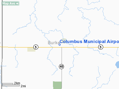
Location & QuickFacts
| FAA Information Effective: | 2008-09-25 |
| Airport Identifier: | D49 |
| Airport Status: | Operational |
| Longitude/Latitude: | 102-47-31.6340W/48-53-55.1160N
-102.792121/48.898643 (Estimated) |
| Elevation: | 1930 ft / 588.26 m (Estimated) |
| Land: | 97 acres |
| From nearest city: | 1 nautical miles SW of Columbus, ND |
| Location: | Burke County, ND |
| Magnetic Variation: | 12E (1985) |
Owner & Manager
| Ownership: | Publicly owned |
| Owner: | Columbus Arpt Auth
CLERK FOR APT AUTH |
| Address: | Box 2
Columbus, ND 58727 |
| Phone number: | 701-939-6671 |
| Manager: | Roger Lautenschlager
CHAIRMAN OF ARPT AUTH; WES PETERSON (701) 939-5288 |
| Address: | Po Box 335
Columbus, ND 58727 |
| Phone number: | 701-939-5288
ADNL CTC PHONE 701-939-6671 KEITH BERG OR DAVE RONNING 701-939-4511 |
Airport Operations and Facilities
| Airport Use: | Open to public |
| Wind indicator: | Yes |
| Segmented Circle: | No |
| Control Tower: | No |
| Landing fee charge: | No |
| Sectional chart: | Billings |
| Region: | AGL - Great Lakes |
| Boundary ARTCC: | ZMP - Minneapolis |
| Tie-in FSS: | GFK - Grand Forks |
| FSS on Airport: | No |
| FSS Toll Free: | 1-800-WX-BRIEF |
| NOTAMs Facility: | D49 (NOTAM-d service avaliable) |
| Federal Agreements: | 1 |
Airport Communications
Airport Services
| Airframe Repair: | NONE |
| Power Plant Repair: | NONE |
| Bottled Oxygen: | NONE |
| Bulk Oxygen: | NONE |
Runway Information
Runway 07/25
| Dimension: | 2560 x 100 ft / 780.3 x 30.5 m |
| Surface: | TURF, Fair Condition |
| |
Runway 07 |
Runway 25 |
| Longitude: | 102-47-48.6300W | 102-47-12.6300W |
| Latitude: | 48-53-50.4800N | 48-53-59.1100N |
| Elevation: | 1929.00 ft | 1926.00 ft |
| Traffic Pattern: | Left | Left |
| Crossing Height: | 13.00 ft | 13.00 ft |
| Displaced threshold: | 0.00 ft | 200.00 ft
DSPLCD THR MKD WITH RED/WHITE PANEL AND LGTD. |
| VASI: | nonstandard system
APAP LEFT & RIGHT SIDES. | nonstandard system
APAP LEFT & RIGHT SIDES. |
| Visual Glide Angle: | 5.00° | 5.00° |
| Runway End Identifier: | No | No |
| Centerline Lights: | No | No |
| Touchdown Lights: | No | No |
| Obstruction: | , 50:1 slope to clear | 17 ft road, 40.0 ft from runway, 2:1 slope to clear
APCH RATIO 14:1 TO DSPLCD THR. |
|
Radio Navigation Aids
| ID |
Type |
Name |
Ch |
Freq |
Var |
Dist |
Remarks
- NO SNOW REMOVAL AVAILABLE WINTER MONTHS; CFM WINTER CONDS WITH AMGR (701) 939-5288/4511/6671/7831.
- TEST ARPT FOR NEW RWY MKG SYSTEM.
- RR 135' FM THR-APCH RATIO 5:1 ON RWY 25.
- RY 07/25 VASI-PLYWOOD PANELS LGTD NGT.
- RY 25 HAS -5 FT DITCH 30 FT FROM THR.
Images and information placed above are from
http://www.airport-data.com/airport/D49/
We thank them for the data!
| General Info
|
| Country |
United States
|
| State |
NORTH DAKOTA
|
| FAA ID |
D49
|
| Latitude |
48-53-55.116N
|
| Longitude |
102-47-31.634W
|
| Elevation |
1930 feet
|
| Near City |
COLUMBUS
|
We don't guarantee the information is fresh and accurate. The data may
be wrong or outdated.
For more up-to-date information please refer to other sources.
|
|


