 |
|
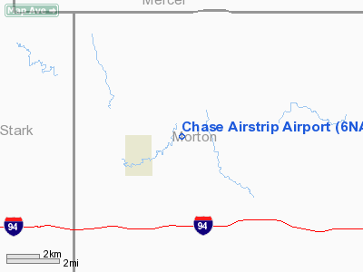
Location & QuickFacts
| FAA Information Effective: | 2008-09-25 |
| Airport Identifier: | 6NA5 |
| Airport Status: | Operational |
| Longitude/Latitude: | 102-00-32.5840W/46-54-46.0250N
-102.009051/46.912785 (Estimated) |
| Elevation: | 2140 ft / 652.27 m (Estimated) |
| Land: | 9 acres |
| From nearest city: | 2 nautical miles ES of Hebron, ND |
| Location: | Morton County, ND |
| Magnetic Variation: | 11E (1985) |
Owner & Manager
| Ownership: | Privately owned |
| Address: |
|
| Manager: | Keith R. Chase |
| Address: | Box 48
Hebron, ND 58638 |
| Phone number: | 701-878-4093 |
Airport Operations and Facilities
| Airport Use: | Private |
| Wind indicator: | Yes |
| Segmented Circle: | No |
| Control Tower: | No |
| Landing fee charge: | No |
| Sectional chart: | Billings |
| Region: | AGL - Great Lakes |
| Boundary ARTCC: | ZMP - Minneapolis |
| Tie-in FSS: | GFK - Grand Forks |
| FSS on Airport: | No |
| FSS Toll Free: | 1-800-WX-BRIEF |
Runway Information
Runway 13/31
| Dimension: | 3800 x 100 ft / 1158.2 x 30.5 m |
| Surface: | TURF, Poor Condition |
| |
Runway 13 |
Runway 31 |
| Traffic Pattern: | Left | Left |
|
Radio Navigation Aids
| ID |
Type |
Name |
Ch |
Freq |
Var |
Dist |
| DIK | VORTAC | Dickinson | 076X | 112.90 | 14E | 31.6 nm |
Images and information placed above are from
http://www.airport-data.com/airport/6NA5/
We thank them for the data!
| General Info
|
| Country |
United States
|
| State |
NORTH DAKOTA
|
| FAA ID |
6NA5
|
| Latitude |
46-54-46.025N
|
| Longitude |
102-00-32.584W
|
| Elevation |
2140 feet
|
| Near City |
HEBRON
|
We don't guarantee the information is fresh and accurate. The data may
be wrong or outdated.
For more up-to-date information please refer to other sources.
|
|


