 |
|
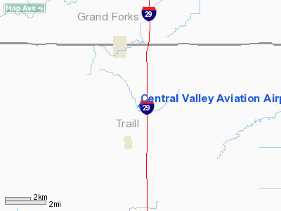
Central Valley Aviation Airport |
Location & QuickFacts
| FAA Information Effective: | 2008-09-25 |
| Airport Identifier: | NA81 |
| Airport Status: | Operational |
| Longitude/Latitude: | 097-05-11.3060W/47-37-41.9240N
-97.086474/47.628312 (Estimated) |
| Elevation: | 920 ft / 280.42 m (Estimated) |
| Land: | 2 acres |
| From nearest city: | 2 nautical miles NE of Buxton, ND |
| Location: | Traill County, ND |
| Magnetic Variation: | 06E (1985) |
Owner & Manager
| Ownership: | Privately owned |
| Owner: | Greg Troftgruben |
| Address: | P O Box 146
Buxton, ND 58218 |
| Phone number: | 701-847-2043 |
| Manager: | Greg Troftgruben |
| Address: | P O Box 146
Buxton, ND 58218 |
| Phone number: | 701-847-2043 |
Airport Operations and Facilities
| Airport Use: | Private
PERSONAL USE. |
| Segmented Circle: | No |
| Control Tower: | No |
| Sectional chart: | Twin Cities |
| Region: | AGL - Great Lakes |
| Boundary ARTCC: | ZMP - Minneapolis |
| Tie-in FSS: | GFK - Grand Forks |
| FSS on Airport: | No |
| FSS Toll Free: | 1-800-WX-BRIEF |
Airport Services
Runway Information
Runway 09/27
| Dimension: | 2000 x 20 ft / 609.6 x 6.1 m |
| Surface: | CONC, |
| |
Runway 09 |
Runway 27 |
| Traffic Pattern: | Left | Left |
| Obstruction: | , 30.0 ft from runway | 30 ft road, 50.0 ft from runway |
|
Radio Navigation Aids
| ID |
Type |
Name |
Ch |
Freq |
Var |
Dist |
| CKN | NDB | Crookston | | 400.00 | 07E | 22.9 nm |
| AA | NDB | Kenie | | 365.00 | 06E | 38.8 nm |
| RDR | TACAN | Red River | 111X | | 06E | 23.6 nm |
| GFK | VOR/DME | Grand Forks | 090X | 114.30 | 09E | 20.0 nm |
| TVF | VOR/DME | Thief River Falls | 021X | 108.40 | 08E | 45.0 nm |
Remarks
- TREES PARALLEL AND SOUTH OF RWY CNTRLN.
- PROVIDED TREES ADJACENT TO SOUTH EDGE OF RWY ARE REMOVED AS THEY MAY CAUSE TURBULENCE DURING CROSSWIND OPERATIONS.
Images and information placed above are from
http://www.airport-data.com/airport/NA81/
We thank them for the data!
| General Info
|
| Country |
United States
|
| State |
NORTH DAKOTA
|
| FAA ID |
NA81
|
| Latitude |
47-37-41.924N
|
| Longitude |
097-05-11.306W
|
| Elevation |
920 feet
|
| Near City |
BUXTON
|
We don't guarantee the information is fresh and accurate. The data may
be wrong or outdated.
For more up-to-date information please refer to other sources.
|
|


