 |
|
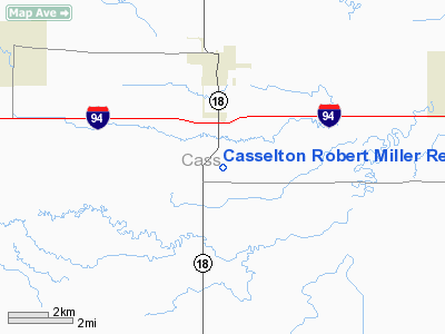
Casselton Robert Miller Rgnl Airport |
| Casselton Robert Miller Regional Airport |
| IATA: none – ICAO: none – FAA LID: 5N8 |
| Summary |
| Airport type |
Public |
| Owner |
Casselton Regional Airport Authority |
| Location |
Casselton, North Dakota |
| Elevation AMSL |
933 ft / 284 m |
| Coordinates |
46°51′15″N 97°12′31″W / 46.85417°N 97.20861°W / 46.85417; -97.20861 |
| Runways |
| Direction |
Length |
Surface |
| ft |
m |
| 13/31 |
3,900 |
1,189 |
Concrete |
| Statistics (1999) |
| Aircraft operations |
15,450 |
| Source: Federal Aviation Administration |
Casselton Robert Miller Regional Airport (FAA LID: 5N8) is a public airport located 4 miles (6.4 km) south of the central business district of Casselton, in Cass County, North Dakota, United States. It is owned by the Casselton Regional Airport Authority.
Facilities and aircraft
Casselton Robert Miller Regional Airport covers an area of 107 acres (43 ha) which contains one runway:
- Runway 13/31: 3,900 × 75 ft (1,189 × 23 m), Surface: Concrete
For the 12-month period ending October 20, 1999, the airport had 15,450 aircraft operations: 97% general aviation, 3% air taxi, and less than 1% military.
The above content comes from Wikipedia and is published under free licenses – click here to read more.
Location & QuickFacts
| FAA Information Effective: | 2008-09-25 |
| Airport Identifier: | 5N8 |
| Airport Status: | Operational |
| Longitude/Latitude: | 097-12-28.3000W/46-51-14.2000N
-97.207861/46.853944 (Estimated) |
| Elevation: | 933 ft / 284.38 m (Surveyed) |
| Land: | 107 acres |
| From nearest city: | 4 nautical miles S of Casselton, ND |
| Location: | Cass County, ND |
| Magnetic Variation: | 06E (1985) |
Owner & Manager
| Ownership: | Publicly owned |
| Owner: | Casselton Regional Apt Auth |
| Address: | C/o Chrmn - Box 64
Casselton, ND 58012 |
| Phone number: | 701-347-5519 |
| Manager: | Bob Miller
ADNL CTC PERRY OSCHNER 701-347-4680. |
| Address: | Box 64
Casselton, ND 58012 |
| Phone number: | 701-347-5519
ADNL PHONE FOR SVC 701-799-4606/701-347-4680. |
Airport Operations and Facilities
| Airport Use: | Open to public |
| Wind indicator: | Yes |
| Segmented Circle: | Yes |
| Control Tower: | No |
| Lighting Schedule: | RDO-CTL
ACTVT MIRL RY 13/31; PAPI RYS 13 & 31 & REIL RY 31 - CTAF. |
| Sectional chart: | Twin Cities |
| Region: | AGL - Great Lakes |
| Boundary ARTCC: | ZMP - Minneapolis |
| Tie-in FSS: | GFK - Grand Forks |
| FSS on Airport: | No |
| FSS Toll Free: | 1-800-WX-BRIEF |
| NOTAMs Facility: | GFK (NOTAM-d service avaliable) |
| Federal Agreements: | NGY |
Airport Communications
| CTAF: | 122.800 |
| Unicom: | 122.800 |
Airport Services
| Fuel available: | 100LL
FUEL AVAILABLE 24 HRS WITH CREDIT CARD OR CALL 701-347-5214. |
| Airframe Repair: | MAJOR |
| Power Plant Repair: | MAJOR |
Runway Information
Runway 13/31
| Dimension: | 3900 x 75 ft / 1188.7 x 22.9 m |
| Surface: | CONC, Good Condition |
| Weight Limit: | Single wheel: 12500 lbs. |
| Edge Lights: | Medium |
| |
Runway 13 |
Runway 31 |
| Longitude: | 097-12-48.3404W | 097-12-08.2463W |
| Latitude: | 46-51-27.6450N | 46-51-00.7081N |
| Elevation: | 933.00 ft | 928.00 ft |
| Alignment: | 127 | 127 |
| Traffic Pattern: | Left | Left |
| Markings: | Non-precision instrument, Good Condition | Non-precision instrument, Good Condition |
| Crossing Height: | 20.00 ft | 20.00 ft |
| VASI: | 2-light PAPI on right side
PAPI OTS INDEFLY. | 2-light PAPI on left side
PAPI OTS INDEFLY. |
| Visual Glide Angle: | 2.50° | 2.50° |
| Runway End Identifier: | | Yes |
| Obstruction: | 18 ft road, 700.0 ft from runway, 27:1 slope to clear | 12 ft road, 450.0 ft from runway, 300 ft right of centerline, 20:1 slope to clear |
|
Radio Navigation Aids
| ID |
Type |
Name |
Ch |
Freq |
Var |
Dist |
| AA | NDB | Kenie | | 365.00 | 06E | 18.6 nm |
| VCY | NDB | Valley City | | 382.00 | 07E | 29.1 nm |
| GWR | NDB | Gwinner | | 278.00 | 07E | 42.0 nm |
| BWP | NDB | Breckenridge-wahpeton | | 233.00 | 05E | 44.3 nm |
| FAR | VORTAC | Fargo | 109X | 116.20 | 09E | 15.9 nm |
Remarks
- CONFIRM WINTER CONDS & SNOW REMOVAL WITH AMGR CALL 701-347-4680 BTN 0800-1700.
- NUMEROUS AGRI OPNS MAY-AUG.
- RY 13/31 PARALLEL TWY MARKED WITH REFLECTORS.
- AIRCRAFT PAINT SHOP AVAILABLE 701-347-5262.
Images and information placed above are from
http://www.airport-data.com/airport/5N8/
We thank them for the data!
| General Info
|
| Country |
United States
|
| State |
NORTH DAKOTA
|
| FAA ID |
5N8
|
| Latitude |
46-51-16.903N
|
| Longitude |
097-12-31.321W
|
| Elevation |
932 feet
|
| Near City |
CASSELTON
|
We don't guarantee the information is fresh and accurate. The data may
be wrong or outdated.
For more up-to-date information please refer to other sources.
|
|


