 |
|
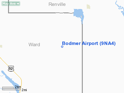
Location & QuickFacts
| FAA Information Effective: | 2008-09-25 |
| Airport Identifier: | 9NA4 |
| Airport Status: | Operational |
| Longitude/Latitude: | 101-53-26.5850W/48-39-58.0820N
-101.890718/48.666134 (Estimated) |
| Elevation: | 1885 ft / 574.55 m (Estimated) |
| Land: | 0 acres |
| From nearest city: | 9 nautical miles E of Kenmare, ND |
| Location: | Ward County, ND |
| Magnetic Variation: | 09E (1990) |
Owner & Manager
| Ownership: | Privately owned |
| Owner: | Henry L Bodmer |
| Address: | Box 326
Kenmare, ND 58746 |
| Phone number: | 701-385-4029 |
| Manager: | Henery L Bodmer |
| Address: | Box 326
Kenmare, ND 58746 |
| Phone number: | 701-385-4029 |
Airport Operations and Facilities
| Airport Use: | Private |
| Wind indicator: | Yes |
| Segmented Circle: | No |
| Control Tower: | No |
| Sectional chart: | Billings |
| Region: | AGL - Great Lakes |
| Boundary ARTCC: | ZMP - Minneapolis |
| Tie-in FSS: | GFK - Grand Forks |
| FSS Toll Free: | 1-800-WX-BRIEF |
Runway Information
Runway 17/35
| Dimension: | 2600 x 75 ft / 792.5 x 22.9 m |
| Surface: | TURF, Poor Condition |
| |
Runway 17 |
Runway 35 |
| Traffic Pattern: | Left | Left |
|
Radio Navigation Aids
| ID |
Type |
Name |
Ch |
Freq |
Var |
Dist |
| HBC | NDB | Mohall | | 350.00 | 11E | 15.2 nm |
| PSH | NDB | Parshall | | 379.00 | 11E | 45.0 nm |
| MIB | TACAN | Deering | 096X | | 10E | 25.7 nm |
| MOT | VORTAC | Minot | 118X | 117.10 | 13E | 34.3 nm |
Remarks
- TREES ALONG WEST SIDE OF RWY NORTH END
Images and information placed above are from
http://www.airport-data.com/airport/9NA4/
We thank them for the data!
| General Info
|
| Country |
United States
|
| State |
NORTH DAKOTA
|
| FAA ID |
9NA4
|
| Latitude |
48-39-58.082N
|
| Longitude |
101-53-26.585W
|
| Elevation |
1885 feet
|
| Near City |
KENMARE
|
We don't guarantee the information is fresh and accurate. The data may
be wrong or outdated.
For more up-to-date information please refer to other sources.
|
|


