 |
|
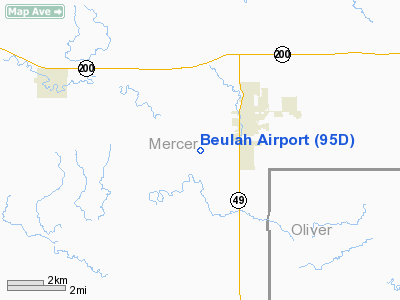
Location & QuickFacts
| FAA Information Effective: | 2008-09-25 |
| Airport Identifier: | 95D |
| Airport Status: | Operational |
| Longitude/Latitude: | 101-48-50.6070W/47-15-03.0270N
-101.814058/47.250841 (Estimated) |
| Elevation: | 1791 ft / 545.90 m (Surveyed) |
| Land: | 80 acres |
| From nearest city: | 2 nautical miles SW of Beulah, ND |
| Location: | Mercer County, ND |
| Magnetic Variation: | 11E (1985) |
Owner & Manager
| Ownership: | Privately owned |
| Owner: | City Of Beulah |
| Address: | Box 910
Beulah, ND 58523
CLERK OF APT AUTH - JOHN PHILLIPS |
| Phone number: | 701-873-2110 |
| Manager: | Shawn Morten
OR CTC KEVIN LEE, CHRMN ARPT AUTH 701-873-2259 OR 873-2311. |
| Address: | 6220 County Road 20
Beulah, ND 58523 |
| Phone number: | 701-873-4100 |
Airport Operations and Facilities
| Airport Use: | Open to public |
| Wind indicator: | Yes |
| Segmented Circle: | No |
| Control Tower: | No |
| Lighting Schedule: | RDO-CTL
ACTVT LIRL RY 10/28; ROTG BCN & SAVASI RY 28 - CTAF. |
| Beacon Color: | Clear-Green (lighted land airport) |
| Landing fee charge: | No |
| Sectional chart: | Billings |
| Region: | AGL - Great Lakes |
| Boundary ARTCC: | ZMP - Minneapolis |
| Tie-in FSS: | GFK - Grand Forks |
| FSS on Airport: | No |
| FSS Toll Free: | 1-800-WX-BRIEF |
| NOTAMs Facility: | GFK (NOTAM-d service avaliable) |
Airport Communications
Airport Services
| Fuel available: | 100LLA1
FOR FUEL CALL 701-873-4100/2259/2311. |
| Airframe Repair: | MAJOR |
| Power Plant Repair: | MAJOR |
Runway Information
Runway 10/28
| Dimension: | 4000 x 60 ft / 1219.2 x 18.3 m |
| Surface: | ASPH, Good Condition
FROST HEAVES FEB-APR ON RY SFC AT 1000 FT FM E END. |
| Weight Limit: | Single wheel: 12500 lbs. |
| Edge Lights: | Non-standard lighting system
NSTD LIRL 20 FT FROM EDGE OF ASPH SFC. |
| |
Runway 10 |
Runway 28 |
| Longitude: | 101-49-06.6100W | 101-48-11.1600W |
| Latitude: | 47-15-08.0300N | 47-14-56.4800N |
| Elevation: | 1790.00 ft | 1791.00 ft |
| Traffic Pattern: | Left | Left |
| Markings: | Basic, Fair Condition | Basic, Fair Condition |
| Crossing Height: | 0.00 ft | 25.00 ft |
| VASI: | | 2-box SAVASI on left side |
| Visual Glide Angle: | 0.00° | 3.00° |
| Obstruction: | 10 ft tree, 325.0 ft from runway, 130 ft left of centerline, 12:1 slope to clear | 15 ft road, 225.0 ft from runway, 1:1 slope to clear
+4 FT FENCE 100 FT FM THLD 50 FT LEFT OF CNTRLN. |
|
Radio Navigation Aids
| ID |
Type |
Name |
Ch |
Freq |
Var |
Dist |
| PSH | NDB | Parshall | | 379.00 | 11E | 43.2 nm |
| DIK | VORTAC | Dickinson | 076X | 112.90 | 14E | 45.8 nm |
Remarks
- LIGHTED STACK 498' AGL LCTD 1.8 NM S.
- ARPT LCTD IN RIVER VALLEY WITH +200' RDGS SRNDG APRX 1500' FM THR.
- 250 FT AGL STACK WITH INVISIBLE FLAME TO 250 FT ABV STACK LCTD 8 NM NNW.
- SNOW REMOVAL IREG; CONFIRM WINTER CONDITIONS WITH AMGR ON 701-873-2311/4100.
- STACKS 600 FT AGL 6 MI N UNLGTD.
- PRVDD RWY 10 THR IS DSPLCD TO PRVD A MIN 20:1 OBSTN FREE CLNC OVER A 15' VEHICLE ON COUNTY ROAD.
Images and information placed above are from
http://www.airport-data.com/airport/95D/
We thank them for the data!
| General Info
|
| Country |
United States
|
| State |
NORTH DAKOTA
|
| FAA ID |
95D
|
| Latitude |
47-15-03.027N
|
| Longitude |
101-48-50.607W
|
| Elevation |
1791 feet
|
| Near City |
BEULAH
|
We don't guarantee the information is fresh and accurate. The data may
be wrong or outdated.
For more up-to-date information please refer to other sources.
|
|


