 |
|
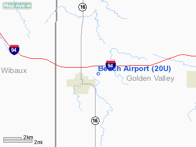
| Beach Airport |
| IATA: none – ICAO: none – FAA LID: 20U |
| Summary |
| Airport type |
Public |
| Owner |
Golden Valley County Airport Authority |
| Operator |
Golden Valley Airport Authority |
| Location |
Beach, North Dakota |
| Elevation AMSL |
2,756 ft / 840 m |
| Coordinates |
46°55′31″N 103°58′55″W / 46.92528°N 103.98194°W / 46.92528; -103.98194 |
| Runways |
| Direction |
Length |
Surface |
| ft |
m |
| 12/30 |
4,200 |
1,280 |
Asphalt |
| Statistics (2006) |
| Aircraft operations |
1,670 |
| Source: Federal Aviation Administration |
Beach Airport (FAA LID: 20U) is a public airport located one mile (1.6 km) east-northeast of the central business district of Beach, in Golden Valley County, North Dakota, United States. It is owned by the Golden Valley County Airport Authority.
Facilities and aircraft
Beach Airport covers an area of 149 acres (60 ha) which contains one runway:
- Runway 12/30: 4,200 x 60 ft (1,280 x 18 m), Surface: Asphalt
For the 12-month period ending December 31, 2006, the airport had 1,670 aircraft operations: 96% general aviation, 4% air taxi, and less than 1% military.
The above content comes from Wikipedia and is published under free licenses – click here to read more.
Location & QuickFacts
| FAA Information Effective: | 2008-09-25 |
| Airport Identifier: | 20U |
| Airport Status: | Operational |
| Longitude/Latitude: | 103-58-55.4000W/46-55-30.6000N
-103.982056/46.925167 (Estimated) |
| Elevation: | 2756 ft / 840.03 m (Estimated) |
| Land: | 149 acres |
| From nearest city: | 1 nautical miles EN of Beach, ND |
| Location: | Golden Valley County, ND |
| Magnetic Variation: | 12E (1985) |
Owner & Manager
| Ownership: | Publicly owned |
| Owner: | Golden Valley Co Arpt Auth.
OPERATED BY GOLDEN VALLEY ARPT AUTH, CHRMN DON HARDY 701-872-4461 OR CELL 701-218-0400 |
| Address: | Box 308
Beach, ND 58621 |
| Phone number: | 701-872-4461 |
| Manager: | Byod Trester
AMGR AVBL MAY-SEP; OTHERWISE CALL DAVE QUALE AT 701-872-4617. |
| Address: | Box 217
Sentinnel Butte, ND 58654 |
| Phone number: | 701-872-4646
AFT HRS CALL MAY-SEP AT 1-800-258-2069/260-1053 |
Airport Operations and Facilities
| Airport Use: | Open to public |
| Wind indicator: | Yes |
| Segmented Circle: | Yes |
| Control Tower: | No |
| Lighting Schedule: | DUSK-DAWN
ACTVT MIRL RY 12/30 & PAPI RYS 12 & 30 - CTAF. |
| Beacon Color: | Clear-Green (lighted land airport) |
| Landing fee charge: | No |
| Sectional chart: | Billings |
| Region: | AGL - Great Lakes |
| Boundary ARTCC: | ZLC - Salt Lake City |
| Tie-in FSS: | GFK - Grand Forks |
| FSS on Airport: | No |
| FSS Toll Free: | 1-800-WX-BRIEF |
| NOTAMs Facility: | GFK (NOTAM-d service avaliable) |
| Federal Agreements: | NGY |
Airport Communications
| CTAF: | 122.800 |
| Unicom: | 122.800
UNICOM UNATTENTED. |
Airport Services
| Fuel available: | 100LL
FUEL SELF SERVICE 24 HR CREDIT CARD ACCESS. |
| Airframe Repair: | NONE |
| Power Plant Repair: | NONE |
| Bottled Oxygen: | NONE |
| Bulk Oxygen: | NONE |
Runway Information
Runway 12/30
| Dimension: | 4200 x 60 ft / 1280.2 x 18.3 m |
| Surface: | ASPH, Good Condition |
| Weight Limit: | Single wheel: 12500 lbs. |
| Edge Lights: | Medium |
| |
Runway 12 |
Runway 30 |
| Longitude: | 103-59-17.3917W | 103-58-33.4494W |
| Latitude: | 46-55-44.8366N | 46-55-16.3339N |
| Elevation: | 2756.00 ft | 2748.00 ft |
| Alignment: | 127 | 127 |
| Traffic Pattern: | Left | Left |
| Markings: | Non-precision instrument, Good Condition | Non-precision instrument, Good Condition |
| Crossing Height: | 25.00 ft | 25.00 ft |
| VASI: | 2-light PAPI on left side | 2-light PAPI on left side |
| Visual Glide Angle: | 3.00° | 3.00° |
| Runway End Identifier: | No | No |
| Centerline Lights: | No | No |
| Touchdown Lights: | No | No |
| Obstruction: | , 50:1 slope to clear | 15 ft road, 800.0 ft from runway, 150 ft left of centerline, 40:1 slope to clear |
|
Radio Navigation Aids
| ID |
Type |
Name |
Ch |
Freq |
Var |
Dist |
| GDV | NDB | Glendive | | 410.00 | 13E | 36.0 nm |
| BKU | NDB | Timber | | 344.00 | 12E | 36.5 nm |
| SDY | NDB | Sidney | | 359.00 | 12E | 48.0 nm |
| DIK | VORTAC | Dickinson | 076X | 112.90 | 14E | 49.8 nm |
Remarks
- CFM SNOW REMOVAL AFT MAJOR WINTER STORM 701-872-4123
- DEER ON & INVOF ARPT.
Images and information placed above are from
http://www.airport-data.com/airport/20U/
We thank them for the data!
| General Info
|
| Country |
United States
|
| State |
NORTH DAKOTA
|
| FAA ID |
20U
|
| Latitude |
46-55-25.048N
|
| Longitude |
103-58-42.740W
|
| Elevation |
2752 feet
|
| Near City |
BEACH
|
We don't guarantee the information is fresh and accurate. The data may
be wrong or outdated.
For more up-to-date information please refer to other sources.
|
|


