 |
|
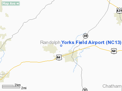
Location & QuickFacts
| FAA Information Effective: | 2008-09-25 |
| Airport Identifier: | NC13 |
| Airport Status: | Operational |
| Longitude/Latitude: | 079-40-14.0970W/35-45-05.4940N
-79.670583/35.751526 (Estimated) |
| Elevation: | 571 ft / 174.04 m (Surveyed) |
| Land: | 10 acres |
| From nearest city: | 2 nautical miles NW of Ramseur, NC |
| Location: | Randolph County, NC |
| Magnetic Variation: | 06W (1985) |
Owner & Manager
| Ownership: | Privately owned |
| Owner: | Mrs. Lonnie York |
| Address: | Route 3 Box 270
Ramseur, NC 27316 |
| Phone number: | 336-824-2689 |
| Manager: | Ken York |
| Address: | Route 3 Box 268
Ramseur, NC 27316 |
| Phone number: | 336-824-8329 |
Airport Operations and Facilities
| Airport Use: | Private |
| Wind indicator: | Yes |
| Segmented Circle: | No |
| Control Tower: | No |
| Landing fee charge: | No |
| Sectional chart: | Charlotte |
| Region: | ASO - Southern |
| Boundary ARTCC: | ZDC - Washington |
| Tie-in FSS: | RDU - Raleigh |
| FSS on Airport: | No |
| FSS Toll Free: | 1-800-WX-BRIEF |
Airport Services
| Airframe Repair: | NONE |
| Power Plant Repair: | NONE |
Runway Information
Runway 18/36
| Dimension: | 3000 x 100 ft / 914.4 x 30.5 m |
| Surface: | TURF, Good Condition
SOFT WHEN WET. |
| |
Runway 18 |
Runway 36 |
| Traffic Pattern: | Left | Left |
| Obstruction: | 50 ft trees, 50 ft right of centerline | 50 ft trees, 100.0 ft from runway, 2:1 slope to clear |
|
Radio Navigation Aids
| ID |
Type |
Name |
Ch |
Freq |
Var |
Dist |
| OQA | FAN MARKER | Rockingham County | | | | 41.3 nm |
| CQJ | NDB | City Lake | | 266.00 | 08W | 9.7 nm |
| TOX | NDB | Siler City | | 371.00 | 07W | 10.2 nm |
| HB | NDB | Himun | | 361.00 | 08W | 14.3 nm |
| VU | NDB | Aller | | 346.00 | 06W | 25.5 nm |
| TT | NDB | Leeco | | 406.00 | 08W | 30.1 nm |
| SEN | NDB | Swearing/dcmsnd | | 260.00 | 06W | 30.7 nm |
| EEJ | NDB | Lee County/dcmsnd | | 428.00 | 07W | 31.6 nm |
| SIF | NDB | Slammer | | 423.00 | 07W | 38.2 nm |
| DVZ | NDB | Davie | | 354.00 | 06W | 39.5 nm |
| RU | NDB | Rovdy | | 275.00 | 06W | 40.0 nm |
| HUR | NDB | Person | | 220.00 | 08W | 41.3 nm |
| HFF | NDB | Mackall | | 278.00 | 06W | 44.4 nm |
| POB | NDB | Pope | | 338.00 | 07W | 47.2 nm |
| LE | NDB | Leevy | | 350.00 | 07W | 47.4 nm |
| AFP | NDB | Anson County | | 283.00 | 07W | 48.2 nm |
| POB | TACAN | Pope | 085X | | 07W | 47.7 nm |
| LIB | VORTAC | Liberty | 077X | 113.00 | 03W | 4.6 nm |
| GSO | VORTAC | Greensboro | 109X | 116.20 | 03W | 23.1 nm |
| SDZ | VORTAC | Sandhills | 055X | 111.80 | 03W | 32.5 nm |
| RDU | VORTAC | Raleigh/durham | 119X | 117.20 | 04W | 43.9 nm |
Remarks
- CONCRETE DRIVEWAY CROSSES 850' FROM RWY 36 THR; ADDITIONAL GRVL DRIVEWAY CROSSES 800' FROM RWY 18 THR.
- FIRST 150' RWY 36 5% UPSLOPE TO NORTH.
- RWY 36 +50' POWERLINE ALONG TREELINE 100' FROM THR.
- VFR OPNS ONLY;LIMITED TO PVT USE.
Images and information placed above are from
http://www.airport-data.com/airport/NC13/
We thank them for the data!
| General Info
|
| Country |
United States
|
| State |
NORTH CAROLINA
|
| FAA ID |
NC13
|
| Latitude |
35-45-05.494N
|
| Longitude |
079-40-14.097W
|
| Elevation |
571 feet
|
| Near City |
RAMSEUR
|
We don't guarantee the information is fresh and accurate. The data may
be wrong or outdated.
For more up-to-date information please refer to other sources.
|
|


