 |
|
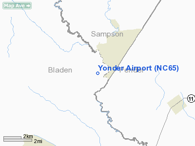
Location & QuickFacts
| FAA Information Effective: | 2008-09-25 |
| Airport Identifier: | NC65 |
| Airport Status: | Operational |
| Longitude/Latitude: | 078-16-04.9940W/34-33-34.6060N
-78.268054/34.559613 (Estimated) |
| Elevation: | 35 ft / 10.67 m (Estimated) |
| Land: | 0 acres |
| From nearest city: | 5 nautical miles NW of Atkinson, NC |
| Location: | Bladen County, NC |
| Magnetic Variation: | 07W (1985) |
Owner & Manager
| Ownership: | Privately owned |
| Owner: | Heath M. Chapin |
| Address: | 320 Walnut Creek Pky ,h
Raleh, NC 27606 |
| Phone number: | 919-669-2232 |
| Manager: | Heath M. Chapin |
| Address: | Rt 1, Box 153
Ivanhoe, NC 28447 |
| Phone number: | 919-669-2232 |
Airport Operations and Facilities
| Airport Use: | Private |
| Wind indicator: | Yes |
| Segmented Circle: | No |
| Control Tower: | No |
| Landing fee charge: | No |
| Sectional chart: | Charlotte |
| Region: | ASO - Southern |
| Boundary ARTCC: | ZDC - Washington |
| Tie-in FSS: | RDU - Raleigh |
| FSS on Airport: | No |
| FSS Toll Free: | 1-800-WX-BRIEF |
Runway Information
Runway 06/24
| Dimension: | 3200 x 75 ft / 975.4 x 22.9 m |
| Surface: | TURF, |
| |
Runway 06 |
Runway 24 |
| Traffic Pattern: | Left | Left |
|
Radio Navigation Aids
| ID |
Type |
Name |
Ch |
Freq |
Var |
Dist |
| TGQ | NDB | Elizabethtown | | 398.00 | 08W | 12.4 nm |
| ACZ | NDB | Pendy | | 379.00 | 09W | 16.1 nm |
| CTZ | NDB | Clinton | | 412.00 | 08W | 25.4 nm |
| CPC | NDB | Camp | | 227.00 | 07W | 28.1 nm |
| CLB | NDB | Carolina Beach | | 216.00 | 04W | 31.2 nm |
| DKA | NDB | Kenan | | 332.00 | 07W | 35.3 nm |
| SUT | NDB | Yaupon | | 233.00 | 08W | 39.2 nm |
| RSY | NDB | Robeson | | 359.00 | 08W | 39.3 nm |
| NCA | NDB | New River | | 356.00 | 08W | 42.6 nm |
| JB | NDB | Jigel | | 384.00 | 08W | 43.1 nm |
| FGP | NDB | Fort Bragg | | 393.00 | 07W | 44.0 nm |
| DIW | NDB/DME | Dixon | 107X | 198.00 | 08W | 40.4 nm |
| NCA | TACAN | New River | 101X | | 08W | 41.9 nm |
| GSB | TACAN | Seymour Johnson | 112X | | 08W | 48.8 nm |
| LBT | VOR | Lumberton | | 110.00 | 08W | 39.1 nm |
| FAY | VOR/DME | Fayetteville | 025X | 108.80 | 04W | 39.4 nm |
| ILM | VORTAC | Wilmington | 117X | 117.00 | 07W | 23.2 nm |
Remarks
- PRIVATE USE; VFR WX OPERATIONS ONLY.
Images and information placed above are from
http://www.airport-data.com/airport/NC65/
We thank them for the data!
| General Info
|
| Country |
United States
|
| State |
NORTH CAROLINA
|
| FAA ID |
NC65
|
| Latitude |
34-33-34.606N
|
| Longitude |
078-16-04.994W
|
| Elevation |
35 feet
|
| Near City |
ATKINSON
|
We don't guarantee the information is fresh and accurate. The data may
be wrong or outdated.
For more up-to-date information please refer to other sources.
|
|


