 |
|
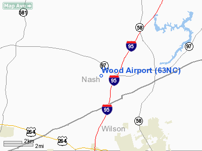
Location & QuickFacts
| FAA Information Effective: | 2008-09-25 |
| Airport Identifier: | 63NC |
| Airport Status: | Operational |
| Longitude/Latitude: | 077-59-46.9520W/35-50-10.5610N
-77.996376/35.836267 (Estimated) |
| Elevation: | 170 ft / 51.82 m (Estimated) |
| Land: | 0 acres |
| From nearest city: | 6 nautical miles NW of Wilson, NC |
| Location: | Nash County, NC |
| Magnetic Variation: | 08W (1985) |
Owner & Manager
| Ownership: | Privately owned |
| Owner: | Callbie F. Wood Jr. |
| Address: | 10717 Old Bailey Hwy
Wilson, NC 27896 |
| Phone number: | 919-237-0208 |
| Manager: | Callbie F. Wood Jr. |
| Address: | 10717 Old Bailey Hwy
Wilson, NC 27896 |
| Phone number: | 252-243-6708 |
Airport Operations and Facilities
| Airport Use: | Private |
| Wind indicator: | No |
| Segmented Circle: | No |
| Control Tower: | No |
| Landing fee charge: | No |
| Sectional chart: | Charlotte |
| Region: | ASO - Southern |
| Boundary ARTCC: | ZDC - Washington |
| Tie-in FSS: | RDU - Raleigh |
| FSS on Airport: | No |
| FSS Toll Free: | 1-800-WX-BRIEF |
Runway Information
Runway 09/27
| Dimension: | 2800 x 100 ft / 853.4 x 30.5 m |
| Surface: | TURF, |
| |
Runway 09 |
Runway 27 |
| Traffic Pattern: | Left | Left |
|
Radio Navigation Aids
| ID |
Type |
Name |
Ch |
Freq |
Var |
Dist |
| PGV | FAN MARKER | Belvoir | | | 06W | 32.2 nm |
| RW | NDB | Jambe | | 235.00 | 09W | 4.4 nm |
| JYN | NDB | Wayne | | 208.00 | 08W | 19.2 nm |
| EUU | NDB | Jnall | | 251.00 | 07W | 22.3 nm |
| ETC | NDB | Tarboro | | 257.00 | 08W | 22.7 nm |
| JN | NDB | Jurly | | 263.00 | 09W | 30.2 nm |
| AQE | NDB | Alwood | | 230.00 | 09W | 31.4 nm |
| LE | NDB | Leevy | | 350.00 | 07W | 35.8 nm |
| RZZ | NDB | Rapids | | 407.00 | 08W | 38.9 nm |
| MCZ | NDB | Williamston | | 336.00 | 09W | 39.9 nm |
| HQT | NDB | Harnett | | 417.00 | 08W | 41.1 nm |
| HXO | NDB | Huntsboro | | 271.00 | 07W | 41.1 nm |
| DKA | NDB | Kenan | | 332.00 | 07W | 46.1 nm |
| AEA | NDB | Jones | | 373.00 | 09W | 46.9 nm |
| RNW | NDB | Chocowinity | | 388.00 | 07W | 47.7 nm |
| ASJ | NDB | Ahoskie | | 415.00 | 10W | 48.6 nm |
| GSB | TACAN | Seymour Johnson | 112X | | 08W | 30.2 nm |
| TYI | VORTAC | Tar River | 125X | 117.80 | 05W | 16.6 nm |
| ISO | VORTAC | Kinston | 033X | 109.60 | 05W | 35.2 nm |
| RDU | VORTAC | Raleigh/durham | 119X | 117.20 | 04W | 38.4 nm |
Remarks
Images and information placed above are from
http://www.airport-data.com/airport/63NC/
We thank them for the data!
| General Info
|
| Country |
United States
|
| State |
NORTH CAROLINA
|
| FAA ID |
63NC
|
| Latitude |
35-50-10.561N
|
| Longitude |
077-59-46.952W
|
| Elevation |
170 feet
|
| Near City |
WILSON
|
We don't guarantee the information is fresh and accurate. The data may
be wrong or outdated.
For more up-to-date information please refer to other sources.
|
|


