|
|
 |
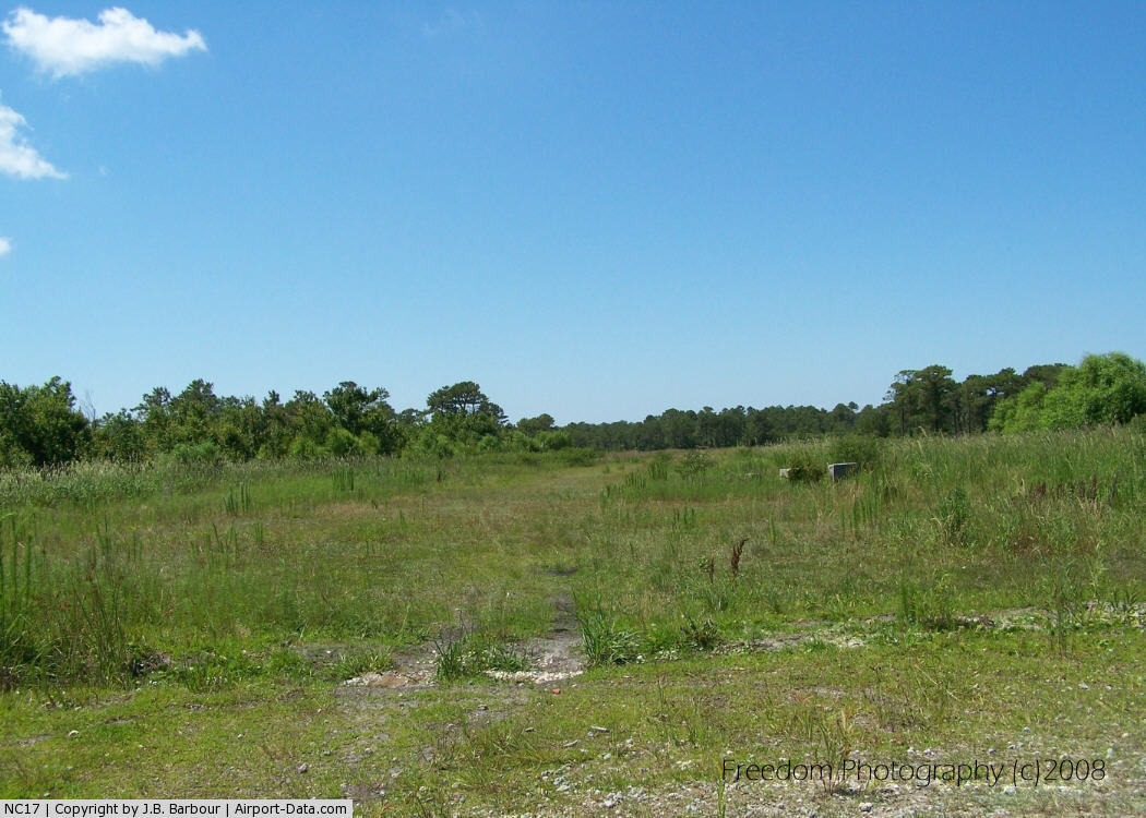
(Click on the photo to enlarge) |
Location & QuickFacts
| FAA Information Effective: | 2008-09-25 |
| Airport Identifier: | NC17 |
| Airport Status: | Operational |
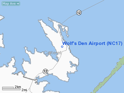
| Longitude/Latitude: | 076-18-28.6890W/34-58-48.5930N
-76.307969/34.980165 (Estimated) |
| Elevation: | 10 ft / 3.05 m (Estimated) |
| Land: | 13 acres |
| From nearest city: | 2 nautical miles W of Cedar Island, NC |
| Location: | Carteret County, NC |
| Magnetic Variation: | 08W (1985) |
Owner & Manager
| Ownership: | Privately owned |
| Owner: | Isaac Goodwin |
| Address: | Rt 1,box 54
Cedar Island, NC 28520 |
| Phone number: | 919-225-1871 |
| Manager: | Isaac Goodwin |
| Address: | Rt 1, Box 54
Cedar Island, NC 28520 |
| Phone number: | 919-225-1871 |
Airport Operations and Facilities
| Airport Use: | Private |
| Wind indicator: | Yes |
| Segmented Circle: | No |
| Control Tower: | No |
| Sectional chart: | Charlotte |
| Region: | ASO - Southern |
| Boundary ARTCC: | ZDC - Washington |
| Tie-in FSS: | RDU - Raleigh |
| FSS Toll Free: | 1-800-WX-BRIEF |
Airport Services
Runway Information
Runway 16/34
| Dimension: | 2400 x 60 ft / 731.5 x 18.3 m |
| Surface: | TURF, |
| |
Runway 16 |
Runway 34 |
| Traffic Pattern: | Left | Right |
| Obstruction: | 50 ft trees | 25 ft trees, 30.0 ft from runway |
|
Radio Navigation Aids
| ID |
Type |
Name |
Ch |
Freq |
Var |
Dist |
| HI | MARINE NDB | Hatteras Inlet Station/dcm | | 1.00 | 09W | 32.6 nm |
| MRH | NDB | Morehead | | 269.00 | 08W | 23.0 nm |
| OUC | NDB/DME | Pamlico/dcmsnd | 034X | 404.00 | 09W | 17.8 nm |
| NKT | TACAN | Cherry Point | 075X | | 09W | 28.3 nm |
| NJM | TACAN | Bogue Mcalf | 067X | | 08W | 39.6 nm |
| EWN | VOR/DME | New Bern | 083X | 113.60 | 08W | 36.7 nm |
Remarks
- VFR; PRIVATE USE; INGRESS/EGRESS ROUTES & ALTITUDES AS AGREED TO WITH U.S. MARINE CORP
Images and information placed above are from
http://www.airport-data.com/airport/NC17/
We thank them for the data!
| General Info
|
| Country |
United States
|
| State |
NORTH CAROLINA
|
| FAA ID |
NC17
|
| Latitude |
34-58-48.593N
|
| Longitude |
076-18-28.689W
|
| Elevation |
10 feet
|
| Near City |
CEDAR ISLAND
|
We don't guarantee the information is fresh and accurate. The data may
be wrong or outdated.
For more up-to-date information please refer to other sources.
|
|