 |
|
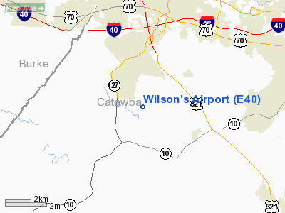
Location & QuickFacts
| FAA Information Effective: | 2008-09-25 |
| Airport Identifier: | E40 |
| Airport Status: | Operational |
| Longitude/Latitude: | 081-21-28.3100W/35-39-07.4760N
-81.357864/35.652077 (Estimated) |
| Elevation: | 985 ft / 300.23 m (Estimated) |
| Land: | 27 acres |
| From nearest city: | 4 nautical miles S of Hickory, NC |
| Location: | Catawba County, NC |
| Magnetic Variation: | 05W (1985) |
Owner & Manager
| Ownership: | Privately owned |
| Owner: | Wilson's Estate |
| Address: | 5284 Pittstown Road
Hickory, NC 28601 |
| Manager: | Claude Wilson |
| Address: | 814 6th Avenue, S.w.
Hickory, NC 28602 |
| Phone number: | 828-322-6537 |
Airport Operations and Facilities
| Airport Use: | Open to public |
| Wind indicator: | Yes |
| Segmented Circle: | No |
| Control Tower: | No |
| Landing fee charge: | No |
| Sectional chart: | Atlanta |
| Region: | ASO - Southern |
| Boundary ARTCC: | ZTL - Atlanta |
| Tie-in FSS: | RDU - Raleigh |
| FSS on Airport: | No |
| FSS Toll Free: | 1-800-WX-BRIEF |
| NOTAMs Facility: | RDU (NOTAM-d service avaliable) |
Airport Communications
Airport Services
| Airframe Repair: | NONE |
| Power Plant Repair: | NONE |
| Bottled Oxygen: | NONE |
| Bulk Oxygen: | NONE |
Runway Information
Runway 17/35
| Dimension: | 2175 x 70 ft / 662.9 x 21.3 m |
| Surface: | TURF, Fair Condition |
| |
Runway 17 |
Runway 35 |
| Traffic Pattern: | Left | Left |
| Obstruction: | 32 ft trees, 34.0 ft from runway, 99 ft right of centerline, 1:1 slope to clear
32 FT TREES 99 FT R - SLOPE 1:1. RY 17 APCH RATIO 9:1 TO DISPLCD THLD. | 58 ft trees, 26.0 ft from runway, 98 ft left of centerline
58 FT TREES 98 FT L - SLOPE 0:1. RY 35 APCH RATIO 6:1 TO DISPLCD THLD. |
|
Radio Navigation Aids
| ID |
Type |
Name |
Ch |
Freq |
Var |
Dist |
| MRN | FAN MARKER | Lenoir | | | 03W | 15.6 nm |
| HK | NDB | Tawba | | 332.00 | 06W | 8.5 nm |
| IZN | NDB | Lincolnton | | 432.00 | 06W | 14.9 nm |
| FIQ | NDB | Fiddlers | | 391.00 | 07W | 15.7 nm |
| VW | NDB | Temky | | 280.00 | 05W | 16.1 nm |
| SLP | NDB | First River | | 417.00 | 06W | 26.7 nm |
| GHJ | NDB | Stonia | | 260.00 | 06W | 29.4 nm |
| UKF | NDB | Wilki | | 209.00 | 06W | 30.4 nm |
| RFE | NDB | Rutherford | | 344.00 | 05W | 34.3 nm |
| BAR | NDB | Hemlock | | 320.00 | 02W | 39.4 nm |
| RU | NDB | Rovdy | | 275.00 | 06W | 42.7 nm |
| DVZ | NDB | Davie | | 354.00 | 06W | 46.7 nm |
| JU | NDB | Ashee | | 410.00 | 07W | 47.0 nm |
| UZ | NDB | Rally | | 227.00 | 05W | 47.8 nm |
| BZM | VOR/DME | Barretts Mountain | 045X | 110.80 | 06W | 14.2 nm |
| CLT | VOR/DME | Charlotte | 097X | 115.00 | 05W | 34.1 nm |
| FML | VORTAC | Fort Mill | 071X | 112.40 | 02W | 44.5 nm |
| SPA | VORTAC | Spartanburg | 104X | 115.70 | 02W | 46.5 nm |
| SUG | VORTAC | Sugarloaf Mountain | 059X | 112.20 | 02W | 46.9 nm |
| HKY | VOT | Hickory Regional | | 110.00 | | 5.6 nm |
| CLT | VOT | Charlotte | | 112.00 | | 33.4 nm |
Remarks
- 130 FT AGL UNMKD POWERLINES 1000 FT NORTH & EAST OF RY.
- RY 35 SLOPES UPHILL. LAST HALF OF RY 17 SLOPES DOWNHILL - DEP END OF RY 35 IS 6 FT LOWER THAN OPPOSITE END.
- VFR USE ONLY.
Images and information placed above are from
http://www.airport-data.com/airport/E40/
We thank them for the data!
| General Info
|
| Country |
United States
|
| State |
NORTH CAROLINA
|
| FAA ID |
E40
|
| Latitude |
35-39-07.476N
|
| Longitude |
081-21-28.310W
|
| Elevation |
985 feet
|
| Near City |
HICKORY
|
We don't guarantee the information is fresh and accurate. The data may
be wrong or outdated.
For more up-to-date information please refer to other sources.
|
|


