 |
|
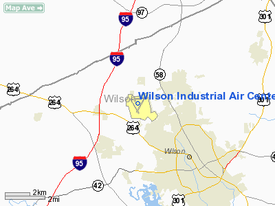
Wilson Industrial Air Center Airport |
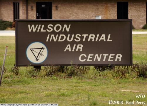 |
(Click on the photo to enlarge) |
Location & QuickFacts
| FAA Information Effective: | 2008-09-25 |
| Airport Identifier: | W03 |
| Airport Status: | Operational |
| Longitude/Latitude: | 077-58-11.2490W/35-46-13.4650N
-77.969791/35.770407 (Estimated) |
| Elevation: | 161 ft / 49.07 m (Surveyed) |
| Land: | 775 acres |
| From nearest city: | 3 nautical miles N of Wilson, NC |
| Location: | Wilson County, NC |
| Magnetic Variation: | 08W (1985) |
Owner & Manager
| Ownership: | Publicly owned |
| Owner: | City Of Wilson |
| Address: | Po Box 10
Wilson, NC 27894 |
| Phone number: | 252-399-2489 |
| Manager: | Gronna Jones |
| Address: | Po Box 10
Wilson, NC 27894 |
| Phone number: | 252-399-2489 |
Airport Operations and Facilities
| Airport Use: | Open to public |
| Wind indicator: | Yes |
| Segmented Circle: | No |
| Control Tower: | No |
| Lighting Schedule: | DUSK-DAWN
MIRL RY 03/21 PRESET LOW INTST; TO INCR INTST AND ACTVT PAPI RYS 03 & 21 AND REIL RYS 03 & 21 - CTAF. |
| Beacon Color: | Clear-Green (lighted land airport) |
| Landing fee charge: | No |
| Sectional chart: | Charlotte |
| Region: | ASO - Southern |
| Boundary ARTCC: | ZDC - Washington |
| Tie-in FSS: | RDU - Raleigh |
| FSS on Airport: | No |
| FSS Toll Free: | 1-800-WX-BRIEF |
| NOTAMs Facility: | RDU (NOTAM-d service avaliable) |
| Federal Agreements: | PR13 |
Airport Communications
| CTAF: | 123.000 |
| Unicom: | 123.000 |
Airport Services
| Fuel available: | 100LLA |
| Airframe Repair: | NONE |
| Power Plant Repair: | NONE |
| Bottled Oxygen: | NONE |
| Bulk Oxygen: | NONE |
Runway Information
Runway 03/21
| Dimension: | 4500 x 150 ft / 1371.6 x 45.7 m |
| Surface: | ASPH, Fair Condition |
| Weight Limit: | Single wheel: 20000 lbs. |
| Edge Lights: | Medium |
| |
Runway 03 |
Runway 21 |
| Longitude: | 077-58-16.3770W | 077-57-48.6490W |
| Latitude: | 35-45-50.0660N | 35-46-28.4100N |
| Elevation: | 156.00 ft | 156.00 ft |
| Alignment: | 31 | 127 |
| Traffic Pattern: | Left | Left |
| Markings: | Non-precision instrument, Good Condition | Non-precision instrument, Good Condition |
| Crossing Height: | 40.00 ft | 40.00 ft |
| VASI: | 2-light PAPI on left side | 2-light PAPI on left side |
| Visual Glide Angle: | 3.54° | 3.81° |
| Runway End Identifier: | Yes | Yes |
| Obstruction: | 42 ft trees, 919.0 ft from runway, 265 ft left of centerline, 17:1 slope to clear | 32 ft trees, 406.0 ft from runway, 268 ft right of centerline, 6:1 slope to clear |
|
Runway 09/27
| Dimension: | 4500 x 150 ft / 1371.6 x 45.7 m |
| Surface: | ASPH, Fair Condition |
| Weight Limit: | Single wheel: 20000 lbs. |
| |
Runway 09 |
Runway 27 |
| Longitude: | 077-58-36.6380W | 077-57-42.0310W |
| Latitude: | 35-46-24.4650N | 35-46-24.0810N |
| Elevation: | 160.00 ft | 156.00 ft |
| Alignment: | 90 | 127 |
| Traffic Pattern: | Left | Left |
| Markings: | Basic, Good Condition | Basic, Good Condition |
| Obstruction: | 56 ft trees, 828.0 ft from runway, 62 ft right of centerline, 11:1 slope to clear | 53 ft trees, 661.0 ft from runway, 184 ft left of centerline, 8:1 slope to clear |
|
Runway 15/33
| Dimension: | 4499 x 150 ft / 1371.3 x 45.7 m |
| Surface: | ASPH, Fair Condition |
| Weight Limit: | Single wheel: 20000 lbs. |
| |
Runway 15 |
Runway 33 |
| Longitude: | 077-58-35.4050W | 077-58-08.5040W |
| Latitude: | 35-46-26.1590N | 35-45-47.4450N |
| Elevation: | 161.00 ft | 152.00 ft |
| Alignment: | 127 | 127 |
| Traffic Pattern: | Left | Left |
| Markings: | Basic, Good Condition | Basic, Good Condition |
| Obstruction: | 34 ft trees, 346.0 ft from runway, 271 ft right of centerline, 4:1 slope to clear | 30 ft trees, 335.0 ft from runway, 200 ft right of centerline, 4:1 slope to clear |
|
Radio Navigation Aids
| ID |
Type |
Name |
Ch |
Freq |
Var |
Dist |
| PGV | FAN MARKER | Belvoir | | | 06W | 29.7 nm |
| RW | NDB | Jambe | | 235.00 | 09W | 0.3 nm |
| JYN | NDB | Wayne | | 208.00 | 08W | 15.1 nm |
| EUU | NDB | Jnall | | 251.00 | 07W | 21.2 nm |
| ETC | NDB | Tarboro | | 257.00 | 08W | 22.9 nm |
| JN | NDB | Jurly | | 263.00 | 09W | 28.5 nm |
| AQE | NDB | Alwood | | 230.00 | 09W | 29.4 nm |
| LE | NDB | Leevy | | 350.00 | 07W | 37.8 nm |
| MCZ | NDB | Williamston | | 336.00 | 09W | 39.0 nm |
| HQT | NDB | Harnett | | 417.00 | 08W | 40.0 nm |
| DKA | NDB | Kenan | | 332.00 | 07W | 42.0 nm |
| RZZ | NDB | Rapids | | 407.00 | 08W | 42.3 nm |
| HXO | NDB | Huntsboro | | 271.00 | 07W | 44.8 nm |
| RNW | NDB | Chocowinity | | 388.00 | 07W | 45.0 nm |
| GSB | TACAN | Seymour Johnson | 112X | | 08W | 26.2 nm |
| TYI | VORTAC | Tar River | 125X | 117.80 | 05W | 17.9 nm |
| ISO | VORTAC | Kinston | 033X | 109.60 | 05W | 31.3 nm |
| RDU | VORTAC | Raleigh/durham | 119X | 117.20 | 04W | 40.1 nm |
Remarks
- NO LINE-OF-SIGHT BTN RY ENDS.
- DEER ON & INVOF ARPT.
- GCO AVBL ON FREQ 121.725 THRU FLT SVCS OTS INDEFLY.
Images and information placed above are from
http://www.airport-data.com/airport/W03/
We thank them for the data!
| General Info
|
| Country |
United States
|
| State |
NORTH CAROLINA
|
| FAA ID |
W03
|
| Latitude |
35-46-13.465N
|
| Longitude |
077-58-11.249W
|
| Elevation |
161 feet
|
| Near City |
WILSON
|
We don't guarantee the information is fresh and accurate. The data may
be wrong or outdated.
For more up-to-date information please refer to other sources.
|
|


