 |
|
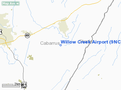
Location & QuickFacts
| FAA Information Effective: | 2008-09-25 |
| Airport Identifier: | 9NC7 |
| Airport Status: | Operational |
| Longitude/Latitude: | 080-26-24.0000W/35-22-11.0000N
-80.440000/35.369722 (Estimated) |
| Elevation: | 572 ft / 174.35 m (Estimated) |
| Land: | 0 acres |
| From nearest city: | 2 nautical miles N of Mt Pleasant, NC |
| Location: | Cabarrus County, NC |
| Magnetic Variation: | () |
Owner & Manager
| Ownership: | Privately owned |
| Owner: | Mark Searcy |
| Address: | 3525 Willow Creek Drive
Mt Pleasant, NC 28124 |
| Phone number: | 704-436-9702 |
| Manager: | Mark Searcy |
| Address: | 3525 Willow Creek Drive
Mt Pleasant, NC 28124 |
| Phone number: | 704-436-9702 |
Airport Operations and Facilities
| Airport Use: | Private |
| Control Tower: | No |
| Sectional chart: | Charlotte |
| Region: | ASO - Southern |
| Boundary ARTCC: | ZTL - Atlanta |
| Tie-in FSS: | RDU - Raleigh |
| FSS Toll Free: | 1-800-WX-BRIEF |
Runway Information
Runway 12/30
| Dimension: | 2300 x 80 ft / 701.0 x 24.4 m |
| Surface: | TURF, |
| |
Runway 12 |
Runway 30 |
| Traffic Pattern: | Left | Left |
|
Radio Navigation Aids
| ID |
Type |
Name |
Ch |
Freq |
Var |
Dist |
| VU | NDB | Aller | | 346.00 | 06W | 19.0 nm |
| RU | NDB | Rovdy | | 275.00 | 06W | 22.0 nm |
| SEN | NDB | Swearing/dcmsnd | | 260.00 | 06W | 25.6 nm |
| AFP | NDB | Anson County | | 283.00 | 07W | 27.2 nm |
| TWL | NDB | Wesley | | 204.00 | 06W | 28.2 nm |
| DVZ | NDB | Davie | | 354.00 | 06W | 32.7 nm |
| IZN | NDB | Lincolnton | | 432.00 | 06W | 33.2 nm |
| CQJ | NDB | City Lake | | 266.00 | 08W | 35.0 nm |
| GHJ | NDB | Stonia | | 260.00 | 06W | 36.8 nm |
| PYG | NDB | Pageland | | 270.00 | 06W | 37.9 nm |
| VW | NDB | Temky | | 280.00 | 05W | 39.1 nm |
| UZ | NDB | Rally | | 227.00 | 05W | 42.7 nm |
| LKR | NDB | Lancaster | | 400.00 | 07W | 43.9 nm |
| CQW | NDB | Cheraw | | 409.00 | 05W | 47.2 nm |
| RCZ | NDB | Roscoe | | 375.00 | 07W | 48.1 nm |
| HK | NDB | Tawba | | 332.00 | 06W | 49.2 nm |
| CLT | VOR/DME | Charlotte | 097X | 115.00 | 05W | 27.3 nm |
| CTF | VOR/DME | Chesterfield | 019X | 108.20 | 03W | 44.0 nm |
| BZM | VOR/DME | Barretts Mountain | 045X | 110.80 | 06W | 49.3 nm |
| FML | VORTAC | Fort Mill | 071X | 112.40 | 02W | 34.1 nm |
| SDZ | VORTAC | Sandhills | 055X | 111.80 | 03W | 42.8 nm |
| GSO | VORTAC | Greensboro | 109X | 116.20 | 03W | 46.5 nm |
| LIB | VORTAC | Liberty | 077X | 113.00 | 03W | 48.4 nm |
| CLT | VOT | Charlotte | | 112.00 | | 26.1 nm |
Remarks
- 95 FT TWR, 1000 FT S OF MIDFIELD.
- PRVDD VFR OPNS AND PVT USE.
Images and information placed above are from
http://www.airport-data.com/airport/9NC7/
We thank them for the data!
| General Info
|
| Country |
United States
|
| State |
NORTH CAROLINA
|
| FAA ID |
9NC7
|
| Latitude |
36-05-27.494N
|
| Longitude |
080-16-08.180W
|
| Elevation |
882 feet
|
| Near City |
WINSTON-SALEM
|
We don't guarantee the information is fresh and accurate. The data may
be wrong or outdated.
For more up-to-date information please refer to other sources.
|
|


