 |
|
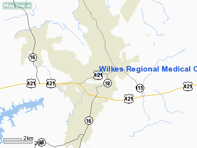
Wilkes Rgnl Medical Center Heliport |
Location & QuickFacts
| FAA Information Effective: | 2008-09-25 |
| Airport Identifier: | 49NC |
| Airport Status: | Operational |
| Longitude/Latitude: | 081-09-28.0000W/36-09-33.0000N
-81.157778/36.159167 (Estimated) |
| Elevation: | 985 ft / 300.23 m (Estimated) |
| Land: | 0 acres |
| From nearest city: | 0 nautical miles W of North Wilkesboro, NC |
| Location: | Wilkes County, NC |
| Magnetic Variation: | 06W (1995) |
Owner & Manager
| Ownership: | Privately owned |
| Owner: | Wilkes Rgnl Medical Center |
| Address: | 1370 West D Street
North Wilkesboro, NC 28659 |
| Phone number: | 336-651-8100 |
| Manager: | Paul Barlow
DIRECTOR OF ENGINEERING. |
| Address: | 1370 West D Street
North Wilkesboro, NC 28659 |
| Phone number: | 336-651-8100 |
Airport Operations and Facilities
| Airport Use: | Private
MEDICAL USE. |
| Segmented Circle: | No |
| Control Tower: | No |
| Lighting Schedule: | PHONE REQ
FOR PERIMETER LGTS CALL 336-651-8100. |
| Sectional chart: | Cincinnati |
| Region: | ASO - Southern |
| Boundary ARTCC: | ZTL - Atlanta |
| Tie-in FSS: | RDU - Raleigh |
| FSS Toll Free: | 1-800-WX-BRIEF |
Runway Information
Helipad H1
| Dimension: | 50 x 50 ft / 15.2 x 15.2 m |
| Surface: | CONC, |
| |
Runway H1 |
Runway |
| Traffic Pattern: | Left | Left |
|
Radio Navigation Aids
| ID |
Type |
Name |
Ch |
Freq |
Var |
Dist |
| MRN | FAN MARKER | Lenoir | | | 03W | 31.5 nm |
| UKF | NDB | Wilki | | 209.00 | 06W | 4.0 nm |
| JU | NDB | Ashee | | 410.00 | 07W | 18.3 nm |
| ZEF | NDB | Zephyr | | 326.00 | 05W | 23.0 nm |
| HK | NDB | Tawba | | 332.00 | 06W | 23.5 nm |
| VW | NDB | Temky | | 280.00 | 05W | 23.6 nm |
| AZW | NDB | Mount Airy | | 223.00 | 07W | 32.8 nm |
| BAR | NDB | Hemlock | | 320.00 | 02W | 35.0 nm |
| JJO | NDB | Mountain City | | 396.00 | 04W | 35.8 nm |
| FIQ | NDB | Fiddlers | | 391.00 | 07W | 36.8 nm |
| DVZ | NDB | Davie | | 354.00 | 06W | 37.2 nm |
| IZN | NDB | Lincolnton | | 432.00 | 06W | 37.5 nm |
| HLX | NDB | Hillsville | | 269.00 | 06W | 39.7 nm |
| RU | NDB | Rovdy | | 275.00 | 06W | 41.4 nm |
| MK | NDB | Suzze | | 335.00 | 06W | 45.9 nm |
| SEN | NDB | Swearing/dcmsnd | | 260.00 | 06W | 47.6 nm |
| BZM | VOR/DME | Barretts Mountain | 045X | 110.80 | 06W | 17.9 nm |
| HMV | VORTAC | Holston Mountain | 093X | 114.60 | 04W | 50.0 nm |
| HKY | VOT | Hickory Regional | | 110.00 | | 27.6 nm |
Remarks
- PRVDD VFR/PVT USE, AREA IS MARKED & WIND INDICATOR IS MAINTAINED.
Images and information placed above are from
http://www.airport-data.com/airport/49NC/
We thank them for the data!
| General Info
|
| Country |
United States
|
| State |
NORTH CAROLINA
|
| FAA ID |
49NC
|
| Latitude |
36-09-33.000N
|
| Longitude |
081-09-28.000W
|
| Elevation |
985 feet
|
| Near City |
NORTH WILKESBORO
|
We don't guarantee the information is fresh and accurate. The data may
be wrong or outdated.
For more up-to-date information please refer to other sources.
|
|


