|
|
| Wilkes County Airport |
| IATA: IKB – ICAO: KUKF – FAA LID: UKF |
| Summary |
| Airport type |
Public |
| Operator |
Wilkes County |
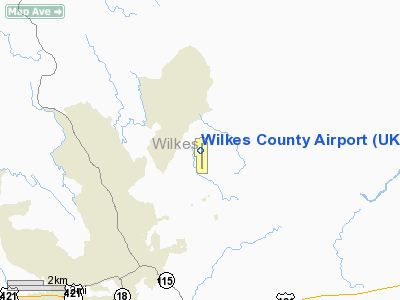
| Location |
North Wilkesboro, North Carolina |
| Elevation AMSL |
1,301 ft / 396.5 m |
| Coordinates |
36°13′22″N 081°05′54″W / 36.22278°N 81.09833°W / 36.22278; -81.09833Coordinates: 36°13′22″N 081°05′54″W / 36.22278°N 81.09833°W / 36.22278; -81.09833 |
| Runways |
| Direction |
Length |
Surface |
| ft |
m |
| 1/19 |
6,200 |
1,890 |
Asphalt |
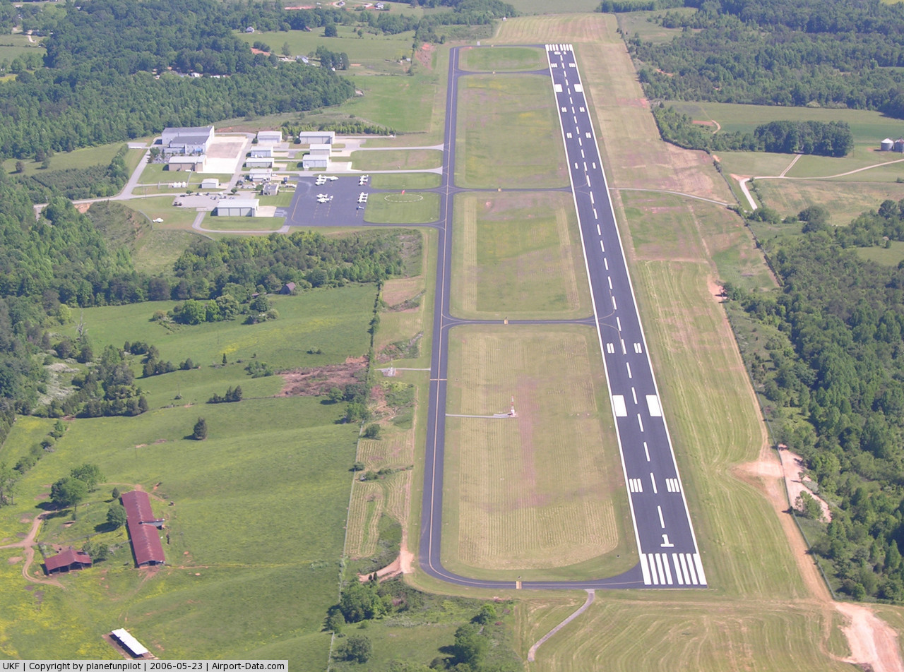
Wilkes County Airport (IATA: IKB, ICAO: KUKF, FAA LID: UKF) is a public airport located four miles (6 km) northeast of the central business district (CBD) of North Wilkesboro, a town in Wilkes County, North Carolina, USA. This general aviation airport covers 237 acres (96 ha) and has one runway.
Although most U.S. airports use the same three-letter location identifier for the FAA and IATA, Wilkes County Airport is assigned UKF by the FAA and IKB by the IATA. The airport's ICAO identifier is KUKF.
The above content comes from Wikipedia and is published under free licenses – click here to read more.
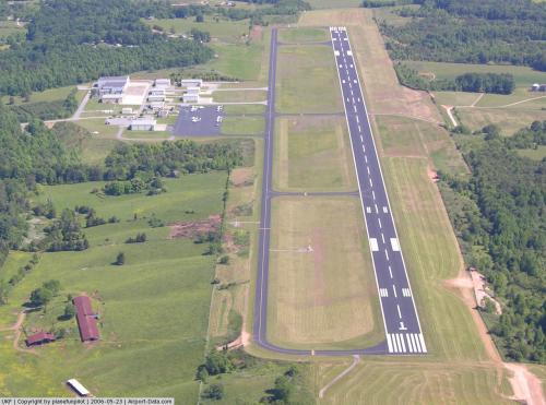 |
(Click on the photo to enlarge) |
Location & QuickFacts
| FAA Information Effective: | 2008-09-25 |
| Airport Identifier: | UKF |
| Airport Status: | Operational |
| Longitude/Latitude: | 081-05-54.0200W/36-13-22.2300N
-81.098339/36.222842 (Estimated) |
| Elevation: | 1301 ft / 396.54 m (Surveyed) |
| Land: | 237 acres |
| From nearest city: | 4 nautical miles NE of North Wilkesboro, NC |
| Location: | Wilkes County, NC |
| Magnetic Variation: | 06W (1990) |
Owner & Manager
| Ownership: | Publicly owned |
| Owner: | Wilkes County |
| Address: | 110 North Street
Wilkesboro, NC 28697 |
| Phone number: | 336-651-7345 |
| Manager: | Jack Steelman |
| Address: | 640 Wood Wallace
North Wilkesboro, NC 28659 |
| Phone number: | 336-696-2000 |
Airport Operations and Facilities
| Airport Use: | Open to public |
| Wind indicator: | Yes |
| Segmented Circle: | Yes |
| Control Tower: | No |
| Lighting Schedule: | DUSK-DAWN
MIRL RY 01/19 PRESET LOW INTST; TO INCR INTST & ACTVT MALSR RY 01, PAPI RY 01 & PAPI RY 19, REIL 19 AND TWY LGTS - CTAF. |
| Beacon Color: | Clear-Green (lighted land airport) |
| Sectional chart: | Cincinnati |
| Region: | ASO - Southern |
| Boundary ARTCC: | ZTL - Atlanta |
| Tie-in FSS: | RDU - Raleigh |
| FSS on Airport: | No |
| FSS Toll Free: | 1-800-WX-BRIEF |
| NOTAMs Facility: | UKF (NOTAM-d service avaliable) |
| Federal Agreements: | NGY |
Airport Communications
| CTAF: | 122.700 |
| Unicom: | 122.700 |
Airport Services
| Fuel available: | 100LLA A1+ |
| Airframe Repair: | MAJOR |
| Power Plant Repair: | MAJOR |
Runway Information
Runway 01/19
| Dimension: | 6200 x 100 ft / 1889.8 x 30.5 m |
| Surface: | ASPH, Good Condition |
| Weight Limit: | Single wheel: 45000 lbs.
Dual wheel: 60000 lbs. |
| Edge Lights: | Medium |
| |
Runway 01 |
Runway 19 |
| Longitude: | 081-05-54.1000W | 081-05-55.8800W |
| Latitude: | 36-12-54.3200N | 36-13-55.6100N |
| Elevation: | 1249.00 ft | 1305.00 ft |
| Alignment: | 127 | 127 |
| ILS Type: | ILS/DME
| |
| Traffic Pattern: | Left | Left |
| Markings: | Precision instrument, Good Condition | Precision instrument, Good Condition |
| Crossing Height: | 44.00 ft | 36.00 ft |
| VASI: | 2-light PAPI on left side | 2-light PAPI on left side |
| Visual Glide Angle: | 3.00° | 3.00° |
| Approach lights: | MALSR | |
| Runway End Identifier: | Yes | Yes |
| Obstruction: | 35 ft trees, 272.0 ft from runway, 357 ft left of centerline, 2:1 slope to clear
+45 FT TREE 0-200 FT FM THLD 450 RIGHT. | 74 ft hill, 619.0 ft from runway, 340 ft left of centerline, 5:1 slope to clear
+20 FT TERRAIN 0-200 FT FM THLD 490 RIGHT. |
|
Radio Navigation Aids
| ID |
Type |
Name |
Ch |
Freq |
Var |
Dist |
| MRN | FAN MARKER | Lenoir | | | 03W | 36.2 nm |
| UKF | NDB | Wilki | | 209.00 | 06W | 6.6 nm |
| JU | NDB | Ashee | | 410.00 | 07W | 16.7 nm |
| ZEF | NDB | Zephyr | | 326.00 | 05W | 19.0 nm |
| VW | NDB | Temky | | 280.00 | 05W | 27.0 nm |
| HK | NDB | Tawba | | 332.00 | 06W | 28.1 nm |
| AZW | NDB | Mount Airy | | 223.00 | 07W | 28.7 nm |
| HLX | NDB | Hillsville | | 269.00 | 06W | 35.1 nm |
| DVZ | NDB | Davie | | 354.00 | 06W | 36.3 nm |
| JJO | NDB | Mountain City | | 396.00 | 04W | 37.0 nm |
| BAR | NDB | Hemlock | | 320.00 | 02W | 38.1 nm |
| IZN | NDB | Lincolnton | | 432.00 | 06W | 41.2 nm |
| FIQ | NDB | Fiddlers | | 391.00 | 07W | 41.6 nm |
| RU | NDB | Rovdy | | 275.00 | 06W | 41.8 nm |
| MK | NDB | Suzze | | 335.00 | 06W | 42.5 nm |
| SEN | NDB | Swearing/dcmsnd | | 260.00 | 06W | 47.1 nm |
| BZM | VOR/DME | Barretts Mountain | 045X | 110.80 | 06W | 22.4 nm |
| HKY | VOT | Hickory Regional | | 110.00 | | 32.3 nm |
Remarks
Images and information placed above are from
http://www.airport-data.com/airport/UKF/
We thank them for the data!
| General Info
|
| Country |
United States
|
| State |
NORTH CAROLINA
|
| FAA ID |
UKF
|
| Latitude |
36-13-22.225N
|
| Longitude |
081-05-54.015W
|
| Elevation |
1300 feet
|
| Near City |
NORTH WILKESBORO
|
We don't guarantee the information is fresh and accurate. The data may
be wrong or outdated.
For more up-to-date information please refer to other sources.
|
|