 |
|
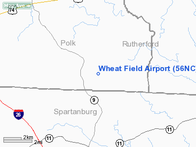
Location & QuickFacts
| FAA Information Effective: | 2008-09-25 |
| Airport Identifier: | 56NC |
| Airport Status: | Operational |
| Longitude/Latitude: | 082-01-55.0000W/35-12-24.0000N
-82.031944/35.206667 (Estimated) |
| Elevation: | 960 ft / 292.61 m (Estimated) |
| Land: | 0 acres |
| From nearest city: | 12 nautical miles E of Tryon, NC |
| Location: | Polk County, NC |
| Magnetic Variation: | 06W (2000) |
Owner & Manager
| Ownership: | Privately owned |
| Owner: | Jim & Kathe Wheaton |
| Address: | P.o. Box 1536
Tryon, NC 28782 |
| Phone number: | 828-863-2222 |
| Address: |
|
Airport Operations and Facilities
| Airport Use: | Private |
| Segmented Circle: | No |
| Control Tower: | No |
| Sectional chart: | Atlanta |
| Region: | ASO - Southern |
| Boundary ARTCC: | ZTL - Atlanta |
| Tie-in FSS: | RDU - Raleigh |
| FSS Toll Free: | 1-800-WX-BRIEF |
Runway Information
Runway 09/27
| Dimension: | 1500 x 80 ft / 457.2 x 24.4 m |
| Surface: | TURF, |
| |
Runway 09 |
Runway 27 |
| Traffic Pattern: | Left | Left |
| Obstruction: | 1350 ft pline, 30.0 ft from runway | 250 ft trees, 40.0 ft from runway |
|
Radio Navigation Aids
| ID |
Type |
Name |
Ch |
Freq |
Var |
Dist |
| MRN | FAN MARKER | Lenoir | | | 03W | 40.6 nm |
| RFE | NDB | Rutherford | | 344.00 | 05W | 9.4 nm |
| FRT | NDB | Fairmont | | 248.00 | 05W | 18.4 nm |
| SLP | NDB | First River | | 417.00 | 06W | 21.4 nm |
| BRA | NDB | Broad River | | 379.00 | 04W | 21.9 nm |
| FIQ | NDB | Fiddlers | | 391.00 | 07W | 35.0 nm |
| UOT | NDB | Union County | | 326.00 | 04W | 36.8 nm |
| GY | NDB | Dyana | | 338.00 | 03W | 37.0 nm |
| LQK | NDB | Lake Keowee | | 408.00 | 04W | 40.7 nm |
| LUX | NDB | Laurens | | 307.00 | 04W | 42.2 nm |
| GHJ | NDB | Stonia | | 260.00 | 06W | 43.0 nm |
| DCM | NDB | Chester | | 220.00 | 06W | 48.1 nm |
| HK | NDB | Tawba | | 332.00 | 06W | 49.8 nm |
| SPA | VORTAC | Spartanburg | 104X | 115.70 | 02W | 11.6 nm |
| SUG | VORTAC | Sugarloaf Mountain | 059X | 112.20 | 02W | 16.7 nm |
| HKY | VOT | Hickory Regional | | 110.00 | | 44.9 nm |
Remarks
- RCMD ACFT TKOF TO THE WEST, LND FROM THE WEST DUE TO TREES TO EAST.
- PRVDD VFR, PVT USE.
Images and information placed above are from
http://www.airport-data.com/airport/56NC/
We thank them for the data!
| General Info
|
| Country |
United States
|
| State |
NORTH CAROLINA
|
| FAA ID |
56NC
|
| Latitude |
35-12-24.000N
|
| Longitude |
082-01-55.000W
|
| Elevation |
960 feet
|
| Near City |
TRYON
|
We don't guarantee the information is fresh and accurate. The data may
be wrong or outdated.
For more up-to-date information please refer to other sources.
|
|


