 |
|
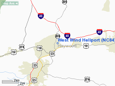
Location & QuickFacts
| FAA Information Effective: | 2008-09-25 |
| Airport Identifier: | NC84 |
| Airport Status: | Operational |
| Longitude/Latitude: | 082-57-11.4910W/35-32-05.3730N
-82.953192/35.534826 (Estimated) |
| Elevation: | 2700 ft / 822.96 m (Estimated) |
| Land: | 0 acres |
| From nearest city: | 1 nautical miles NW of Lake Junaluska, NC |
| Location: | Haywood County, NC |
| Magnetic Variation: | 04W (1985) |
Owner & Manager
| Ownership: | Privately owned |
| Owner: | West Wind Helicopters Inc |
| Address: | 81 Paragon Pkwy
Clyde, NC 28721 |
| Phone number: | 828-456-9423 |
| Manager: | Dr. Ted Rogers |
| Address: | 79 Paragon Pkwy
Clyde, NC 28721 |
| Phone number: | 828-456-9423 |
Airport Operations and Facilities
| Airport Use: | Private |
| Wind indicator: | Yes |
| Segmented Circle: | No |
| Control Tower: | No |
| Landing fee charge: | No |
| Sectional chart: | Atlanta |
| Region: | ASO - Southern |
| Boundary ARTCC: | ZTL - Atlanta |
| Tie-in FSS: | RDU - Raleigh |
| FSS on Airport: | No |
| FSS Toll Free: | 1-800-WX-BRIEF |
Runway Information
Helipad H1
| Dimension: | 500 x 300 ft / 152.4 x 91.4 m |
| Surface: | TURF, |
| |
Runway H1 |
Runway |
| Traffic Pattern: | Left | Left |
|
Radio Navigation Aids
| ID |
Type |
Name |
Ch |
Freq |
Var |
Dist |
| BRA | NDB | Broad River | | 379.00 | 04W | 28.4 nm |
| DYQ | NDB | Dulaney | | 263.00 | 04W | 36.3 nm |
| JXT | NDB | Jefferson | | 346.00 | 04W | 43.0 nm |
| LQK | NDB | Lake Keowee | | 408.00 | 04W | 45.2 nm |
| SOT | VORTAC | Snowbird | 025X | 108.80 | 04W | 16.1 nm |
| SUG | VORTAC | Sugarloaf Mountain | 059X | 112.20 | 02W | 34.4 nm |
Remarks
- VFR OPERATIONS ONLY; PRIVATE USE ONLY; USE OF HELIPORT IS COORDINATED WITH CHARLOTTE GENERAL AVIATION DISTRICT OFFICE.
Images and information placed above are from
http://www.airport-data.com/airport/NC84/
We thank them for the data!
| General Info
|
| Country |
United States
|
| State |
NORTH CAROLINA
|
| FAA ID |
NC84
|
| Latitude |
35-32-05.373N
|
| Longitude |
082-57-11.491W
|
| Elevation |
2700 feet
|
| Near City |
LAKE JUNALUSKA
|
We don't guarantee the information is fresh and accurate. The data may
be wrong or outdated.
For more up-to-date information please refer to other sources.
|
|


