 |
|
Location & QuickFacts
| FAA Information Effective: | 2008-09-25 |
| Airport Identifier: | NC90 |
| Airport Status: | Operational |
| Longitude/Latitude: | 080-52-08.2580W/35-13-43.5110N
-80.868961/35.228753 (Estimated) |
| Elevation: | 630 ft / 192.02 m (Estimated) |
| Land: | 0 acres |
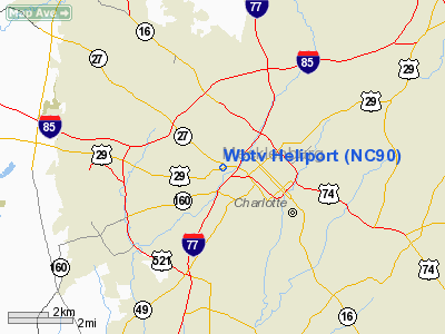
| From nearest city: | 1 nautical miles W of Charlotte, NC |
| Location: | Mecklenburg County, NC |
| Magnetic Variation: | 05W (1985) |
Owner & Manager
| Ownership: | Privately owned |
| Owner: | Jefferson-pilot Bcstg Co |
| Address: | One Julian Price Place
Charlotte, NC 28208-5211 |
| Phone number: | 704-374-3691 |
| Manager: | Ronald P Harrington |
| Address: | One Julian Price Place
Charlotte, NC 28208-5211 |
| Phone number: | 704-374-3792 |
Airport Operations and Facilities
| Airport Use: | Private |
| Wind indicator: | Yes |
| Segmented Circle: | No |
| Control Tower: | No |
| Landing fee charge: | No |
| Sectional chart: | Charlotte |
| Region: | ASO - Southern |
| Boundary ARTCC: | ZTL - Atlanta |
| Tie-in FSS: | RDU - Raleigh |
| FSS on Airport: | No |
| FSS Toll Free: | 1-800-WX-BRIEF |
Runway Information
Helipad H1
| Dimension: | 40 x 30 ft / 12.2 x 9.1 m |
| Surface: | CONC, |
| |
Runway H1 |
Runway |
| Traffic Pattern: | Left | Left |
|
Radio Navigation Aids
| ID |
Type |
Name |
Ch |
Freq |
Var |
Dist |
| GHJ | NDB | Stonia | | 260.00 | 06W | 14.3 nm |
| TWL | NDB | Wesley | | 204.00 | 06W | 18.4 nm |
| IZN | NDB | Lincolnton | | 432.00 | 06W | 21.4 nm |
| UZ | NDB | Rally | | 227.00 | 05W | 22.9 nm |
| LKR | NDB | Lancaster | | 400.00 | 07W | 30.4 nm |
| DCM | NDB | Chester | | 220.00 | 06W | 31.2 nm |
| VW | NDB | Temky | | 280.00 | 05W | 34.2 nm |
| RU | NDB | Rovdy | | 275.00 | 06W | 35.6 nm |
| SLP | NDB | First River | | 417.00 | 06W | 35.9 nm |
| PYG | NDB | Pageland | | 270.00 | 06W | 39.1 nm |
| HK | NDB | Tawba | | 332.00 | 06W | 39.8 nm |
| AFP | NDB | Anson County | | 283.00 | 07W | 40.6 nm |
| VU | NDB | Aller | | 346.00 | 06W | 41.7 nm |
| SEN | NDB | Swearing/dcmsnd | | 260.00 | 06W | 43.3 nm |
| DVZ | NDB | Davie | | 354.00 | 06W | 45.8 nm |
| FIQ | NDB | Fiddlers | | 391.00 | 07W | 48.8 nm |
| CLT | VOR/DME | Charlotte | 097X | 115.00 | 05W | 4.7 nm |
| BZM | VOR/DME | Barretts Mountain | 045X | 110.80 | 06W | 42.6 nm |
| CTF | VOR/DME | Chesterfield | 019X | 108.20 | 03W | 45.4 nm |
| FML | VORTAC | Fort Mill | 071X | 112.40 | 02W | 15.0 nm |
| CLT | VOT | Charlotte | | 112.00 | | 3.5 nm |
| HKY | VOT | Hickory Regional | | 110.00 | | 40.0 nm |
Remarks
- E111: ALL OPNS ARE CONDUCTED IN VFR WX CONDS; LNDG AREA IS LTD TO PVT USE; THE PROPONENT COORDINATES USE OF HELI WITH THE GADO; CHARLOTTE NC.... E111 CONTD: A WRITTEN OPNL AGREEMENT IS MNTND WITH THE FAA ATCT AT DOUGLAS MUNICIPAL ARPT; CHARLOTTE NC.
Images and information placed above are from
http://www.airport-data.com/airport/NC90/
We thank them for the data!
| General Info
|
| Country |
United States
|
| State |
NORTH CAROLINA
|
| FAA ID |
NC90
|
| Latitude |
35-13-43.511N
|
| Longitude |
080-52-08.258W
|
| Elevation |
630 feet
|
| Near City |
CHARLOTTE
|
We don't guarantee the information is fresh and accurate. The data may
be wrong or outdated.
For more up-to-date information please refer to other sources.
|
|


