 |
|
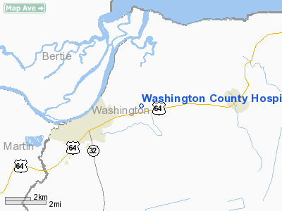
Washington County Hospital Heliport |
Location & QuickFacts
| FAA Information Effective: | 2008-09-25 |
| Airport Identifier: | 0NC3 |
| Airport Status: | Operational |
| Longitude/Latitude: | 076-41-58.7940W/35-52-30.5820N
-76.699665/35.875162 (Estimated) |
| Elevation: | 19 ft / 5.79 m (Estimated) |
| Land: | 0 acres |
| From nearest city: | 1 nautical miles E of Plymouth, NC |
| Location: | Washington County, NC |
| Magnetic Variation: | 09W (1985) |
Owner & Manager
| Ownership: | Publicly owned |
| Owner: | Washington County Hospital |
| Address: | 1 Medical Plaza
Plymouth, NC 27962 |
| Phone number: | 919-793-4135 |
| Manager: | Alan Monty |
| Address: | 1 Medical Plaza
Plymouth, NC 27962 |
| Phone number: | 919-793-4135 |
Airport Operations and Facilities
| Airport Use: | Private
MEDICAL. |
| Wind indicator: | Yes |
| Segmented Circle: | No |
| Control Tower: | No |
| Lighting Schedule: | PHONE REQ
FOR PERIMETER LGTS CALL 919-793-4135. |
| Sectional chart: | Charlotte |
| Region: | ASO - Southern |
| Boundary ARTCC: | ZDC - Washington |
| Tie-in FSS: | RDU - Raleigh |
| FSS on Airport: | No |
| FSS Toll Free: | 1-800-WX-BRIEF |
Runway Information
Helipad H1
| Dimension: | 70 x 70 ft / 21.3 x 21.3 m
DIAMETER OF CIRCULAR HELIPAD |
| Surface: | TURF,
HELIPAD AREA UNMARKED; GROUNDS ADJACENT TO HOSPITAL ARE USED OCNLY. |
| |
Runway H1 |
Runway |
| Traffic Pattern: | Left | Left |
|
Radio Navigation Aids
| ID |
Type |
Name |
Ch |
Freq |
Var |
Dist |
| PGV | FAN MARKER | Belvoir | | | 06W | 36.2 nm |
| PMZ | NDB | Plymouth | | 221.00 | 10W | 5.0 nm |
| EDE | NDB | Edenton | | 265.00 | 10W | 11.1 nm |
| MCZ | NDB | Williamston | | 336.00 | 09W | 23.3 nm |
| RNW | NDB | Chocowinity | | 388.00 | 07W | 29.6 nm |
| LLW | NDB | Woodville | | 254.00 | 10W | 30.4 nm |
| AQE | NDB | Alwood | | 230.00 | 09W | 34.3 nm |
| ASJ | NDB | Ahoskie | | 415.00 | 10W | 34.4 nm |
| ETC | NDB | Tarboro | | 257.00 | 08W | 41.4 nm |
| RK | NDB | Waley | | 249.00 | 10W | 43.6 nm |
| EY | NDB | Chesi | | 233.00 | 09W | 46.2 nm |
| MQI | NDB | Manteo | | 370.00 | 09W | 49.0 nm |
| ECG | VOR/DME | Elizabeth City | 072X | 112.50 | 07W | 34.3 nm |
| RBX | VOR/DME | Wright Brothers | 053X | 111.60 | 08W | 48.9 nm |
| CVI | VORTAC | Cofield | 093X | 114.60 | 09W | 31.1 nm |
| TYI | VORTAC | Tar River | 125X | 117.80 | 05W | 49.3 nm |
Remarks
- VFR, PVT USE, COORD USE OF HELI WITH RALEIGH GADO.
Images and information placed above are from
http://www.airport-data.com/airport/0NC3/
We thank them for the data!
| General Info
|
| Country |
United States
|
| State |
NORTH CAROLINA
|
| FAA ID |
0NC3
|
| Latitude |
35-52-30.582N
|
| Longitude |
076-41-58.794W
|
| Elevation |
19 feet
|
| Near City |
PLYMOUTH
|
We don't guarantee the information is fresh and accurate. The data may
be wrong or outdated.
For more up-to-date information please refer to other sources.
|
|


