|
|
 |
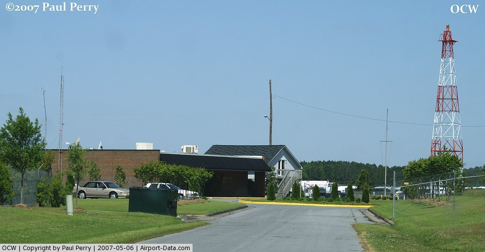
(Click on the photo to enlarge) |
 |
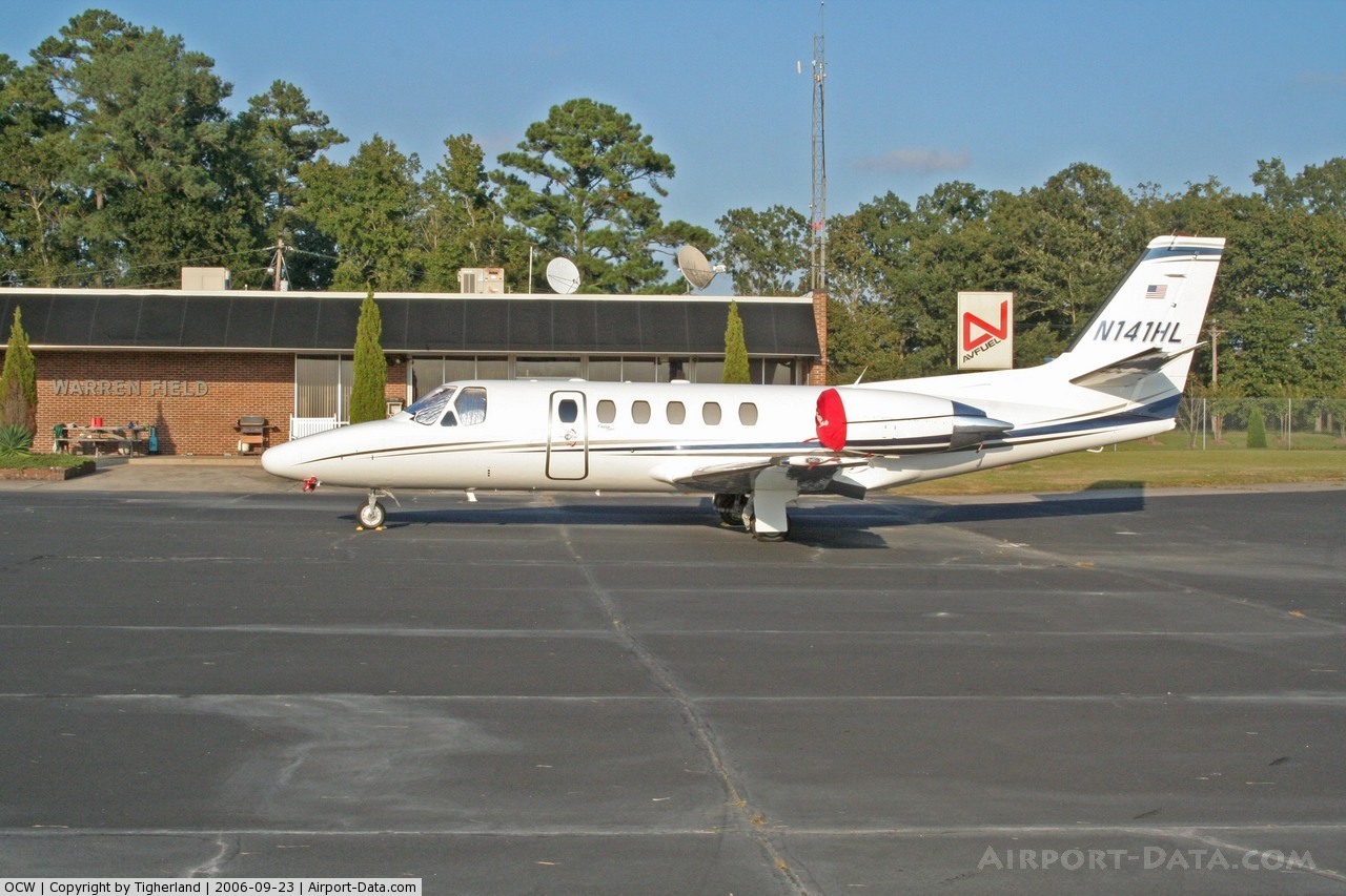
(Click on the photo to enlarge) |
Location & QuickFacts
| FAA Information Effective: | 2008-09-25 |
| Airport Identifier: | OCW |
| Airport Status: | Operational |
| Longitude/Latitude: | 077-02-59.3300W/35-34-13.6800N
-77.049814/35.570467 (Estimated) |
| Elevation: | 38 ft / 11.58 m (Surveyed) |
| Land: | 479 acres |
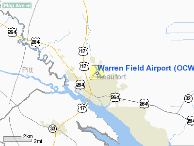
| From nearest city: | 0 nautical miles NE of Washington, NC |
| Location: | Beaufort County, NC |
| Magnetic Variation: | 08W (1985) |
Owner & Manager
| Ownership: | Publicly owned |
| Owner: | City Of Washington |
| Address: | Po Box 1988
Washington, NC 27889 |
| Phone number: | 252-946-3900 |
| Manager: | Elmo Carawan |
| Address: | 200 Airport Road
Washington, NC 27889-9681 |
| Phone number: | 252-946-3900 |
Airport Operations and Facilities
| Airport Use: | Open to public |
| Wind indicator: | Yes |
| Segmented Circle: | No |
| Control Tower: | No |
| Lighting Schedule: | DUSK-DAWN
MIRL RY 05/23 PRESET ON LOW INTST; TO INCR INTST & ACTVT MIRL RY 17/35, VASI RY 23, PAPI RY 5 AND REILS RY 05 & 23 - CTAF. |
| Beacon Color: | Clear-Green (lighted land airport) |
| Landing fee charge: | No |
| Sectional chart: | Charlotte |
| Region: | ASO - Southern |
| Boundary ARTCC: | ZDC - Washington |
| Tie-in FSS: | RDU - Raleigh |
| FSS on Airport: | No |
| FSS Toll Free: | 1-800-WX-BRIEF |
| NOTAMs Facility: | OCW (NOTAM-d service avaliable) |
| Federal Agreements: | N3 |
Airport Communications
| CTAF: | 122.700 |
| Unicom: | 122.700 |
Airport Services
| Fuel available: | 100LLA1+
FOR FUEL AFTER HOURS CALL 252-975-9320. |
| Airframe Repair: | NONE |
| Power Plant Repair: | NONE |
| Bottled Oxygen: | NONE |
| Bulk Oxygen: | NONE |
Runway Information
Runway 05/23
| Dimension: | 5000 x 100 ft / 1524.0 x 30.5 m |
| Surface: | ASPH, Good Condition
GRASS GROWING THROUGH CRACKS & SMALL POT HOLES, PVMT HEAVING & SPALLING.
LOOSE GRAVEL, POT HOLES., CRACKS, PVMT HEAVING & SPALLING, VEGETATION IN RY. |
| Weight Limit: | Single wheel: 30000 lbs.
Dual wheel: 38000 lbs. |
| Edge Lights: | Medium |
| |
Runway 05 |
Runway 23 |
| Longitude: | 077-03-23.0700W | 077-02-46.8200W |
| Latitude: | 35-34-00.2000N | 35-34-39.7900N |
| Elevation: | 32.00 ft | 38.00 ft |
| Alignment: | 37 | 127 |
| ILS Type: | LOC/DME
| |
| Traffic Pattern: | Left | Left |
| Markings: | Non-precision instrument, Good Condition | Non-precision instrument, Good Condition |
| Crossing Height: | 40.00 ft | 40.00 ft |
| Displaced threshold: | 0.00 ft | 199.00 ft |
| VASI: | 2-light PAPI on left side
RY 05 PAPI OTS INDEFLY. | 2-box on left side |
| Visual Glide Angle: | 3.00° | 3.00° |
| Runway End Identifier: | Yes | Yes |
| Obstruction: | 26 ft trees, 680.0 ft from runway, 156 ft right of centerline, 18:1 slope to clear | 26 ft trees, 330.0 ft from runway, 242 ft left of centerline, 5:1 slope to clear
APCH RATIO 12:1 TO DSPLCD THLD. |
|
Runway 11/29
| Dimension: | 4000 x 150 ft / 1219.2 x 45.7 m |
| Surface: | ASPH-CONC, Poor Condition
GRASS GROWING THROUGH CRACKS & SMALL POT HOLES, PVMT HEAVING & SPALLING.
LOOSE GRAVEL, POT HOLES., CRACKS, PVMT HEAVING & SPALLING, VEGETATION IN RY. |
| Weight Limit: | Single wheel: 22000 lbs. |
| |
Runway 11 |
Runway 29 |
| Longitude: | 077-03-23.7700W | 077-02-35.4000W |
| Latitude: | 35-34-01.3900N | 35-33-59.7200N |
| Elevation: | 32.00 ft | 36.00 ft |
| Alignment: | 92 | 127 |
| Traffic Pattern: | Left | Left |
| Markings: | Numbers only, Poor Condition
NON STD MARKINGS - NUMBERS ONLY; LOCATION OF NUMBERS NON STD., MARKINGS FADED. | Numbers only, Poor Condition
NON STD MARKINGS - NUMBERS ONLY; LOCATION OF NUMBERS NON STD; MARKINGS FADED. |
| Obstruction: | 38 ft trees, 521.0 ft from runway, 47 ft left of centerline, 8:1 slope to clear | 25 ft trees, 610.0 ft from runway, 17 ft left of centerline, 16:1 slope to clear |
|
Runway 17/35
| Dimension: | 5000 x 150 ft / 1524.0 x 45.7 m |
| Surface: | ASPH-CONC, Poor Condition
GRASS GROWING THROUGH CRACKS & SMALL POT HOLES, PVMT HEAVING & SPALLING.
LOOSE GRAVEL, POT HOLES., CRACKS, PVMT HEAVING & SPALLING, VEGETATION IN RY. |
| Weight Limit: | Single wheel: 22000 lbs. |
| Edge Lights: | Medium |
| |
Runway 17 |
Runway 35 |
| Longitude: | 077-03-06.0900W | 077-02-40.7100W |
| Latitude: | 35-34-40.4400N | 35-33-55.5500N |
| Elevation: | 38.00 ft | 35.00 ft |
| Alignment: | 127 | 127 |
| Traffic Pattern: | Left | Left |
| Markings: | Non-precision instrument, Poor Condition
17/35 MARKINGS FADED. | Non-precision instrument, Poor Condition |
| Displaced threshold: | 501.00 ft | 0.00 ft |
| Obstruction: | 33 ft pole, 325.0 ft from runway, 254 ft left of centerline, 3:1 slope to clear
APCH RATIO 17:1 FROM DSPLD THLD. | 41 ft trees, 492.0 ft from runway, 102 ft left of centerline, 7:1 slope to clear
12 FT TREES STARTING 100 FT FROM END OF RY BOTH SIDES & 12 FT TREES 0-200 FT FM END OF RY AND OFFSET 100 FT LEFT. |
|
Radio Navigation Aids
| ID |
Type |
Name |
Ch |
Freq |
Var |
Dist |
| PGV | FAN MARKER | Belvoir | | | 06W | 16.8 nm |
| RNW | NDB | Chocowinity | | 388.00 | 07W | 4.6 nm |
| AQE | NDB | Alwood | | 230.00 | 09W | 17.7 nm |
| MCZ | NDB | Williamston | | 336.00 | 09W | 18.4 nm |
| PMZ | NDB | Plymouth | | 221.00 | 10W | 20.1 nm |
| ETC | NDB | Tarboro | | 257.00 | 08W | 32.7 nm |
| EDE | NDB | Edenton | | 265.00 | 10W | 36.1 nm |
| JYN | NDB | Wayne | | 208.00 | 08W | 41.7 nm |
| ASJ | NDB | Ahoskie | | 415.00 | 10W | 44.2 nm |
| RW | NDB | Jambe | | 235.00 | 09W | 46.2 nm |
| NKT | TACAN | Cherry Point | 075X | | 09W | 41.1 nm |
| GSB | TACAN | Seymour Johnson | 112X | | 08W | 47.3 nm |
| EWN | VOR/DME | New Bern | 083X | 113.60 | 08W | 29.9 nm |
| ISO | VORTAC | Kinston | 033X | 109.60 | 05W | 27.6 nm |
| TYI | VORTAC | Tar River | 125X | 117.80 | 05W | 40.2 nm |
| CVI | VORTAC | Cofield | 093X | 114.60 | 09W | 49.0 nm |
Remarks
- TAXIWAYS NOT LIGHTED.
- LOOSE AGGREGATE/GRAVEL ON ALL RUNWAYS.
- DEER & BIRDS ON & INVOF ARPT.
Images and information placed above are from
http://www.airport-data.com/airport/OCW/
We thank them for the data!
| General Info
|
| Country |
United States
|
| State |
NORTH CAROLINA
|
| FAA ID |
OCW
|
| Latitude |
35-34-13.685N
|
| Longitude |
077-02-59.327W
|
| Elevation |
38 feet
|
| Near City |
WASHINGTON
|
We don't guarantee the information is fresh and accurate. The data may
be wrong or outdated.
For more up-to-date information please refer to other sources.
|
|