|
|

 |
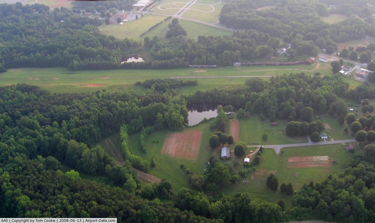
(Click on the photo to enlarge) |
 |
(Click on the photo to enlarge) |
Location & QuickFacts
| FAA Information Effective: | 2008-09-25 |
| Airport Identifier: | 6A5 |
| Airport Status: | Operational |
| Longitude/Latitude: | 079-42-29.1120W/36-19-00.4890N
-79.708087/36.316803 (Estimated) |
| Elevation: | 820 ft / 249.94 m (Estimated) |
| Land: | 14 acres |
| From nearest city: | 3 nautical miles SW of Reidsville, NC |
| Location: | Rockingham County, NC |
| Magnetic Variation: | 06W (1985) |
Owner & Manager
| Ownership: | Privately owned |
| Owner: | A.w. Warf |
| Address: | 77 U.s. 158
Reidsville, NC 27320 |
| Phone number: | 336-349-2195 |
| Manager: | C. Ellis Warf |
| Address: | 77 U.s. 158
Reidsville, NC 27320 |
| Phone number: | 336-349-2195 |
Airport Operations and Facilities
| Airport Use: | Open to public |
| Wind indicator: | Yes |
| Segmented Circle: | No |
| Control Tower: | No |
| Lighting Schedule: | PHONE REQ
FOR LIRL RY 17/35 CALL 336-349-2195. |
| Landing fee charge: | No |
| Sectional chart: | Cincinnati |
| Region: | ASO - Southern |
| Boundary ARTCC: | ZDC - Washington |
| Responsible ARTCC: | ZTL - Atlanta |
| Tie-in FSS: | RDU - Raleigh |
| FSS on Airport: | No |
| FSS Toll Free: | 1-800-WX-BRIEF |
| NOTAMs Facility: | RDU (NOTAM-d service avaliable) |
Airport Communications
Airport Services
| Airframe Repair: | NONE |
| Power Plant Repair: | NONE |
| Bottled Oxygen: | NONE |
| Bulk Oxygen: | NONE |
Runway Information
Runway 17/35
| Dimension: | 2550 x 150 ft / 777.2 x 45.7 m |
| Surface: | CONC-TURF, Good Condition
900 FT BY 18 FT CONC AT NORTH END OF RY. |
| Weight Limit: | Single wheel: 8000 lbs. |
| Edge Lights: | Non-standard lighting system
RY 17/35 NSTD LIRL; NO THLD LGTS ON NORTH END. ONLY SOUTH 2375 FT OF RY LGTD. MOST EDGE LGTS OTS INDEFLY. |
| |
Runway 17 |
Runway 35 |
| Traffic Pattern: | Left | Left |
| Obstruction: | 85 ft trees, 65.0 ft from runway, 30 ft right of centerline
RY 17/35 +60-85 FT TREES 80-100 FT FM RY CNTRLN BOTH SIDES. | 60 ft trees, 0.0 ft from runway, 80 ft left of centerline |
|
Radio Navigation Aids
| ID |
Type |
Name |
Ch |
Freq |
Var |
Dist |
| OQA | FAN MARKER | Rockingham County | | | | 8.8 nm |
| SIF | NDB | Slammer | | 423.00 | 07W | 4.8 nm |
| UV | NDB | Bales | | 396.00 | 07W | 19.3 nm |
| HB | NDB | Himun | | 361.00 | 08W | 21.2 nm |
| HUR | NDB | Person | | 220.00 | 08W | 31.5 nm |
| TOX | NDB | Siler City | | 371.00 | 07W | 35.5 nm |
| CQJ | NDB | City Lake | | 266.00 | 08W | 36.9 nm |
| AZW | NDB | Mount Airy | | 223.00 | 07W | 40.5 nm |
| SEN | NDB | Swearing/dcmsnd | | 260.00 | 06W | 43.2 nm |
| DVZ | NDB | Davie | | 354.00 | 06W | 43.7 nm |
| ZEF | NDB | Zephyr | | 326.00 | 05W | 49.2 nm |
| DAN | VOR | Danville | | 113.10 | 06W | 23.5 nm |
| GSO | VORTAC | Greensboro | 109X | 116.20 | 03W | 20.9 nm |
| LIB | VORTAC | Liberty | 077X | 113.00 | 03W | 30.7 nm |
| SBV | VORTAC | South Boston | 041X | 110.40 | 05W | 39.8 nm |
Remarks
- RY 35 HAS UPHILL GRADE.
- RY 35 HAS MORE THAN 50 FT DROPOFF/DOWNSLOPE 35 FT FROM THLD BOTH SIDES.
- DEER ON AND INVOF AIRPORT.
Images and information placed above are from
http://www.airport-data.com/airport/6A5/
We thank them for the data!
| General Info
|
| Country |
United States
|
| State |
NORTH CAROLINA
|
| FAA ID |
6A5
|
| Latitude |
36-19-00.489N
|
| Longitude |
079-42-29.112W
|
| Elevation |
820 feet
|
| Near City |
REIDSVILLE
|
We don't guarantee the information is fresh and accurate. The data may
be wrong or outdated.
For more up-to-date information please refer to other sources.
|
|