 |
|
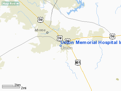
Union Memorial Hospital Inc Heliport |
Location & QuickFacts
| FAA Information Effective: | 2008-09-25 |
| Airport Identifier: | 2NC2 |
| Airport Status: | Operational |
| Longitude/Latitude: | 080-31-25.2380W/34-58-03.5400N
-80.523677/34.967650 (Estimated) |
| Elevation: | 600 ft / 182.88 m (Estimated) |
| Land: | 0 acres |
| From nearest city: | 1 nautical miles SE of Monroe, NC |
| Location: | Union County, NC |
| Magnetic Variation: | 05W (1985) |
Owner & Manager
| Ownership: | Privately owned |
| Owner: | Union Memorial Hospital Inc. |
| Address: | P O Box 5003
Monroe, NC 28111-5003 |
| Phone number: | 704-283-3195 |
| Manager: | Talmadge B. Bridges |
| Address: | 600 Hospital Drive
Monroe, NC 28112-6000 |
| Phone number: | 704-283-3100 |
Airport Operations and Facilities
| Airport Use: | Private
MEDICAL |
| Wind indicator: | Yes |
| Segmented Circle: | No |
| Control Tower: | No |
| Lighting Schedule: | PHONE REQ
FOR PERIMETER LGTS CALL 704-283-3100. |
| Sectional chart: | Charlotte |
| Region: | ASO - Southern |
| Boundary ARTCC: | ZTL - Atlanta |
| Tie-in FSS: | RDU - Raleigh |
| FSS Toll Free: | 1-800-WX-BRIEF |
Runway Information
Helipad H1
| Dimension: | 50 x 50 ft / 15.2 x 15.2 m |
| Surface: | CONC, |
| |
Runway H1 |
Runway |
| Traffic Pattern: | Left | Left |
|
Radio Navigation Aids
| ID |
Type |
Name |
Ch |
Freq |
Var |
Dist |
| TWL | NDB | Wesley | | 204.00 | 06W | 9.0 nm |
| PYG | NDB | Pageland | | 270.00 | 06W | 16.2 nm |
| AFP | NDB | Anson County | | 283.00 | 07W | 22.0 nm |
| LKR | NDB | Lancaster | | 400.00 | 07W | 22.1 nm |
| UZ | NDB | Rally | | 227.00 | 05W | 27.9 nm |
| GHJ | NDB | Stonia | | 260.00 | 06W | 33.9 nm |
| DCM | NDB | Chester | | 220.00 | 06W | 35.1 nm |
| CQW | NDB | Cheraw | | 409.00 | 05W | 35.2 nm |
| VU | NDB | Aller | | 346.00 | 06W | 38.1 nm |
| HVS | NDB | Hartsville | | 341.00 | 07W | 39.2 nm |
| CDN | NDB | Camden | | 263.00 | 05W | 41.2 nm |
| RCZ | NDB | Roscoe | | 375.00 | 07W | 41.5 nm |
| IZN | NDB | Lincolnton | | 432.00 | 06W | 44.0 nm |
| BES | NDB | Bennettsville | | 230.00 | 07W | 44.3 nm |
| UDG | NDB | Darlington | | 245.00 | 06W | 44.5 nm |
| RU | NDB | Rovdy | | 275.00 | 06W | 46.0 nm |
| FDW | NDB | Winnsboro | | 414.00 | 05W | 48.9 nm |
| CTF | VOR/DME | Chesterfield | 019X | 108.20 | 03W | 22.7 nm |
| CLT | VOR/DME | Charlotte | 097X | 115.00 | 05W | 24.9 nm |
| FML | VORTAC | Fort Mill | 071X | 112.40 | 02W | 21.3 nm |
| SDZ | VORTAC | Sandhills | 055X | 111.80 | 03W | 48.4 nm |
| CLT | VOT | Charlotte | | 112.00 | | 25.2 nm |
Remarks
- PRVDD VFR/PVT USE; APCH/DEP ROUTE OPERATIONS ARE CONDUCTED 160 DEGS CLOCKWISE TO 360 DEGS; TAKEOFF/LANDING ARE MARKED; AND A WIND INDICATOR IS MAINTAINED.
Images and information placed above are from
http://www.airport-data.com/airport/2NC2/
We thank them for the data!
| General Info
|
| Country |
United States
|
| State |
NORTH CAROLINA
|
| FAA ID |
2NC2
|
| Latitude |
34-58-03.540N
|
| Longitude |
080-31-25.238W
|
| Elevation |
600 feet
|
| Near City |
MONROE
|
We don't guarantee the information is fresh and accurate. The data may
be wrong or outdated.
For more up-to-date information please refer to other sources.
|
|


