 |
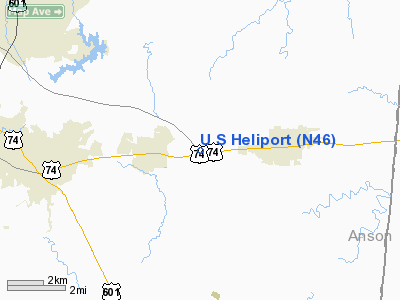
|
Location & QuickFacts
| FAA Information Effective: | 2008-09-25 |
| Airport Identifier: | N46 |
| Airport Status: | Operational |
| Longitude/Latitude: | 080-25-08.9250W/34-59-03.6250N
-80.419146/34.984340 (Estimated) |
| Elevation: | 590 ft / 179.83 m (Estimated) |
| Land: | 3 acres |
| From nearest city: | 3 nautical miles N of Wingate, NC |
| Location: | Union County, NC |
| Magnetic Variation: | 05W (1985) |
Owner & Manager
| Ownership: | Privately owned |
| Owner: | Us Helicopters Inc |
| Address: | Po Box 625
Marshville, NC 28103 |
| Phone number: | 704-233-4254 |
| Manager: | Wayne Schmitz |
| Address: | Po Box 625
Marshville, NC 28103 |
| Phone number: | 704-233-4254 |
Airport Operations and Facilities
| Airport Use: | Open to public |
| Wind indicator: | Yes |
| Segmented Circle: | No |
| Control Tower: | No |
| Sectional chart: | Charlotte |
| Region: | ASO - Southern |
| Boundary ARTCC: | ZTL - Atlanta |
| Tie-in FSS: | RDU - Raleigh |
| FSS Toll Free: | 1-800-WX-BRIEF |
| NOTAMs Facility: | RDU (NOTAM-d service avaliable) |
Airport Communications
| CTAF: | 123.075 |
| Unicom: | 123.075 |
Airport Services
| Fuel available: | A |
| Airframe Repair: | MAJOR |
| Power Plant Repair: | MAJOR |
Runway Information
Helipad H1
| Dimension: | 100 x 100 ft / 30.5 x 30.5 m |
| Surface: | TURF, |
| |
Runway H1 |
Runway |
| Traffic Pattern: | Left | Left |
|
Radio Navigation Aids
| ID |
Type |
Name |
Ch |
Freq |
Var |
Dist |
| TWL | NDB | Wesley | | 204.00 | 06W | 14.2 nm |
| PYG | NDB | Pageland | | 270.00 | 06W | 14.9 nm |
| AFP | NDB | Anson County | | 283.00 | 07W | 16.7 nm |
| LKR | NDB | Lancaster | | 400.00 | 07W | 26.7 nm |
| CQW | NDB | Cheraw | | 409.00 | 05W | 30.9 nm |
| UZ | NDB | Rally | | 227.00 | 05W | 33.1 nm |
| VU | NDB | Aller | | 346.00 | 06W | 34.6 nm |
| RCZ | NDB | Roscoe | | 375.00 | 07W | 36.6 nm |
| HVS | NDB | Hartsville | | 341.00 | 07W | 37.7 nm |
| GHJ | NDB | Stonia | | 260.00 | 06W | 38.4 nm |
| BES | NDB | Bennettsville | | 230.00 | 07W | 40.3 nm |
| DCM | NDB | Chester | | 220.00 | 06W | 40.3 nm |
| UDG | NDB | Darlington | | 245.00 | 06W | 41.8 nm |
| CDN | NDB | Camden | | 263.00 | 05W | 42.7 nm |
| RU | NDB | Rovdy | | 275.00 | 06W | 45.1 nm |
| HFF | NDB | Mackall | | 278.00 | 06W | 46.0 nm |
| IZN | NDB | Lincolnton | | 432.00 | 06W | 46.7 nm |
| SEN | NDB | Swearing/dcmsnd | | 260.00 | 06W | 48.2 nm |
| CTF | VOR/DME | Chesterfield | 019X | 108.20 | 03W | 21.3 nm |
| CLT | VOR/DME | Charlotte | 097X | 115.00 | 05W | 29.0 nm |
| FML | VORTAC | Fort Mill | 071X | 112.40 | 02W | 26.4 nm |
| SDZ | VORTAC | Sandhills | 055X | 111.80 | 03W | 43.2 nm |
| CLT | VOT | Charlotte | | 112.00 | | 29.0 nm |
Remarks
- NUMEROUS UNMARKED OBSTNS IN ALL QUADRANTS: TREES & POWER LINES.
- HELS WITH GWT OVER 10000 LBS USE TURF WEST OF CONC PAD BUT WITHIN FENCED AREA.
- PAD HAS 6 FT PERIMETER FENCE AS CLOSE AS 35 FT FROM S & W ENDS OF PAD
- UNMKD POWER LINES N & S OF PAD; UNMKD HANGAR WITH ANT E OF PAD.
- TKOF & LNDG IN ALL QUADRANTS INTO PREVAILING WIND.
- PPR FOR NIGHT OPNS.
- CONCRETE PADS FOR PARKING ONLY.
- PRVDD VFR USE.
Images and information placed above are from
http://www.airport-data.com/airport/N46/
We thank them for the data!
| General Info
|
| Country |
United States
|
| State |
NORTH CAROLINA
|
| FAA ID |
N46
|
| Latitude |
34-59-03.625N
|
| Longitude |
080-25-08.925W
|
| Elevation |
590 feet
|
| Near City |
WINGATE
|
We don't guarantee the information is fresh and accurate. The data may
be wrong or outdated.
For more up-to-date information please refer to other sources.
|
|


