 |
|
Location & QuickFacts
| FAA Information Effective: | 2008-09-25 |
| Airport Identifier: | NC53 |
| Airport Status: | Operational |
| Longitude/Latitude: | 084-01-29.6710W/35-04-45.3010N
-84.024909/35.079250 (Estimated) |
| Elevation: | 1528 ft / 465.73 m (Estimated) |
| Land: | 1 acres |
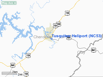
| From nearest city: | 1 nautical miles SE of Murphy, NC |
| Location: | Cherokee County, NC |
| Magnetic Variation: | 03W (1985) |
Owner & Manager
| Ownership: | Publicly owned |
| Owner: | Us Forest Service |
| Address: | 201 Woodland Dr
Murphy, NC 28906 |
| Phone number: | 828-837-5152 |
| Manager: | Usfs District Ranger |
| Address: | 201 Woodland Dr
Murphy, NC 28906 |
| Phone number: | 828-837-5152 |
Airport Operations and Facilities
| Airport Use: | Private |
| Wind indicator: | Yes |
| Segmented Circle: | No |
| Control Tower: | No |
| Landing fee charge: | No |
| Sectional chart: | Atlanta |
| Region: | ASO - Southern |
| Boundary ARTCC: | ZTL - Atlanta |
| Tie-in FSS: | RDU - Raleigh |
| FSS on Airport: | No |
| FSS Toll Free: | 1-800-WX-BRIEF |
Runway Information
Helipad H1
| Dimension: | 150 x 150 ft / 45.7 x 45.7 m |
| Surface: | CONC, |
| |
Runway H1 |
Runway |
| Traffic Pattern: | Left | Left |
|
Radio Navigation Aids
| ID |
Type |
Name |
Ch |
Freq |
Var |
Dist |
| TTQ | NDB | Tomotla | | 335.00 | 01W | 4.0 nm |
| MMI | NDB | Mc Minn County | | 242.00 | 03W | 32.5 nm |
| MNV | NDB | Madisonville | | 361.00 | 04W | 33.1 nm |
| AJR | NDB | Habersham | | 347.00 | 03W | 41.9 nm |
| JZP | NDB | Pickens County | | 285.00 | 04W | 43.2 nm |
| HDI | NDB | Hardwick | | 369.00 | 01W | 43.5 nm |
| UWI | NDB | Whitfield | | 400.00 | 03W | 48.6 nm |
| HRS | VORTAC | Harris | 035X | 109.80 | 00E | 9.8 nm |
| ODF | VORTAC | Foothills | 081X | 113.40 | 00E | 42.6 nm |
| TYS | VOT | Knoxville | | 112.00 | | 44.1 nm |
Remarks
Images and information placed above are from
http://www.airport-data.com/airport/NC53/
We thank them for the data!
| General Info
|
| Country |
United States
|
| State |
NORTH CAROLINA
|
| FAA ID |
NC53
|
| Latitude |
35-04-45.301N
|
| Longitude |
084-01-29.671W
|
| Elevation |
1528 feet
|
| Near City |
MURPHY
|
We don't guarantee the information is fresh and accurate. The data may
be wrong or outdated.
For more up-to-date information please refer to other sources.
|
|


