 |
|
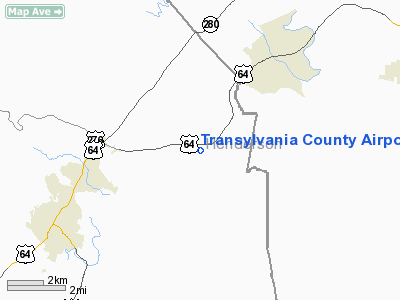
Transylvania County Airport |
Location & QuickFacts
| FAA Information Effective: | 2008-09-25 |
| Airport Identifier: | 22W |
| Airport Status: | Operational |
| Longitude/Latitude: | 082-38-39.0000W/35-16-13.0000N
-82.644167/35.270278 (Estimated) |
| Elevation: | 2110 ft / 643.13 m (Estimated) |
| Land: | 16 acres |
| From nearest city: | 4 nautical miles E of Brevard, NC |
| Location: | Transylvania County, NC |
| Magnetic Variation: | 05W (1995) |
Owner & Manager
| Ownership: | Privately owned |
| Owner: | Kenneth T. Allison |
| Address: | Po Box 1390
Etowah, NC 28729 |
| Phone number: | 828-891-3893 |
| Manager: | Randy Babgy |
| Address: | 5436 Old Hendersonville Hwy
Pisgah Forest, NC 28768 |
| Phone number: | 828-877-5801 |
Airport Operations and Facilities
| Airport Use: | Open to public |
| Wind indicator: | Yes |
| Segmented Circle: | No |
| Control Tower: | No |
| Sectional chart: | Atlanta |
| Region: | ASO - Southern |
| Boundary ARTCC: | ZTL - Atlanta |
| Tie-in FSS: | RDU - Raleigh |
| FSS Toll Free: | 1-800-WX-BRIEF |
| NOTAMs Facility: | RDU (NOTAM-d service avaliable) |
Airport Communications
| CTAF: | 122.700 |
| Unicom: | 122.700 |
Airport Services
| Fuel available: | 100LL |
| Airframe Repair: | MAJOR |
| Power Plant Repair: | MAJOR |
Runway Information
Runway 09/27
| Dimension: | 2903 x 50 ft / 884.8 x 15.2 m |
| Surface: | ASPH, Good Condition |
| |
Runway 09 |
Runway 27 |
| Traffic Pattern: | Left | Left |
| Displaced threshold: | 0.00 ft | 80.00 ft |
| Obstruction: | 40 ft , 383.0 ft from runway, 7 ft right of centerline, 4:1 slope to clear
62 FT TREE 45 FT FM THLD 78 FT LEFT OF CNTRLN. | 9 ft road, 400.0 ft from runway, 22:1 slope to clear |
|
Radio Navigation Aids
| ID |
Type |
Name |
Ch |
Freq |
Var |
Dist |
| BRA | NDB | Broad River | | 379.00 | 04W | 8.5 nm |
| LQK | NDB | Lake Keowee | | 408.00 | 04W | 27.7 nm |
| RFE | NDB | Rutherford | | 344.00 | 05W | 34.2 nm |
| GY | NDB | Dyana | | 338.00 | 03W | 36.2 nm |
| CEU | NDB | Clemson | | 257.00 | 05W | 37.8 nm |
| FRT | NDB | Fairmont | | 248.00 | 05W | 39.3 nm |
| AND | NDB | Anderson County | | 230.00 | 04W | 46.5 nm |
| SUG | VORTAC | Sugarloaf Mountain | 059X | 112.20 | 02W | 20.2 nm |
| SOT | VORTAC | Snowbird | 025X | 108.80 | 04W | 37.1 nm |
| SPA | VORTAC | Spartanburg | 104X | 115.70 | 02W | 38.0 nm |
| ODF | VORTAC | Foothills | 081X | 113.40 | 00E | 47.2 nm |
Remarks
- NOISE ABATEMENT PROCEDURES IN EFFECT, CALL 828-877-5801.
- ARPT OPEN DAYTIME VFR ONLY.
- FARM ACCESS ROAD ADJ TO RY 09.
- PRVDD VFR OPNS, CLEAR 20:1 APCHS, APCH CLNC OVER ROADS & RR OR DSPLCD THLD, CTC ATL FIFO ABOUT PLANS TO GO IFR.
Images and information placed above are from
http://www.airport-data.com/airport/22W/
We thank them for the data!
| General Info
|
| Country |
United States
|
| State |
NORTH CAROLINA
|
| FAA ID |
22W
|
| Latitude |
35-16-13.000N
|
| Longitude |
082-38-39.000W
|
| Elevation |
2110 feet
|
| Near City |
BREVARD
|
We don't guarantee the information is fresh and accurate. The data may
be wrong or outdated.
For more up-to-date information please refer to other sources.
|
|


